The quest for True Color Imagery

The GOES receiver I built and use, receives the HRIT/EMWIN data stream which is then converted to imagery. It’s great to be able to pull in these images and play with the layers, colors and types of data. But I have always looked (with envy) of those that receive the GRB stream, and can get those images and convert them to what it would look like if you were in space looking back at the Earth.
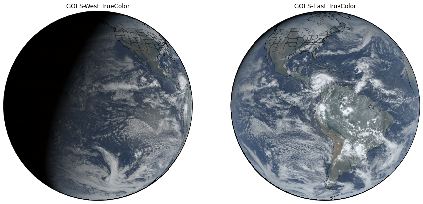
So I began to experiment with different combinations of tools to achieve this. The first one I used, to sort of figure our my baseline was to use a tool that was created to make the True Color images from GOES in the first place. So running Anaconda on my PC I installed and ran https://github.com/blaylockbk/pyBKB_v3 , and downloaded a couple of ABI NETCDF files from GOES 16 and 17. After spending a lot of time learning about Jupyter Lab notebooks, and how to run the scripts, I generated this:
Pretty cool, but it does not work with HRIT files. So, how to create something similar? Fortunately, there are a lot of tools to use. Graphics editors, RGB compositing editors, and some new products on the scene like Sanchez and NASA’s World Wind software.
After I obtain the raw imagery from GOES 16, 17, EWS-G1, GK2A, Elecktro, and Himawari-8, I process it and try and optimize the images with Image Magick. then I use Sanchez (https://github.com/nullpainter/sanchez) to stitch the imagery together and reproject it in a global equirectangular projection. I usually have to optimize and compress the image file size after this as well, and I do that with Photoshop, otherwise, the resulting image is so big it really slows my PC down.
Then using a couple of other pieces of software, NASA’s G Projector, and NASA’s World Wind software I project the imagery onto a 3D sphere and create the elevations, day/night transitions, lighting, etc.
Google Earth Pro or Manifold can be used as well. but the results are not as nice.
http://www.georeference.org/doc/create_a_globe_image.htm
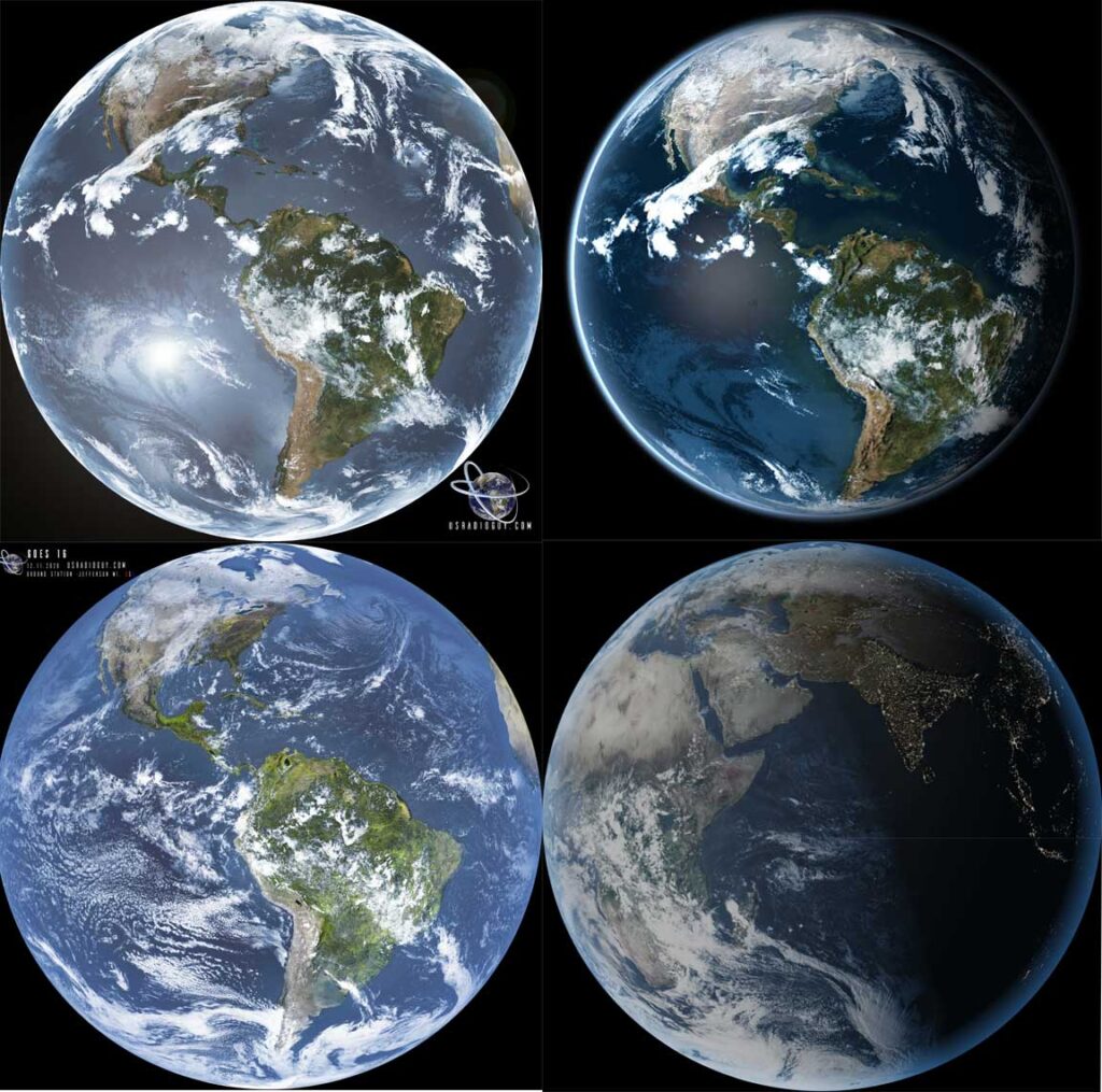
After a lot of trial and error, these are the images I created using HRIT imagery:
A couple of video generated with the imagery.