Skip to content
USRADIOGUY

USRadioguy.com

Welcome to USRadioguy.com – Unlocking the Potential of Software Defined Radio

  • Home
    • Home of USRadioguy
    • USRadioguy Newsletter
    • Tried and Tested Hardware
    • What is RTL-SDR?
    • Global Weather Data
  • Satellite Reception
    • Geo Stationary Satellites
      • Geo-stationary Satellite Imagery Reception
      • GOESTOOLS on the PI
      • Update Goestools for GOES 18,19
      • Receiving GOES with SatDump CLI Mode
      • GOES receiving in Windows for SatDump GUI
      • Decoding EWS-G1/EWS-G2
      • GOES GRB Reception WIP
      • Optimizing a WIFI Grid Antenna for Maximum Efficiency
    • APT Satellites
      • APT RECEPTION
      • Satdump for Meteor and NOAA decoding
      • METEOR M2- Series
      • WxtoImg Fix
      • Converting to new TLE format
      • Layering Fire and Hotspot Data on Meteor Sat Imagery
      • HRPT Satellite Tracking and Capture
    • Receiving Other Satellites
      • Inmarsat Decoding
      • Receiving the Funcube Amateur Satellite
    • User Maps and Dish Pointers
      • Satellite Dish Pointer
      • User Global Ground Station Maps
      • Usermap rendered with Cesium
      • Global Map of Govt Dish Stations
    • Satellite Details & Information
      • ORBITAL DYNAMICS 101
      • HRIT/EMWIN & GRB Defined
      • Mesoscale Imagery Defined
      • Viterbi, R/S Errors, Packets
      • GOES BAND IMAGERY
      • Stray Light Zone (SLZ)
      • Drifting a geostationary satellite
      • GOES-R Series Multimedia Tour
      • Online Satellite Imagery and Information
      • Satellite Frequencies
      • Solar and Space Weather
  • Satellite Imagery
    • IMAGERY- Current GOES East & West HRIT Satellite Imagery
    • IMAGERY- GOES 16&18 – Past 96 Hours of Imagery
    • High Resolution Imagery
    • Daily 3D view of Earth
    • NOAA APT Satellite imagery
    • PlanetMaker
    • GOES16 A full year of received imagery
  • Imagery Processing
    • Custom Color Lookup Table & Gradients
    • GOES-R Custom Imagery Scripts
    • Global geo-ring composites
    • MODIS VIIRS Global Coverage
    • 3D Satellite Tracking
    • The quest for True Color Imagery
    • 3D animation of realtime data
    • Layering Geo-Spatial Fire Data into Satellite Imagery
    • Orbital dynamics and the Moon
    • National Hurricane Data
  • News, VLOGS & BLOGS
    • News & USRadioguy Blogs
    • USRadioguy VLOGS
  • Project Lab
    • Orbital Information and Visualizations
      • Enhanced Planet Earth
      • Satellites in Orbit
      • Solar System
      • Objects in Orbit
    • Current Station Weather
      • Current Groundstation Weather
      • Global Weather Data
      • Space Weather
    • WWII RADIO
      • WWII K-24 Aerial Camera
      • WWII RADIO
      • RADIO SET SCR-284
      • VS-3 VIBRATOR CONVERSION
      • VIBRATOR CONVERSION MODULE
      • BD-71 Field Switch Board and EE-8B Field Telephones
      • R-100/URR 1944 MORALE RADIO
      • A PORTABLE WWII ERA “MORALE RADIO”
      • AN/GRR-5 THE ANGRY 5
      • WWII Audio Page
    • Raspberry Pi Projects
      • ADS-B Reception
      • Allsky Camera
      • Pi Based Picture Frame
      • PI Based Broadcastify Server
      • Solar Power for PI
    • Hubble Space Telescope Data Processing
    • Zombie Satellites
    • DRONES
  • About Me
    • About Usradioguy
      • SETEC Astronomy
    • Tried and Tested Hardware
    • Rare Captures
    • My Other Interests
    • Presentations
    • Merchandise
    • Privacy Policy
  • Home
  • Current GOES 16 & 18 False Color Satellite Imagery

Current GOES 16 & 18 False Color Satellite Imagery

“I don’t want to believe. I want to know.”
― Carl Sagan

Current GOES 18&19 Color Satellite Imagery

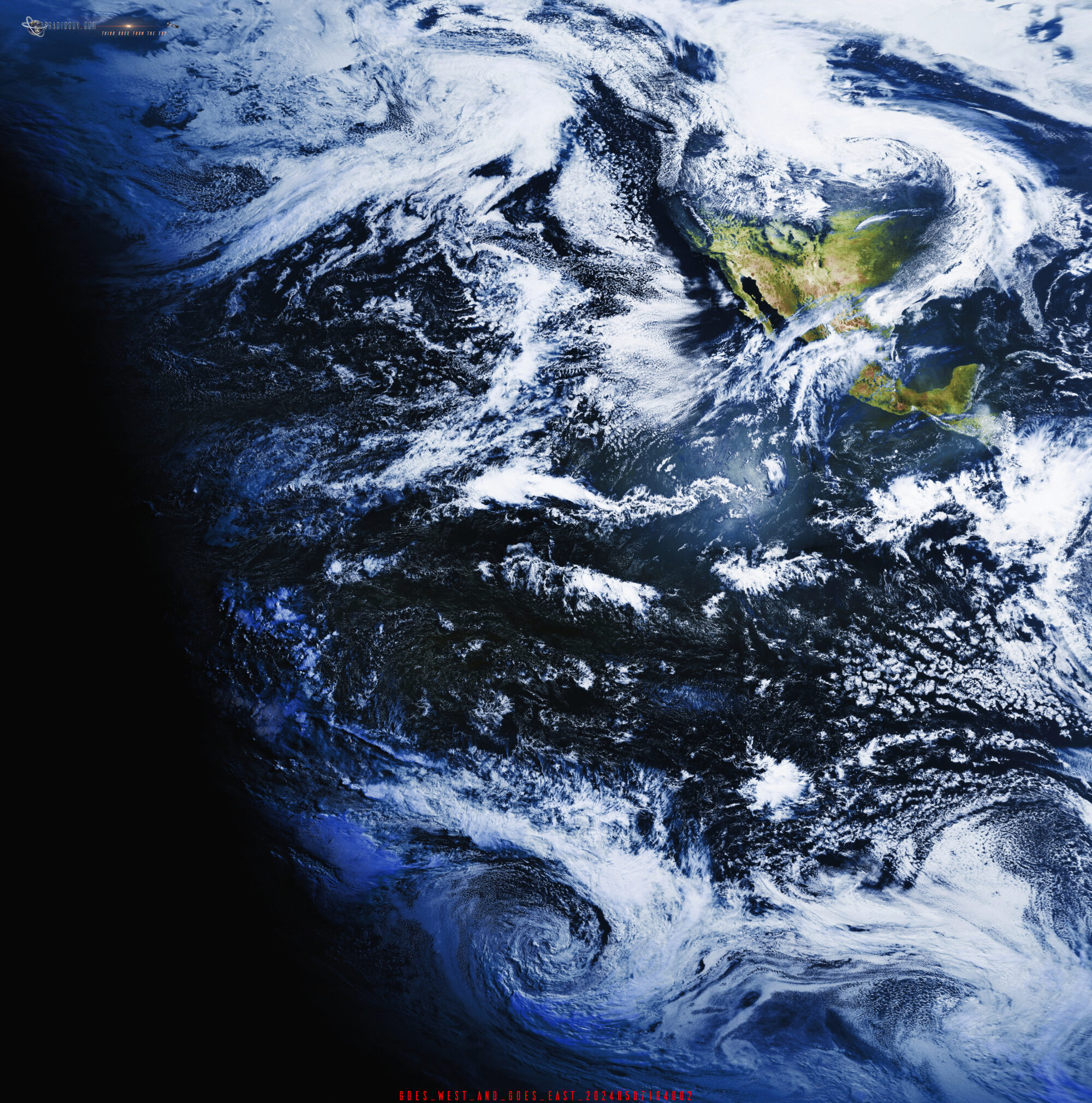
This displays the latest GOES-East (GOES-19) and GOES-West (GOES-18) satellite imagery. An automated script updates these images every half-hour, pulling data directly from my GOES receivers. Note that a completely black image indicates nighttime.

GOES satellites don’t capture true RGB color. They utilize 16 spectral bands, and this image is a false-color composite created using Channel 02 (near-infrared) and Channel 13 (infrared). Channel 02, often called the ‘veggie’ band, provides information that is used to approximate the green component, as it strongly reflects off vegetation.(explained more on the GOES Satellite Reception pages) You may have to reload the page to see the newest imagery. Note: To see the last 96hours of GOES 16 imagery as animation, click here.

Satellite: 75.2W GOES 19
Elevation: 38.5°
Azimuth (true): 160.5°
Azimuth (magn.): 163.7°

GOES EAST (GOES-19)

GOES 16 Imagery
VIEW GOES East in New Window (Allows for most detail)

Satellite: 137.22 W GOES 18
Elevation: 20.9°
Azimuth (true): 238.8°
Azimuth (magn.): 242.1°

GOES WEST (GOES-18)

GOES 18 Imagery
VIEW GOES West in New Window (Allows for most Detail)

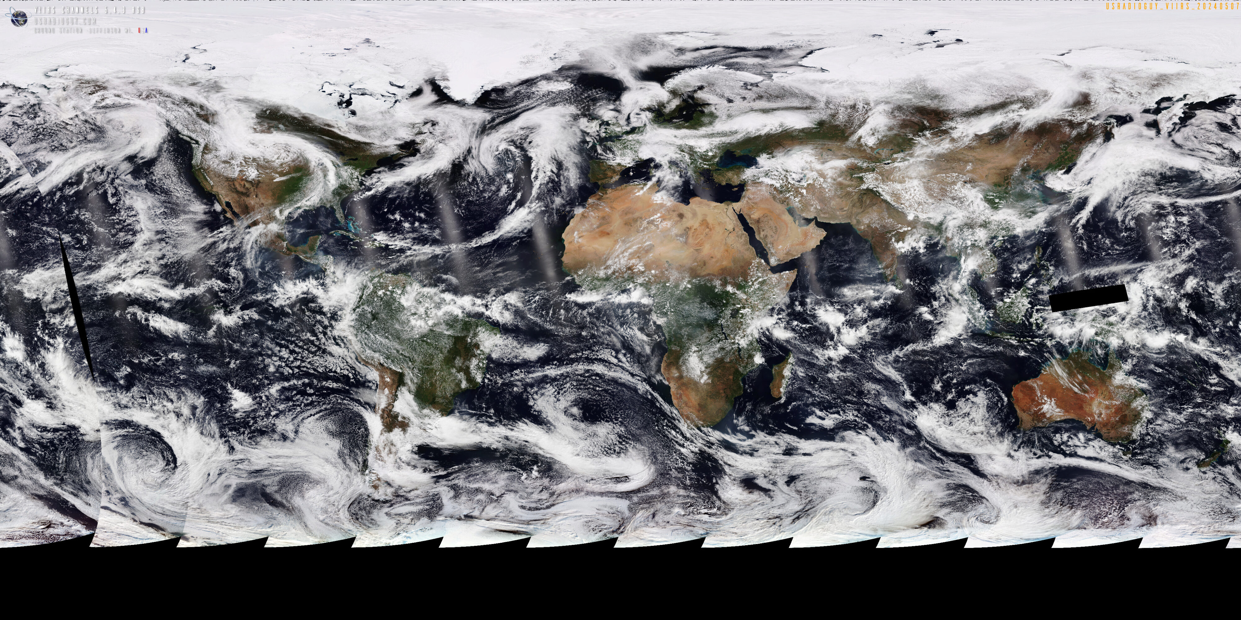
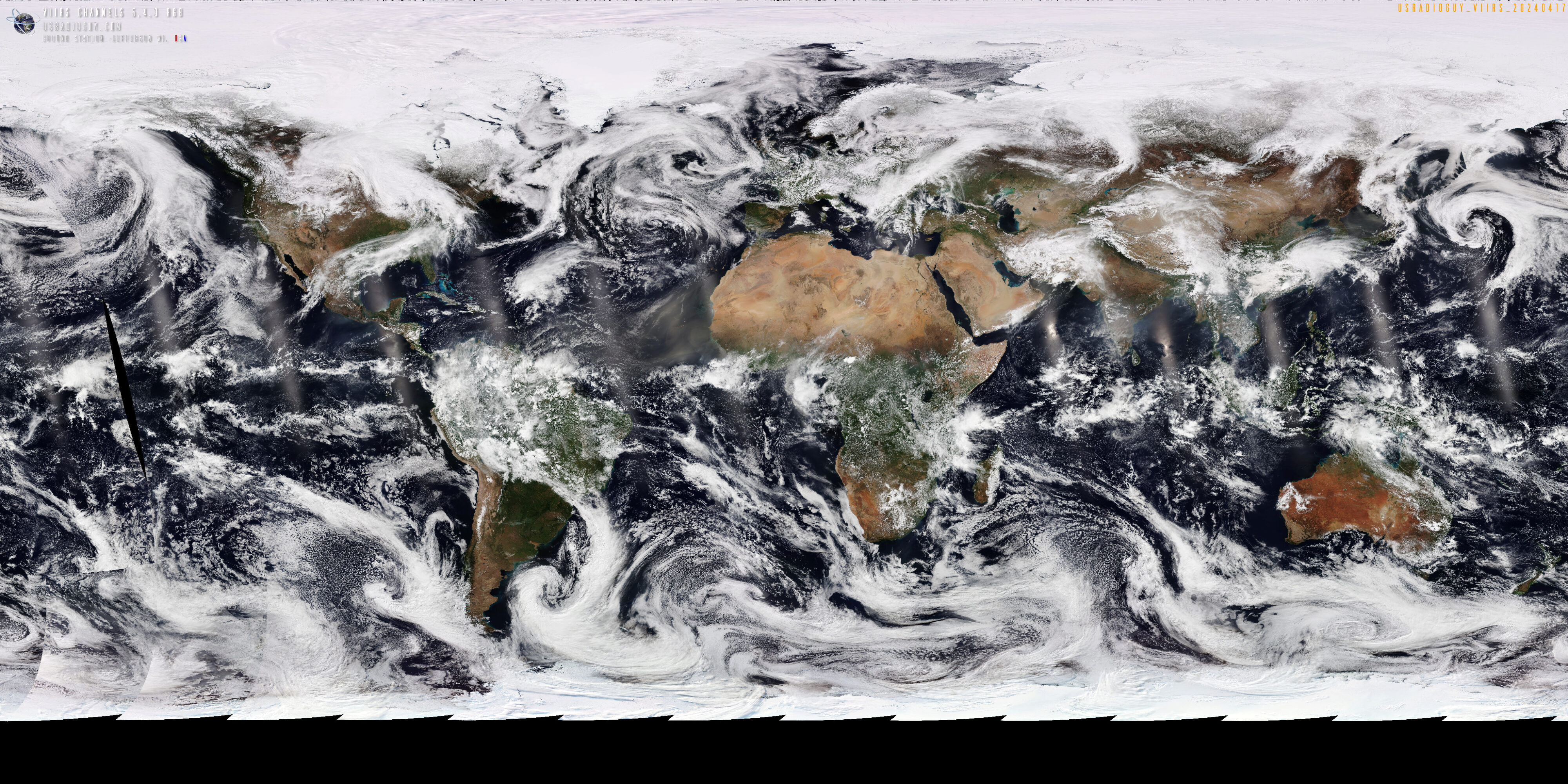
Reprojected Imagery of GOES 16-18 full color using Sanchez Tools – images uploaded at “Satellite High Noon” from my QTH once per day.

GOES1617 Imagery
Open GOES 16 -18 image in new window

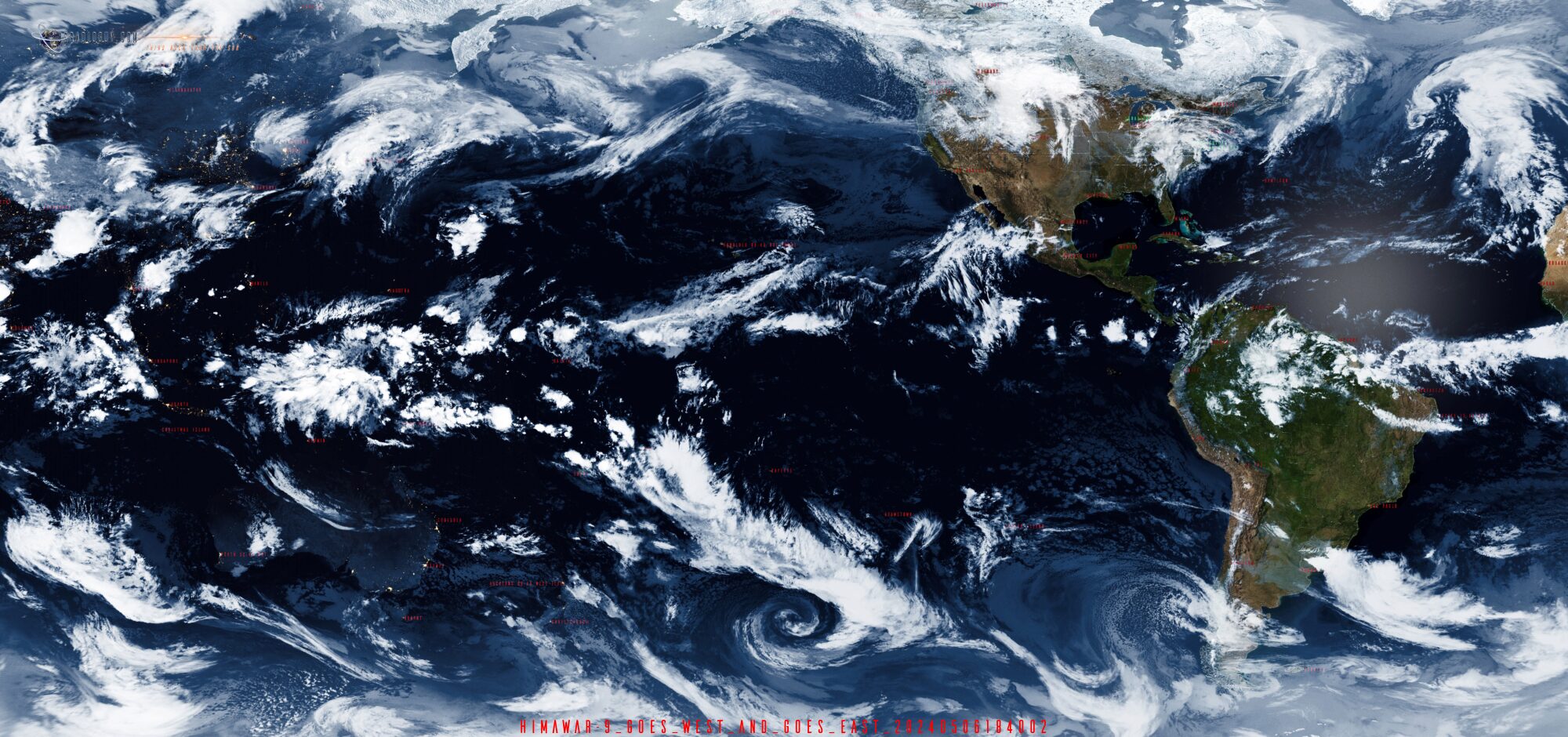
Reprojected Imagery of GOES 19-18 and Himawari-9 with Day and Night Mask using Sanchez Tools – images uploaded at “Satellite High Noon” from my QTH once per day.

Himawari 9, GOES West and GOES East

Open Global Coverage using VIIRS Imagery Imagery in new window

Open Global Sea Surface Temps VIIRS Imagery in a new window

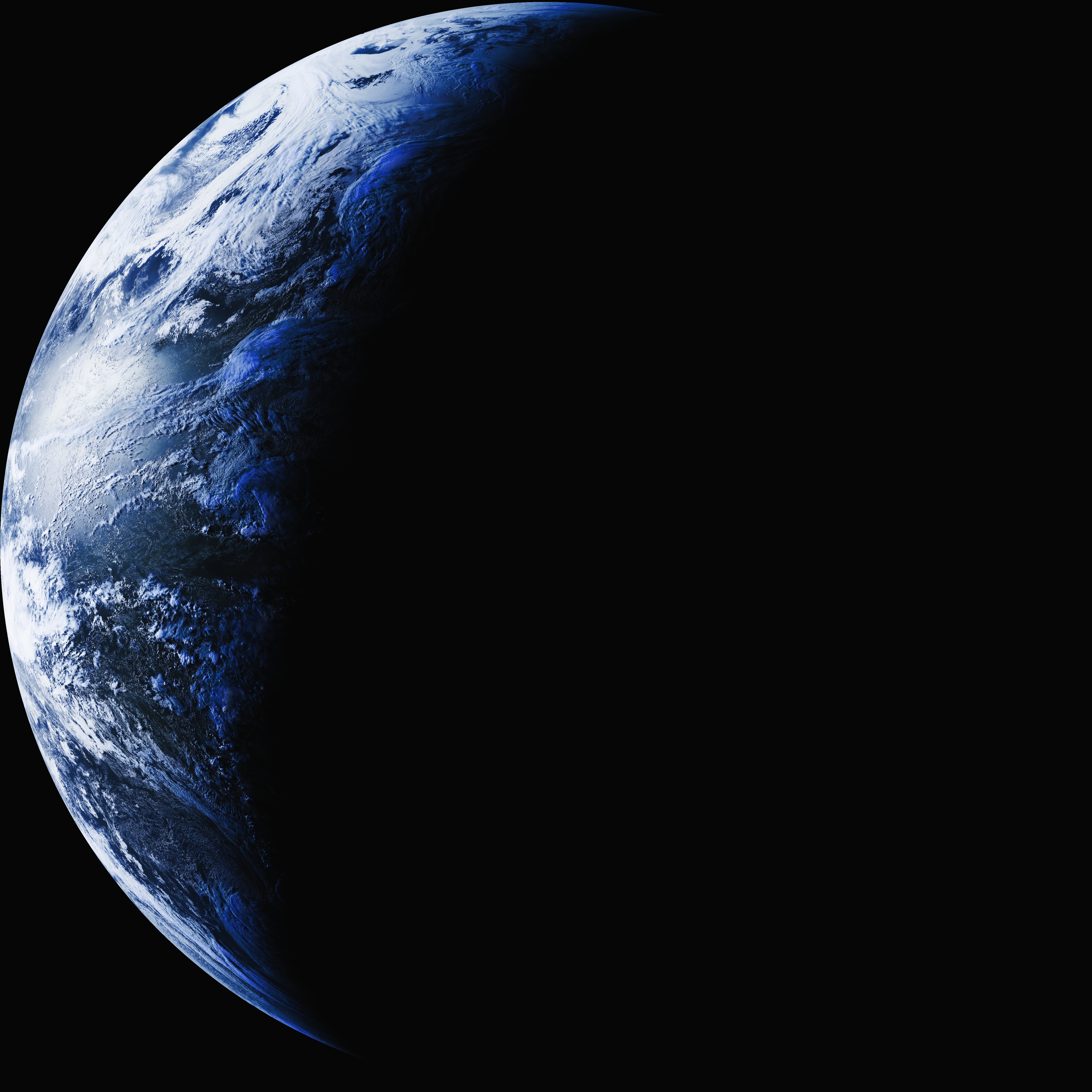
Earth – Sol system, Sector 001, Alpha Quadrant
A typical Class M Planet, within the Goldilocks zone

A spheroid-shaped terrestrial planet with a circumference of 24,901 miles (40,075 kilometers), a mass of 6.6 sextillion tons (5.9722 x 1024 kilograms) (5.513 grams per cubic centimeter). Known to host a plethora of life forms. A relatively new planet having formed only 4.5 billion years ago.

One of the indigenous life forms has achieved space flight and has placed many artificial “satellites” into orbit around the homeworld and in orbit around the fourth planet in the system. Probes have been sent out in many directions into space as well.

Current Ground Station Weather

Thank you

NOAA

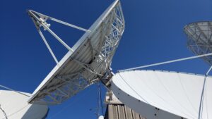
None of this would be possible without the National Oceanic and Atmospheric Administration or NOAA. Allowing anyone with some moderate talent to be able to tap into this resource is amazing. In addition to the fantastic resources and programmers who have, (and in many cases for free), authored the software that allows reception of all this satellite data, I want to thank some of the government and educational institutions that have patiently answered my technical questions.


  • The Office of Satellite and Product Operations (OSPO) 
  • National Environmental Satellite, Data, and Information Service (NESDIS)

Space Science and Engineering Center (SSEC) Really a fantastic resource and the staff have been incredible at answering my questions!

Cooperative Institute for Meteorological Satellite Studies (CIMSS)  Yet another fantastic resource and have again helped me with my tech questions.

Advanced Satellite Products Branch (ASPB) For answering my questions on new ‘products’.

I have to admit, I am lucky that the SSEC and CMISS are right here in Wisconsin as part of the University of Wisconsin Just a few miles from me!

Visiting the SSEC 2022

Hardware Humor Imagery Processing Interesting stuff you should know! Launch News Life News Product Review Satellites Science Software Space Weather Uncategorized VLOG

Satellite And Weather Related Feeds

  • CIMSS Satellite Blog
  • USRadioguy.com
  • wildfires
  • NASA Earth Observatory
  • SPC Particularly Dangerous Situation (PDS) Tornado/Severe Thunderstorm Watch
  • satellites
  • Satellites News -- ScienceDaily
  • Satellite Liaison Blog
Wildfire in Ontario produces a large pyrocumulonimbus cloud
American Samoa’s Wettest Year Gets Wetter
Deadly flash flooding in Ruidoso, New Mexico
Global cloud layers on your Devices
End Of Life for NOAA 15 and 19?….not so fast…
Vitality GOES
Vitality GOES
The fire cycle
Unmasking the complicated chemistry of wildfire smoke: What's in it?
NOAA unveils powerful convergence of AI and science with revolutionary Next-Generation Fire System technology
The Salty Lake of Gas Hure
Greenland’s Bejeweled Ice Sheet
Manitoba Burning
Manitoba Burning
SPC PDS Severe Thunderstorm Watch 399
Five historically huge solar events
65 years since the world’s first weather satellite
Investing in America: NOAA's Science, Service and Stewardship in Action
Earth’s weather satellites just spent 10 years watching Venus — here’s what they found
Record-breaking 10-billion-year radio halo just rewrote the universe’s origin story
Massive thread of hot gas found linking galaxies — and it’s 10 times the mass of the Milky Way
The Need for Speed: OCTANE Cloud-Top Winds at SPC
Summer Storms, Flooding Target Mid-Atlantic
Southwest Thunderstorms – Late June 2025
  • Facebook Geo Stationary Satellites
  • Usradioguy Facebook
  • Instagram
  • Reddit
  • Github
  • Linkedin

Copyright © 2025 USRadioguy.com - All Rights Reserved. All material protected by Fair Use Section 107 of the Copyright Act. This site is Verified and Secured with 256 bit SSL encryption