Skip to content
USRADIOGUY

USRadioguy.com

Welcome to USRadioguy.com – Unlocking the Potential of Software Defined Radio

  • Home
    • Home of USRadioguy
    • USRadioguy Newsletter
    • Tried and Tested Hardware
    • What is RTL-SDR?
    • Global Weather Data
  • Satellite Reception
    • Geo Stationary Satellites
      • Geo-stationary Satellite Imagery Reception
      • GOESTOOLS on the PI
      • Update Goestools for GOES 18,19
      • Receiving GOES with SatDump CLI Mode
      • GOES receiving in Windows for SatDump GUI
      • Decoding EWS-G1/EWS-G2
      • GOES GRB Reception WIP
      • Optimizing a WIFI Grid Antenna for Maximum Efficiency
    • APT Satellites
      • APT RECEPTION
      • Satdump for Meteor and NOAA decoding
      • METEOR M2- Series
      • WxtoImg Fix
      • Converting to new TLE format
      • Layering Fire and Hotspot Data on Meteor Sat Imagery
      • HRPT Satellite Tracking and Capture
    • Receiving Other Satellites
      • Inmarsat Decoding
      • Receiving the Funcube Amateur Satellite
    • User Maps and Dish Pointers
      • Satellite Dish Pointer
      • User Global Ground Station Maps
      • Usermap rendered with Cesium
      • Global Map of Govt Dish Stations
    • Satellite Details & Information
      • ORBITAL DYNAMICS 101
      • HRIT/EMWIN & GRB Defined
      • Mesoscale Imagery Defined
      • Viterbi, R/S Errors, Packets
      • GOES BAND IMAGERY
      • Stray Light Zone (SLZ)
      • Drifting a geostationary satellite
      • GOES-R Series Multimedia Tour
      • Online Satellite Imagery and Information
      • Satellite Frequencies
      • Solar and Space Weather
  • Satellite Imagery
    • IMAGERY- Current GOES East & West HRIT Satellite Imagery
    • IMAGERY- GOES 16&18 – Past 96 Hours of Imagery
    • High Resolution Imagery
    • Daily 3D view of Earth
    • NOAA APT Satellite imagery
    • PlanetMaker
    • GOES16 A full year of received imagery
  • Imagery Processing
    • Custom Color Lookup Table & Gradients
    • GOES-R Custom Imagery Scripts
    • Global geo-ring composites
    • MODIS VIIRS Global Coverage
    • 3D Satellite Tracking
    • The quest for True Color Imagery
    • 3D animation of realtime data
    • Layering Geo-Spatial Fire Data into Satellite Imagery
    • Orbital dynamics and the Moon
    • National Hurricane Data
  • News, VLOGS & BLOGS
    • News & USRadioguy Blogs
    • USRadioguy VLOGS
  • Project Lab
    • Orbital Information and Visualizations
      • Enhanced Planet Earth
      • Satellites in Orbit
      • Solar System
      • Objects in Orbit
    • Current Station Weather
      • Current Groundstation Weather
      • Global Weather Data
      • Space Weather
    • WWII RADIO
      • WWII K-24 Aerial Camera
      • WWII RADIO
      • RADIO SET SCR-284
      • VS-3 VIBRATOR CONVERSION
      • VIBRATOR CONVERSION MODULE
      • BD-71 Field Switch Board and EE-8B Field Telephones
      • R-100/URR 1944 MORALE RADIO
      • A PORTABLE WWII ERA “MORALE RADIO”
      • AN/GRR-5 THE ANGRY 5
      • WWII Audio Page
    • Raspberry Pi Projects
      • ADS-B Reception
      • Allsky Camera
      • Pi Based Picture Frame
      • PI Based Broadcastify Server
      • Solar Power for PI
    • Hubble Space Telescope Data Processing
    • Zombie Satellites
    • DRONES
  • About Me
    • About Usradioguy
      • SETEC Astronomy
    • Tried and Tested Hardware
    • Rare Captures
    • My Other Interests
    • Presentations
    • Merchandise
    • Privacy Policy
  • Home
  • Usradioguy Blogs
  • GOES-19

Tag: GOES-19

GOES 19 Operational Schedule

Posted on March 27, 2025April 3, 2025 By Carl
GOES 19 Operational Schedule
Satellites

Loading

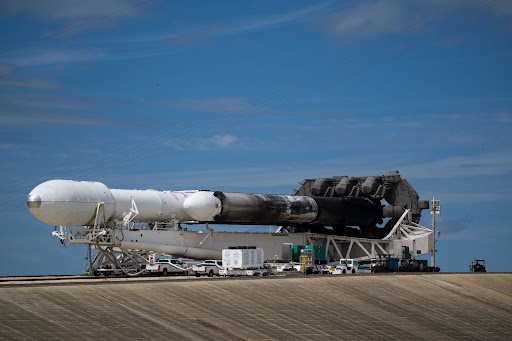
Updated 04/03/2025 Due to the uniquely severe potential of the ongoing Critical Weather Day (CWD), the transition of the GOES-19 satellite to the operational GOES-East position has been postponed. This delay ensures uninterrupted, critical weather monitoring during this period. The transition is now scheduled to occur no earlier than April 7, 2025, at 1510 UTC, … Delve Deeper “GOES 19 Operational Schedule” »

Update – Goes 16 to19 Transition to Operations

Posted on March 4, 2025March 17, 2025 By Carl
Update – Goes 16 to19 Transition to Operations
Interesting stuff you should know!, News, Satellites

Loading

GOES-19 will replace GOES-16 as the operational GOES-East satellite on April 4, 2025. GOES-16 East/West Station Keeping Maneuver and Transition to GOES-19 Data Products Updated 03-17-2025 1400 UTC GOES-16 Transition and Potential Image Artifacts Between March 17th and 31st, GOES-16 will shift its position (drift) from 75.2°W to 75.5°W to accommodate the upcoming GOES-19 satellite. … Delve Deeper “Update – Goes 16 to19 Transition to Operations” »

NOAA’s CCOR-1: A New Eye on the Sun

Posted on October 23, 2024October 23, 2024 By Carl
NOAA’s CCOR-1: A New Eye on the Sun
News, Satellites, Science, Space Weather

Loading

Revolutionizing Space Weather Forecasting The National Oceanic and Atmospheric Administration (NOAA) has recently shared groundbreaking imagery captured by the Compact Coronagraph (CCOR-1), a cutting-edge solar telescope aboard the GOES-19 satellite. This marks a significant milestone in space weather research, as CCOR-1 is the world’s first operational, space-based coronagraph, providing continuous observations of the sun’s outermost … Delve Deeper “NOAA’s CCOR-1: A New Eye on the Sun” »

GOES-East Transition Plan

Posted on July 10, 2024July 15, 2024 By Carl
GOES-East Transition Plan
Satellites, Science

Loading

Swap of GOES-16 and GOES-U/19 GOES-U Launched on June 25, 2024, NOAA has created a Transition to Operations (T2O) plan that they will follow along with NASA, and private sector partners like Lockheed Martin, Space X, and L3 Harris. The T20 is provisional based upon a timely and successful launch. Key Points and dates for … Delve Deeper “GOES-East Transition Plan” »

The new CCOR instrument aboard GOES-U

Posted on July 7, 2024July 10, 2024 By Carl
The new CCOR instrument aboard GOES-U
Hardware, Satellites, Science

Loading

Updated July 7, 2024 Our Sun, a colossal ball of plasma, is a dynamic entity, constantly emitting flares, eruptions, and streams of charged particles. Among these phenomena are Coronal Mass Ejections (CMEs), massive expulsions of solar material that can travel millions of miles per hour and pose significant risks to Earth’s infrastructure and technology. To … Delve Deeper “The new CCOR instrument aboard GOES-U” »

Monitoring Space Weather

Posted on July 6, 2024July 10, 2024 By Carl
Monitoring Space Weather
Imagery Processing, Satellites, Science

Loading

The Importance of Monitoring Space Weather Update July 6th, 2024 The sun is a dynamic and active star, and its activity can significantly impact Earth. The sun’s atmosphere is made up of hot, ionized plasma, and the sun’s magnetic field is constantly changing. These changes can lead to the formation of solar storms, which are … Delve Deeper “Monitoring Space Weather” »

GOES-U Launch Day

Posted on June 25, 2024July 10, 2024 By Carl
GOES-U Launch Day
Launch News, News, Satellites, Science

Loading

GOES-U Launch from Liftoff to Booster touchdown GOES U Separation from Booster into Geo Transfer Orbit. NOAA’s latest weather satellite, GOES-U, blasted off on a SpaceX Falcon Heavy rocket Tuesday, June 25th at 17:16 EST from Kennedy Space Center in Florida. The powerful launch marks a new era for weather forecasting and space weather monitoring. … Delve Deeper “GOES-U Launch Day” »

Please, Help Support USRadioguy.com

If you like what I do please support me on Ko-fi, It really means a lot, every bit helps!

Hardware Humor Imagery Processing Interesting stuff you should know! Launch News Life News Product Review Satellites Science Software Space Weather Uncategorized VLOG

Alphabetical Listing of all Pages on site:

  • 36-Hour Imagery Processing script
  • 3D animation of realtime data
  • A PORTABLE WWII ERA “MORALE RADIO”
  • About Me
  • ADS-B Reception
  • Allsky Camera
  • AN/GRR-5 THE ANGRY 5
  • BD-71 Field Switch Board and EE-8B Field Telephones
  • Current GOES 16 & 18 False Color Satellite Imagery
  • Custom Color Lookup Table
  • Custom Imagery Scripts for GOES
  • Daily 3D view of Earth
  • Daily Global Composites
  • Decoding EWS-G1 or GOES-13
  • Drifting a geostationary satellite
  • DRONE FUN
  • Even the kitchen sink
  • GEO-RING COMPOSITES
  • GEO-SAT PI FRAME
  • Geo-stationary Satellite Imagery Reception
  • Global Weather Data
  • GOES 19&18 – Last 96 Hours of Imagery
  • GOES BAND IMAGERY
  • GOES GRB Reception
  • GOES receiving in Windows for SatDump
  • GOES-18 Preparing for a new satellite
  • GOES-R Series Multimedia Tour
  • GOES-U (19) Countdown to Launch
  • GOES16 A full year of received imagery
  • Ground Station Map
  • High Resolution Imagery
  • Home
  • House History
  • HRIT/EMWIN & GRB
  • HRPT Satellite Tracking and Capture
  • Hubble Space Telescope Data Processing
  • Inmarsat Decoding
  • Layering Fire and Hotspot Data on Meteor Sat Imagery
  • Layering Geo-Spatial Fire Data into Satellite Imagery
  • Mesoscale Imagery Defined
  • METEOR M2- Series
  • MODIS VIIRS Global Coverage
  • My Other Interests
  • NASA, NOAA, Military, GOVT dish, and tower stations.
  • National Hurricane Data
  • Newsletter terms & conditions
  • NOAA & Meteor APT and LRPT RECEPTION
  • Online Satellite Imagery and Information
  • Optimizing a WIFI Grid Antenna for Maximum Efficiency
  • ORBITAL DYNAMICS 101
  • Orbitron, Gpredict, and PSTRotator with new TLE format
  • PI Based Broadcastify Server
  • Pi Based Picture Frame
  • Presentations
  • Privacy Policy
  • Programming the PI for goestools operation
  • R-100/URR 1944 MORALE RADIO
  • RADIO SET SCR-284
  • Rare Captures
  • Receiving GOES 18,19 with goestools
  • Receiving GOES HRIT with SATDUMP
  • Receiving the Funcube Amateur Satellite
  • Satdump for Meteor and NOAA decoding
  • Satellite Finder
  • Satellite Frequencies
  • Satellite Ground Stations
  • Satellite Tracking
  • Security
  • SETEC Astronomy
  • Solar Power for PI
  • South America GOES 16
  • Space Weather
  • Stray Light Zone (SLZ)
  • Thanks!
  • The quest for True Color Imagery
  • Tried and Tested Hardware
  • Usradioguy Blogs
  • Usradioguy Merchandise
  • USRadioguy Newsletter
  • USRadioguy VLOGS
  • USRADIOGUY Youtube Page
  • VIBRATOR CONVERSION MODULE
  • Viterbi, R/S Errors, Packets
  • VS-3 VIBRATOR CONVERSION
  • What is RTL-SDR?
  • WWII Audio Page
  • WWII K-24 Aerial Camera
  • WWII RADIO
  • WxtoImg Fix
  • Zombie Satellites

Hardware Humor Imagery Processing Interesting stuff you should know! Launch News Life News Product Review Satellites Science Software Space Weather Uncategorized VLOG

Satellite And Weather Related Feeds

  • CIMSS Satellite Blog
  • USRadioguy.com
  • wildfires
  • NASA Earth Observatory
  • SPC Particularly Dangerous Situation (PDS) Tornado/Severe Thunderstorm Watch
  • satellites
  • Satellites News -- ScienceDaily
  • Satellite Liaison Blog
Using Polar2grid and Direct Broadcast files to create imagery
Cirrus over the western Great Lakes
Wildfire in Saskatchewan produces a pyrocumulonimbus cloud
End Of Life for NOAA 15,18,19?….not so fast…
GOES-19 now GOES-EAST
GOES 19 Operational Schedule
The fire cycle
March was nation's 6th warmest on record
Podcast: Could the LA Wildfires harm California's marine life?
Mapping the Tiny Plankton That Feed Giant Right Whales
Lights of Southeast Asia
The Arches That Salt Built
SPC PDS Tornado Watch 98
Five historically huge solar events
65 years since the world’s first weather satellite
Investing in America: NOAA's Science, Service and Stewardship in Action
Satellite measures CO2 and NO2 simultaneously from power plant emissions for the first time
Existing international law can help secure peace and security in outer space
Small, faint and 'unexpected in a lot of different ways': Astronomers make galactic discovery
Another Week, Another Deep South Soaker
4 May 2025 Dust and Accumulating Hail
Southern Plains Deluge
  • Facebook Geo Stationary Satellites
  • Usradioguy Facebook
  • Instagram
  • Reddit
  • Github
  • Linkedin

Copyright © 2025 USRadioguy.com - All Rights Reserved. All material protected by Fair Use Section 107 of the Copyright Act. This site is Verified and Secured with 256 bit SSL encryption