Satellite Tracking
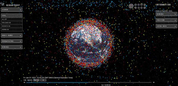
3D Satellite tracking.
After experimenting with the 3D visualization of my received satellite imagery I thought it would be interesting to layer in some satellites in orbit around the planet. It worked in principle but slowed the animation down so much I decided to just make one for just satellite tracking. And since there are so many great open source trackers available, I decided to use one of those and modify it for my own means. I was familiar with NASA’s open-source software package called WorldWinds, and decided to use the code they wrote and customize it for my site and users.
The data comprises publicly available orbital parameters of objects (TLE’s) tracked by the United State’s Air Force 18th Space Control Squadron.
I have set the system to track- payloads (operational and derelict), spent rocket stages, and general space debris with a radar cross-section (RCS) equal or above 5 cm.
Data is retrieved and cross-referenced with http://celestrak.com/.
This might take a few seconds to load on slower systems:
This next one uses the same data as above, but is a “lite” version, no orbits, just data point based on TLE
Man-Made Objects in orbit

