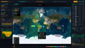
Skip to content
USRADIOGUY

USRadioguy.com

Welcome to USRadioguy.com – Unlocking the Potential of Software Defined Radio

  • Home
    • Home of USRadioguy
    • Tried and Tested Hardware
    • USRadioguy Newsletter
    • What is RTL-SDR?
    • Global Weather Data
  • Satellite Reception
    • Geo Stationary Satellites
      • Geo-stationary Satellite Imagery Reception
      • GOESTOOLS on the PI
      • Update Goestools for GOES 18,19
      • Receiving GOES with SatDump CLI Mode
      • GOES receiving in Windows for SatDump GUI
      • Decoding EWS-G1/EWS-G2
      • GOES GRB Reception WIP
      • Optimizing a WIFI Grid Antenna for Maximum Efficiency
    • APT Satellites
      • APT RECEPTION
      • Satdump for Meteor and NOAA decoding
      • METEOR M2- Series
      • WxtoImg Fix
      • Converting to new TLE format
      • Layering Fire and Hotspot Data on Meteor Sat Imagery
      • HRPT Satellite Tracking and Capture
    • Receiving Other Satellites
      • Inmarsat Decoding
      • Receiving the Funcube Amateur Satellite
    • User Maps and Dish Pointers
      • Satellite Dish Pointer
      • User Global Ground Station Maps
      • Usermap rendered with Cesium
      • Global Map of Govt Dish Stations
    • Satellite Details & Information
      • ORBITAL DYNAMICS 101
      • HRIT/EMWIN & GRB Defined
      • Mesoscale Imagery Defined
      • Viterbi, R/S Errors, Packets
      • GOES BAND IMAGERY
      • Stray Light Zone (SLZ)
      • Drifting a geostationary satellite
      • GOES-R Series Multimedia Tour
      • Online Satellite Imagery and Information
      • Satellite Frequencies
      • Solar and Space Weather
  • Satellite Imagery
    • IMAGERY- Current GOES East & West HRIT Satellite Imagery
    • IMAGERY- GOES 16&18 – Past 96 Hours of Imagery
    • High Resolution Imagery
    • Daily 3D view of Earth
    • PlanetMaker
    • GOES16 A full year of received imagery
  • Imagery Processing
    • Custom Color Lookup Table & Gradients
    • GOES-R Custom Imagery Scripts
    • Global geo-ring composites
    • MODIS VIIRS Global Coverage
    • 3D Satellite Tracking
    • The quest for True Color Imagery
    • 3D animation of realtime data
    • Layering Geo-Spatial Fire Data into Satellite Imagery
    • Orbital dynamics and the Moon
    • National Hurricane Data
  • News, VLOGS & BLOGS
    • News & USRadioguy Blogs
    • USRadioguy VLOGS
  • Project Lab
    • Orbital Information and Visualizations
      • Enhanced Planet Earth
      • Satellites in Orbit
      • Solar System
      • Objects in Orbit
    • Current Station Weather
      • Current Groundstation Weather
      • Global Weather Data
      • Space Weather
    • WWII RADIO
      • WWII K-24 Aerial Camera
      • WWII RADIO
      • RADIO SET SCR-284
      • VS-3 VIBRATOR CONVERSION
      • VIBRATOR CONVERSION MODULE
      • BD-71 Field Switch Board and EE-8B Field Telephones
      • R-100/URR 1944 MORALE RADIO
      • A PORTABLE WWII ERA “MORALE RADIO”
      • AN/GRR-5 THE ANGRY 5
      • WWII Audio Page
    • Raspberry Pi Projects
      • ADS-B Reception
      • Allsky Camera
      • Pi Based Picture Frame
      • PI Based Broadcastify Server
      • Solar Power for PI
    • Your very Own Weather Satellite
    • Hubble Space Telescope Data Processing
    • Zombie Satellites
    • DRONES
  • About Me
    • About Usradioguy
      • SETEC Astronomy
    • Tried and Tested Hardware
    • Rare Captures
    • My Other Interests
    • Presentations
    • Merchandise
    • Privacy Policy
SatDump Software
Satellites
SatDump 2.0
August 20, 2025
Imagery Processing
WXtoIMG: A Legacy in Weather Satellite Decoding
August 5, 2025
News
NOAA 15 and 19 Decommisioning
August 1, 2025
Hardware
Discovery Drive
July 24, 2025
Interesting stuff you should know!
Global cloud layers on your Devices
July 8, 2025
News
End Of Life for NOAA 15 and 19?….not so fast…
June 13, 2025

Home

Somewhere, something incredible is waiting to be known.
Carl Sagan

Help me keep this site online. The costs of hosting and content creation are ongoing, and I rely on the support of my community to continue.

If you can help, please consider donating on my Ko-fi page.
Thank you to these incredible donors:

September 25, 2025 10:16 am

Upgrade Your Radio Game: Must-Have Hardware!

Tired of weak signals and limited range? Or, just want to get into the hobby? I’ve personally tested and rely on Nooelec hardware for my daily radio operations, tutorials, and demos – and the results speak for themselves. Ready to boost your radio experience? Check out my top recommendations below, featuring Nooelec, Raspberry Pi, RTL-SDR Blog, and other brands of essential gear. Don’t miss out on special offers and exclusive bundles!


Newest Pages on the site

Tried and Tested Hardware

Tried and Tested Hardware

Read More…
SETEC Astronomy

SETEC Astronomy

Read More…
WWII Audio Page

WWII Audio Page

Read More…

Your very Own Weather Satellite

Read More…

Who and What are Satellite Data and Imagery Enthusiasts?


Featured Videos

April 2023 Solar Storm
Daily Global Geo Composite rendered in 3D!
Hunga Tonga Eruption 1.15.2022
Current SDO Imagery Space Weather

This website is a resource for those exploring the world of Software-Defined Radios (SDRs). Whether you’re experimenting, scanning frequencies, or decoding signals, you’ll find valuable information, tools, and reviewed and tested hardware here.

Recommended Hardware Check here for the hardware I have tested, the hardware that I use, and the hardware that I recommend.

GOES West and GOES East
GOES Satellite Imagery Received by Author

The who and what of Satellite Data and Imaging Enthusiasts

Imagine a dimension, not of sight, but of unseen secrets. A dimension where whispers brush the atmosphere, carrying messages from machines that circle a lonely blue marble. In this penumbra, a new breed of explorers exists. We call them…Satellite Data and Imaging Enthusiasts.

These are not your typical stargazers. They squint not at twinkling points of light, but at the silent metal messengers humanity has flung into the void. Armed with contraptions that look like rusty jungle gyms – repurposed dishes, software-defined whispers – they reach out, snagging fragments of data cast from on high.

LEO and GEO, acronyms that roll off their tongues, speak of these celestial couriers’ celestial highways. Low Earth Orbit, whispers brush by at a dizzying 2,000 kilometers. Geostationary, giants hang suspended, their gaze fixed on our spinning world.

Once a realm for the privileged few, the veil has begun to thin. Open-source secrets and affordable tools have democratized the hunt. Now, anyone with the hunger and the know-how can become an interceptor, a decoder of the celestial messages.

They are a global tribe, these data wranglers. Bound not by borders, but by the shared thrill of the unseen. Online forums hum with their conversations, a language of frequencies and algorithms. They are citizen scientists, alchemists turning raw transmissions into maps and models, a glimpse into the veiled workings of our planet.

Weather, the tempestuous ballet of atmosphere, is a favorite target. With a flick of a switch, they become storm trackers, their screens glowing with the fury of approaching hurricanes. But their curiosity is boundless. They peer into the belly of the Earth, decode the whispers of airplanes, and map the silent symphony of our environment.

These are the fringe dwellers, the ones who listen to the whispers from above. With a twist of a knob and a glint in their eye, they unlock the secrets the sky broadcasts. The question isn’t who they are, but what they might find. What lies hidden in the data stream? What message from beyond the veil waits to be decoded? The answer, my friend, is out there.

How to get started

For those interested in getting started with receiving and analyzing satellite data, many excellent resources are available. Websites like usradioguy.com offer tutorials and advice on setting up and building antennas and receivers. There is a list of helpful and informative websites here.  Other helpful websites include NOAA and EUMETSAT, which share satellite imagery from their weather satellites with the public. Additionally, there are a number of online forums and discussion boards where enthusiasts can ask questions and share their experiences.

For those who are willing to invest the time and effort, receiving satellite data and imagery directly from satellites can be a rewarding hobby. Not only does it provide a great opportunity to learn about the latest technologies and build complex equipment, but it also allows enthusiasts to make a direct connection with satellites in the sky, and people with similar interests around the planet.  

With the right tools and knowledge, anyone can become one of these enthusiastic explorers, unlocking the secrets of the skies.  

Recommended Hardware Check here for the hardware I have tested, the hardware that I use, and the hardware that I recommend.


If you like what I do please support me on Ko-fi, It really means a lot, every bit helps!

With a passion for both vintage technology and cutting-edge advancements, I’ve spent countless hours exploring everything from tube radios to the latest SDRs. As a history enthusiast and tech geek, I often feel like I’m living in the wrong century! This website is a culmination of my explorations, designed to introduce you to the fascinating world of software-defined radio.

You’ll find a variety of topics covered throughout the site. Be sure to check back regularly as I continually add new content.

73 (amateur radio enthusiast’s greeting)

Current Global Precipitation, Pressure, Radar, Temperature and Wind data, click here to go to the page.


And now for something completely different… I have been interested in science, and space in general because of one influential man, Carl Sagan. Since I read his books, Cosmos, Contact, Pale Blue Dot: A Vision of the Human Future in Space, Broca’s Brain, and saw him lecture, I have always felt the need to look deeper and to look up, if for no other reason, than to just “wonder”.

Hardware Humor Imagery Processing Interesting stuff you should know! Launch News Life News Product Review Satellites Science Software Space Weather Uncategorized VLOG

Satellite And Weather Related Feeds

  • CIMSS Satellite Blog
  • USRadioguy.com
  • wildfires
  • NASA Earth Observatory
  • SPC Particularly Dangerous Situation (PDS) Tornado/Severe Thunderstorm Watch
  • satellites
  • Satellites News -- ScienceDaily
  • Satellite Liaison Blog
Fall Equinox 2025: There GOES Summer!
Super Typhoon Ragasa (Nando) hits Philippines, Taiwan
Category 5 Super Typhoon Ragasa moves WNW across the Philippine Sea and into the Luzon Strait
SatDump 2.0
SatDump 2.0
WXtoIMG: A Legacy in Weather Satellite Decoding
NOAA 15 and 19 Decommisioning
The fire cycle
New NOAA tool can predict potential wildfires on an hourly basis
Unmasking the complicated chemistry of wildfire smoke: What's in it?
A Giant Iceberg’s Final Drift
Ragasa Steers Toward China
September Puzzler
SPC PDS Severe Thunderstorm Watch 399
Experts to preview launch of historic NOAA space weather satellite observatory
Five historically huge solar events
65 years since the world’s first weather satellite
Hubble just revealed the fiery heart of the Cigar Galaxy
This rare white dwarf looks normal, until Hubble shows its explosive secret
A weirdly shaped telescope could finally find Earth 2. 0
Pesky September Low Impacts Mid-Atlantic
Hurricane Erin: East Coast Impacts and Extratropical Transition
Hurricane Erin (2025) Rapid Intensification
  • Facebook Geo Stationary Satellites
  • Usradioguy Facebook
  • Instagram
  • Reddit
  • Github
  • Linkedin

Copyright © 2025 USRadioguy.com - All Rights Reserved. All material protected by Fair Use Section 107 of the Copyright Act. This site is Verified and Secured with 256 bit SSL encryption

Help Fund USRadioguy.com

USRadioguy Needs Your Help