![]()
Going Green, and to Extremes!

Sometimes, you just have to share, and this really deserves to be seen!
A Self-Sufficient Sentinel: Manuel Lausmann’s Remote Satellite Ground Station in Arctic Norway
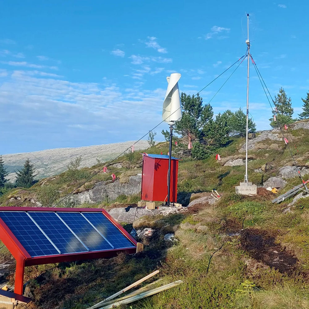
In the remote and challenging environment of Sør-Helgeland, North Norway (JP65EQ), Manuel Lausmann (DO3MLA) has constructed a remarkable, self-powered satellite ground receiving station. This installation stands as a testament to ingenuity and resourcefulness, demonstrating the potential for sustainable, off-grid scientific endeavors.
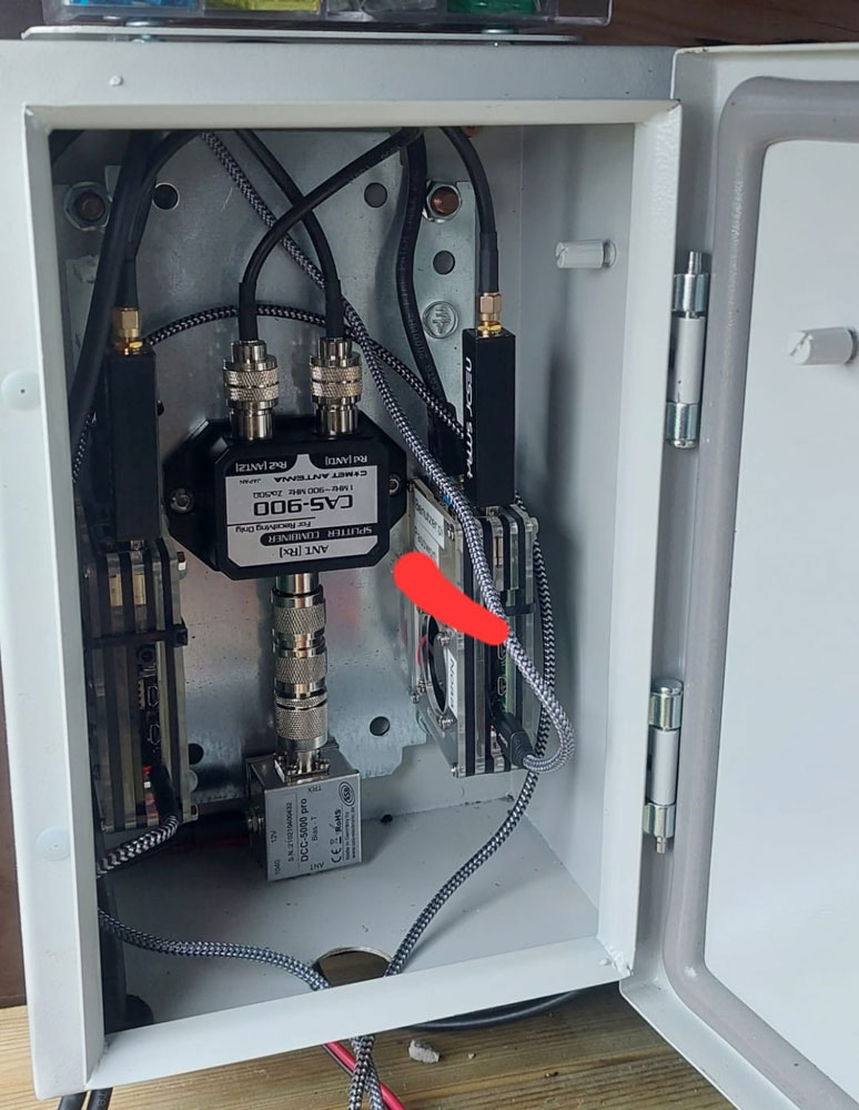
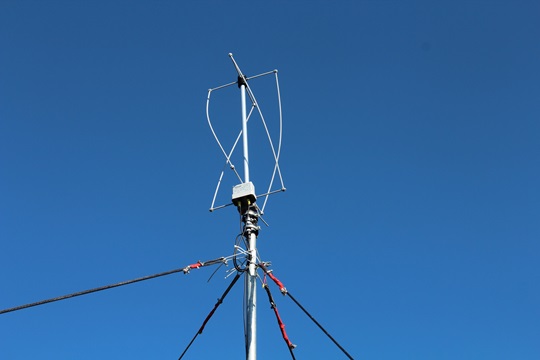
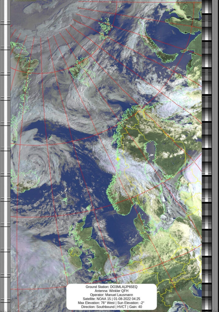
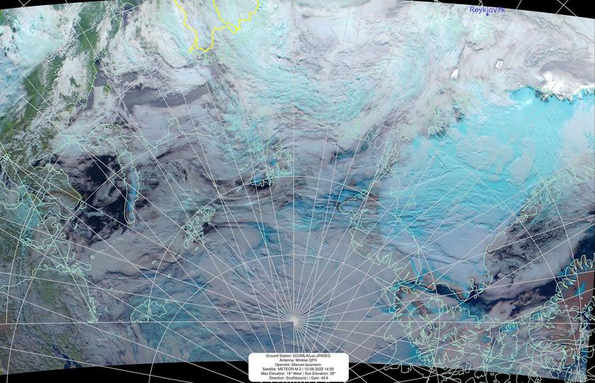
Lausmann’s station is designed to receive and process Automatic Picture Transmission (APT) and Low Rate Picture Transmission (LRPT) satellite imagery, primarily used for meteorological observations. The system also functions as a comprehensive weather station, providing real-time environmental data. What sets this station apart is its complete independence from the traditional power grid.
Powering the Arctic:
The station’s energy needs are met by a sophisticated hybrid renewable energy system. This system comprises:
- Wind Power: A 24V, 600W vertical axis wind turbine (VAWT) with a three-phase generator. This turbine is equipped with a Maximum Power Point Tracking (MPPT) controller, ensuring optimal energy capture from the variable wind conditions common in the region.
- Solar Power: A 300W, 24V solar panel array. This system complements the wind turbine, providing consistent power during periods of sunlight.
- Battery Storage: Dual deep-cycle batteries. These batteries store the generated energy, ensuring a stable power supply for the station’s operations, even during periods of low wind or solar irradiance.
Computational Core and Data Transmission:
The heart of the station consists of multiple Raspberry Pi computers. These small, powerful devices handle tasks such as:
- Satellite signal processing and image decoding.
- Weather data acquisition and logging.
- System monitoring and control.
- TLE (Two-Line Element sets) updates. These updates are essential for accurate satellite tracking.
Data and imagery are transmitted remotely via a mobile LTE router. This allows for continuous data flow and remote management of the station, despite its isolated location.
Significance and Implications:
Lausmann’s project demonstrates the feasibility of establishing sophisticated scientific installations in remote locations using renewable energy sources. This approach has significant implications for:
- Environmental Monitoring: Continuous, off-grid weather and satellite data collection in remote areas, providing valuable insights into climate change and environmental patterns.
- Disaster Preparedness: Real-time weather data and satellite imagery can enhance early warning systems for extreme weather events.
- Scientific Research: Facilitating research in remote and challenging environments, where traditional infrastructure is limited.
- Sustainable Technology: Showcasing the potential of hybrid renewable energy systems for powering remote installations.
Manuel Lausmann’s self-sufficient satellite ground station in North Norway serves as an inspiring example of how innovation and sustainable technology can be harnessed to overcome geographical challenges and advance scientific understanding.

It’s fascinating to delve deeper into the geographical context of Manuel Lausmann’s satellite ground station. Here’s a breakdown of the location and its significance:
- Hamnøya Island:
- This island is part of the Vevelstad Municipality in Nordland county, Norway.
- It’s situated approximately 100 kilometers south of the Arctic Circle, placing it in a region characterized by unique atmospheric conditions.
- The island itself has a relatively small population and is known for its serene and remote environment.
- It is separated from the mainland by the Vevelstadsundet strait.
- Vevelstad Municipality:
- This municipality is located within the Helgeland traditional region of Norway.
- The area is characterized by a blend of coastal landscapes and inland terrain, contributing to diverse weather patterns.
- The location of this ground station in this region, allows for the capturing of unique weather patterns.
- Capturing Arctic Imagery:
- Due to its proximity to the Arctic Circle, Lausmann’s station is ideally positioned to capture imagery of the North Pole that is rarely seen in more southern locations.
- This capability is particularly valuable for meteorological studies and climate monitoring, as it provides insights into Arctic weather phenomena.
- The APT and LRPT imagery that he is able to capture from NOAA APT Satellites and the Meteor M2 satellites, provides valuable weather data.
In essence, the geographical location of this ground station enhances its scientific value, enabling the collection of unique and important data from a remote Arctic region.
As an interesting side note, while researching this article, the area of Vevelstad is absolutely beautiful, but they need people! Yes, the Municipality of Vevelstad is offering free residential land for those who want to build and live in Vevelstad! And as a bonus free nursery care and all newborns receive a gift card of 3,000 Norwegian Kroner. (about $390 US)