![]()
GOES-T Reaches Geostationary Orbit, Now Designated GOES-18
On March 14, 2022, GOES-T executed its final engine burn, placing the satellite in geostationary orbit 22,236 miles above Earth. Upon reaching this milestone, GOES-T was renamed GOES-18. GOES satellites are designated with a letter prior to launch and a number once they achieve geostationary orbit.
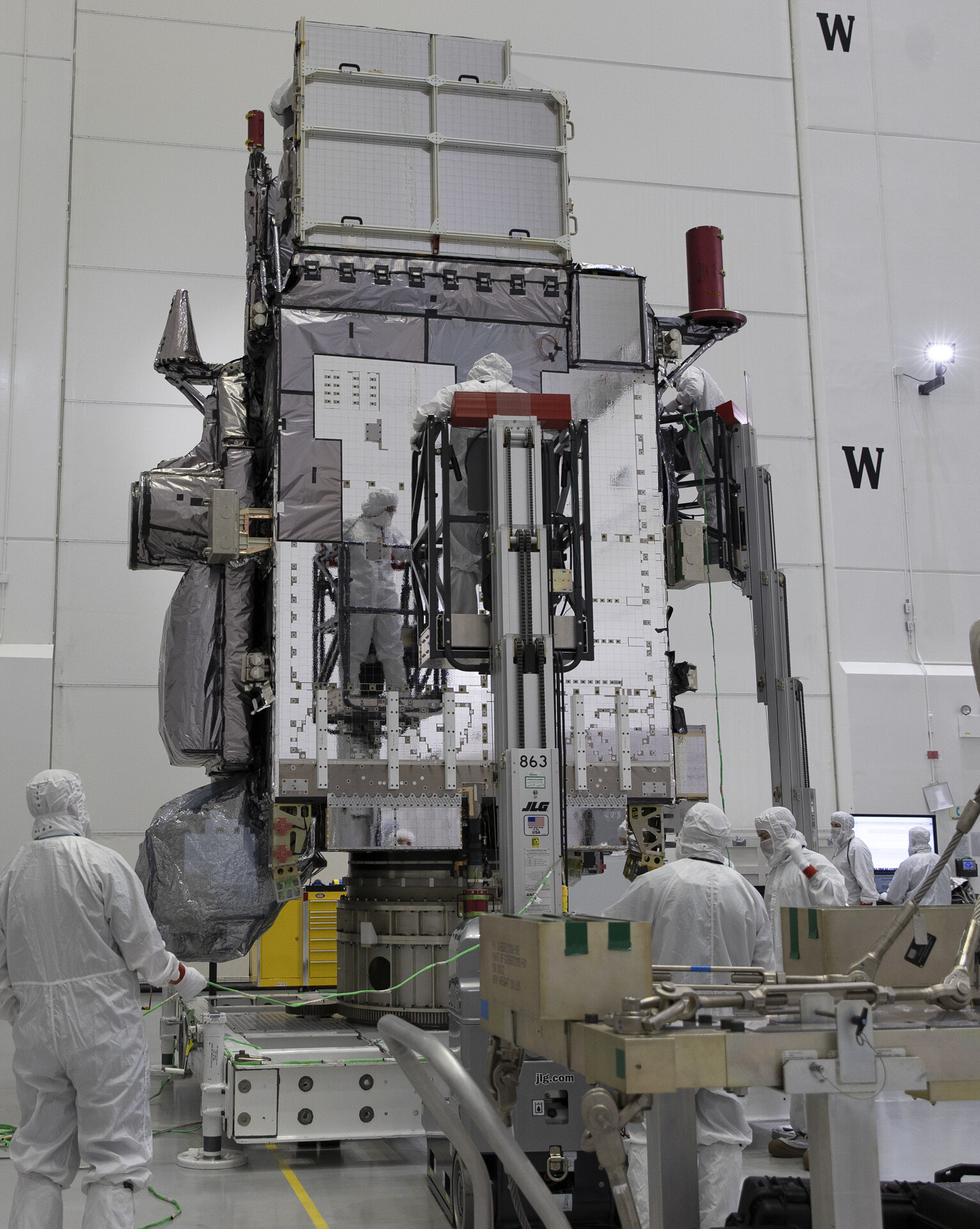
NOAA’s GOES-T satellite launched on March 1, 2022, at 4:38 p.m. EST, lifting off from Cape Canaveral Space Force Station in Florida. The satellite launched aboard a United Launch Alliance Atlas V rocket from Space Launch Complex 41. The launch was managed by NASA’s Launch Services Program, based at Kennedy Space Center.
GOES-T separated from the Atlas V Centaur upper stage at 8:11 p.m. EST on March 1. GOES-T mission managers confirmed that its solar arrays successfully deployed at 8:28 p.m. EST and the satellite was operating on its own power.
The launch vehicle delivered GOES-T to a geostationary transfer orbit, a highly elliptical orbit where the satellite is close to the Earth during one part of its orbit and far from the Earth on the opposite side. Placing GOES-T in a geostationary transfer orbit provides the satellite a path to reach its final geostationary orbit over the equator (see diagram below). After a series of orbit-raising maneuvers and engine burns, on March 14, GOES-T was delivered into a circular geostationary orbit. The satellite is now in position to orbit at the same rate Earth rotates, so it can keep constant watch over the same region.

Next, GOES-18 will perform its second stage solar array deployment, releasing the solar array. The deployed solar panels will form a single solar array wing that will rotate once per day to continuously point its photovoltaic (solar) cells toward the sun. The photovoltaic cells will convert energy from the sun into electricity to power the entire satellite, including the instruments, computers, data processors, sensors, and telecommunications equipment.
In the days that follow, several maneuvers will be conducted to put GOES-T in its 89.5 degrees west longitude initial checkout position, between the operational GOES-East and GOES-West satellites. Then, the magnetometer boom will be deployed. The satellite will then begin on-orbit checkout and validation of its instruments and systems.
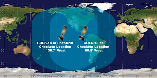
NOAA expects to see the first images from GOES-18 in May. Then GOES-18 will drift west to 136.8 degrees west longitude and finish post-launch testing. NOAA plans for GOES-18 to take over as the operational GOES-West satellite in early 2023, replacing GOES-17. GOES-17 will become the on-orbit backup.
GOES-18 POST-LAUNCH TESTING AND TRANSITION TO OPERATIONS
Additional Information:
GOES-T launched on March 1, 2022. Upon reaching geostationary orbit, the satellite will be renamed GOES-18. Following a successful on-orbit checkout of its instruments and systems, NOAA plans to put GOES-18 immediately into operational service, replacing GOES-17 as GOES-West. GOES-17 will be placed in on-orbit storage.
The GOES-R Program is working on a post-launch testing (PLT) plan that will get GOES-18 into position near the current GOES-West location in August 2022, so its Advanced Baseline Imager (ABI) data will be available for the “warm” period that degrades some GOES-17 imagery during the height of hurricane season.
The plan involves a “split” PLT period of two phases. The satellite will be launched to the regular 89.5 degrees west checkout location and undergo part one of PLT. GOES-18 will then drift to 136.8 west and perform the remainder of PLT at that location near GOES-West. The 0.4 degree offset from GOES-17 will allow X-band RDL downlink from both GOES-17 and GOES-18. The 0.2 degree offset from 137.0W meet ground system product generation requirements. Both GOES-17 and GOES-18 images will be remapped to 137.0W.
The transition plan allows for early operational use of GOES-18 ABI data after Beta maturity is achieved and incorporates radio frequency conflict mitigation between GOES-17 and GOES-18 and telemetry and command uplinks and downlinks. Users will not need to repoint their antennas. GOES-18 ABI data will be available via a Cloud interface and interleaving with GOES-17 non-ABI product data.
After its operational transition, GOES-18 will be nudged over to the GOES-West position at 137.2W and GOES-17 will drift to 105W and placed in on-orbit storage. Assuming a normal launch and checkout, GOES-18 will transition to the operational GOES-West satellite in early 2023.