![]()
Receiving satellite imagery all by itself is interesting science and, for many of us a great hobby. Setting up your satellite receiving station, whether for GOES-R series satellites, or Himawari, FY2 or FY4, GEO-KOMPSAT-2A, Elektro-L series and others, getting the images is, in my opinion, just the start!
Like NOAA, EUMETSAT, ROSCOSMOS, KMA, and other weather services, taking that data and imagery and applying processes to it through various software packages and modifying scripts for image manipulation can result in some spectacular imagery.

There are many types of software I use, and most of them I have written pages about here on my website. Aside from the LINUX based receiving systems I use to handle the heavy lifting with SDR’s PI’s, etc. toactually pull in multiple satellites frequencies, my main computer is currently windows 11, with about 10 TB of storage for imagery I recieve. (and it’s not enough!)
Here are my most common “GoTo” pieces of software for post-processing of received imagery:
- ImageMagick : I use this in every script I have written, very valuable for manipulating imagery via a command line. Used extensively by NOAA, CIRA, SSEC, EUMETSAT, and many others for that fantastic imagery you see on those websites.
- FFMpeg: I use this video manipulation software to generate animation Mp4 and the occasional GIF. Also used extensively by NOAA, CIRA, SSEC, EUMETSAT
- Xplanet: Xplanet is old software, it was inspired by Xearth, which renders an image of the earth into the X root window, the version I am running was compiled in 2002!!! xplanet-1.3.0. It allows me to generate Specular Lighting, rayleigh lighting, Satellite tracks, geo place names, and an important day/night rendering and much more; not bad for a 20-year-old piece of software!
- Sanchez: Sanchez can bring color to full-disc images, but it can also reproject and blend images from multiple satellites – either by creating a flat projected image or by creating a virtual satellite image at a given longitude. Sanchez is a command-line application. It was designed for processing of greyscale IR images from geostationary satellites, and with some tweaking of configurations, it can do quite a bit!
- Powershell: PowerShell is a cross-platform task automation solution made up of a command-line shell, a scripting language, and a configuration management framework. PowerShell runs on Windows, Linux, and macOS.
- Windows Command-line shells: The Command shell was the first shell built into Windows to automate routine tasks, like user account management or nightly backups, with batch (.bat) files. I use it extensively! such as getting UTC times:
- WINSCP: FTP client and FTP client for Microsoft Windows! Copy file between a local computer and remote servers using FTP, FTPS, SCP, SFTP, WebDAV or S3 file transfer protocols.
- FileZilla: The FileZilla Client not only supports FTP, but also FTP over TLS (FTPS) and SFTP.
for /f %%a in ('wmic Path Win32_UTCTime get Year^,Month^,Day^,Hour^,Minute^,Second /Format:List ^| findstr "="') do (set %%a)- I also have some image editing software like PhotoShop Elements.
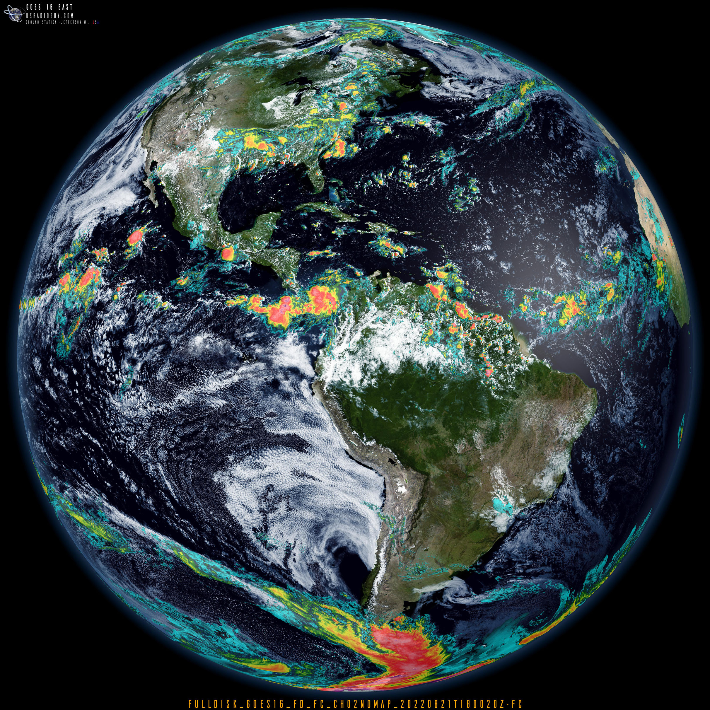
When I combine all these together I can take a received HRIT (High Rate Information Transmission….note, it does not say High Resolution!) image like this, received by using goestools- Band 02 received from GOES-16 on August 21st at 1800 UTC.

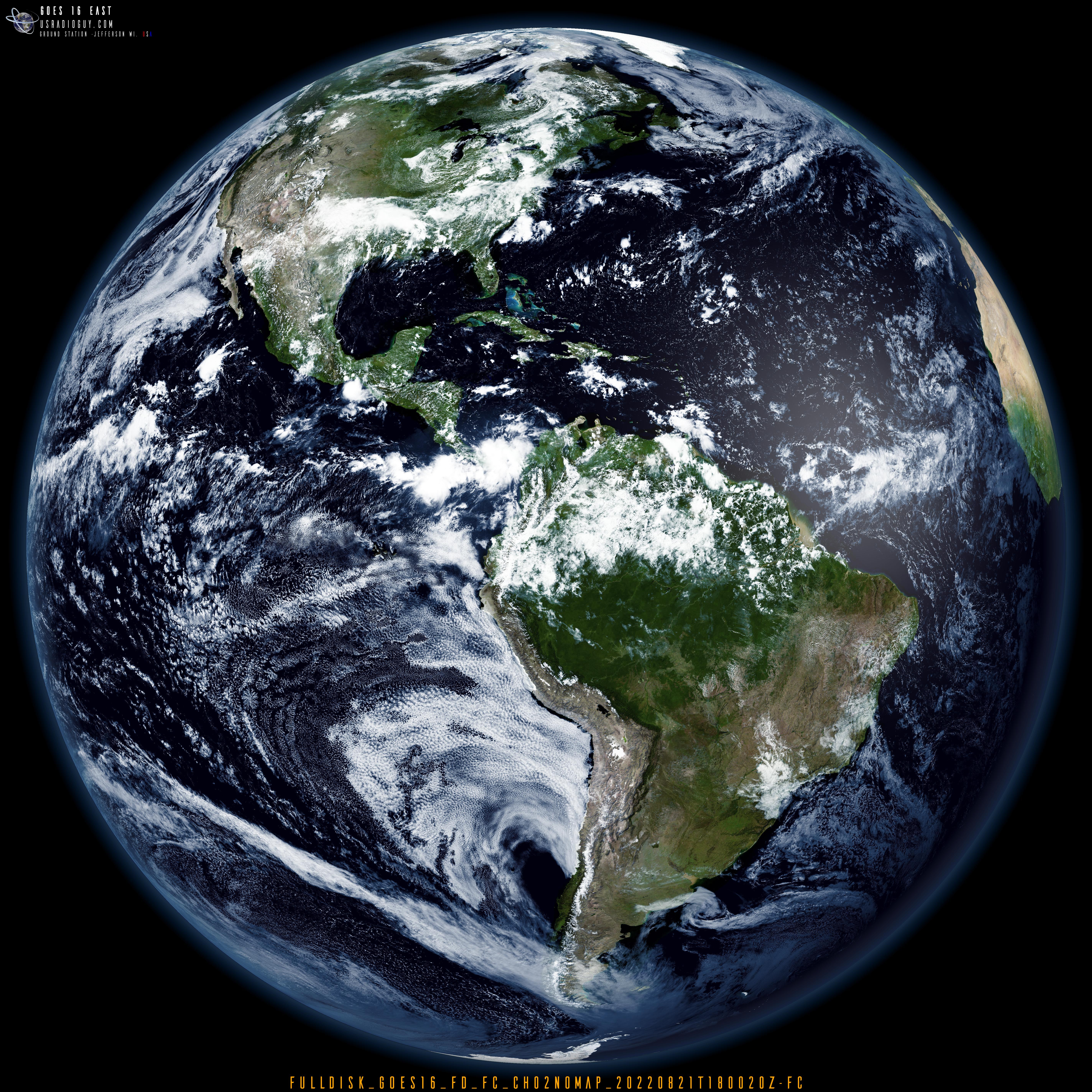
And process it into full-color imagery like this! Click on the image to see it at full processed resolution. Be sure to Zoom in!
GOES 16 2022.08.21 Same as above but with Band 15 layered in.
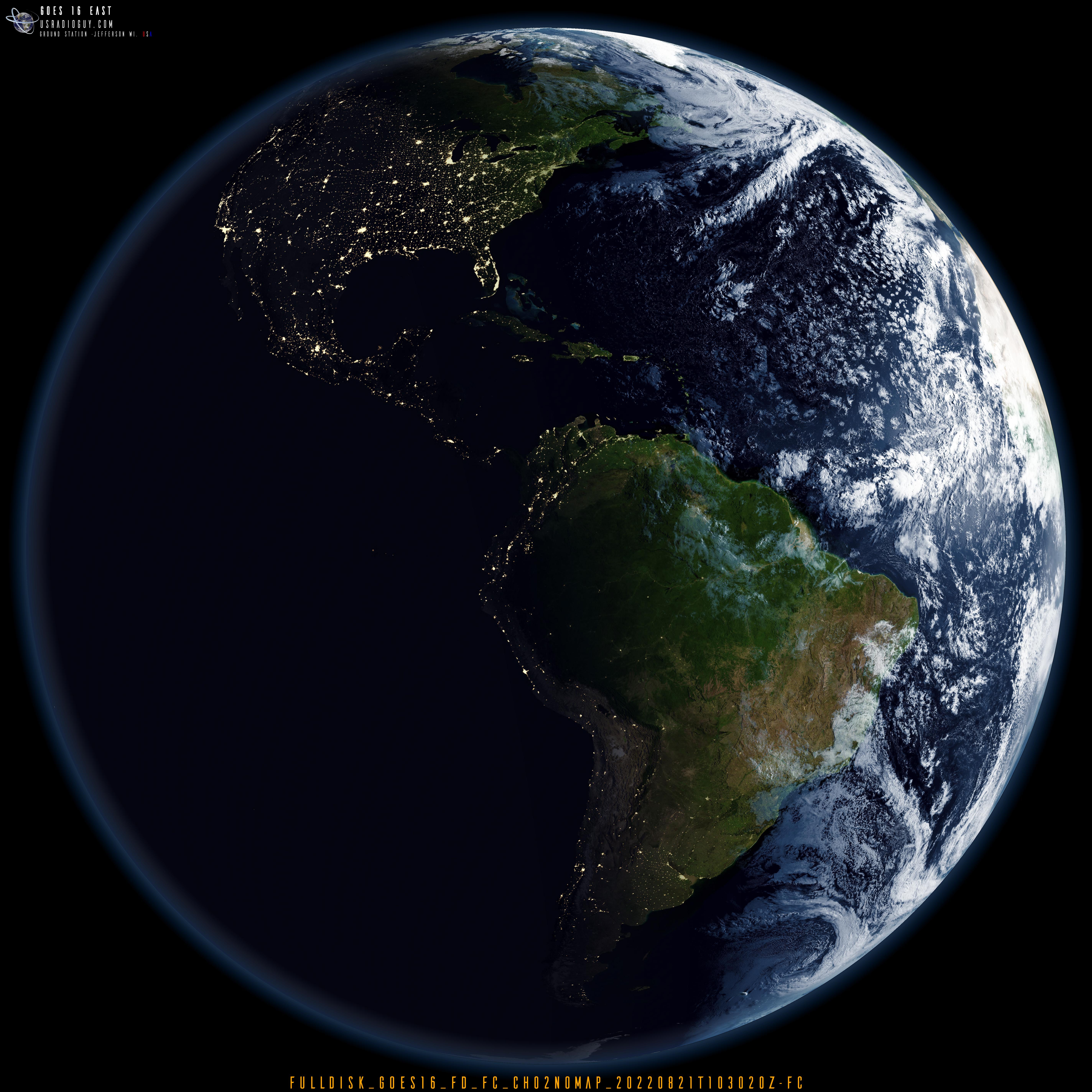

Same image as above, but with cities and locations, and if you zoom in, you can see the orbital tracks of many Polar Orbiting Satellites.

My advice- On the next rainy day, or snowy day, or day when it’s to hot, try learning some software and some code. Dr. Google can be a friend! Have a look at sites like mine that post all sorts of information:
- Custom Imagery Scripts for Geo Sationary Images
- The quest for True Color Imagery
- Creating Global Composites from multiple satellites.
- Custom Color Lookup Table
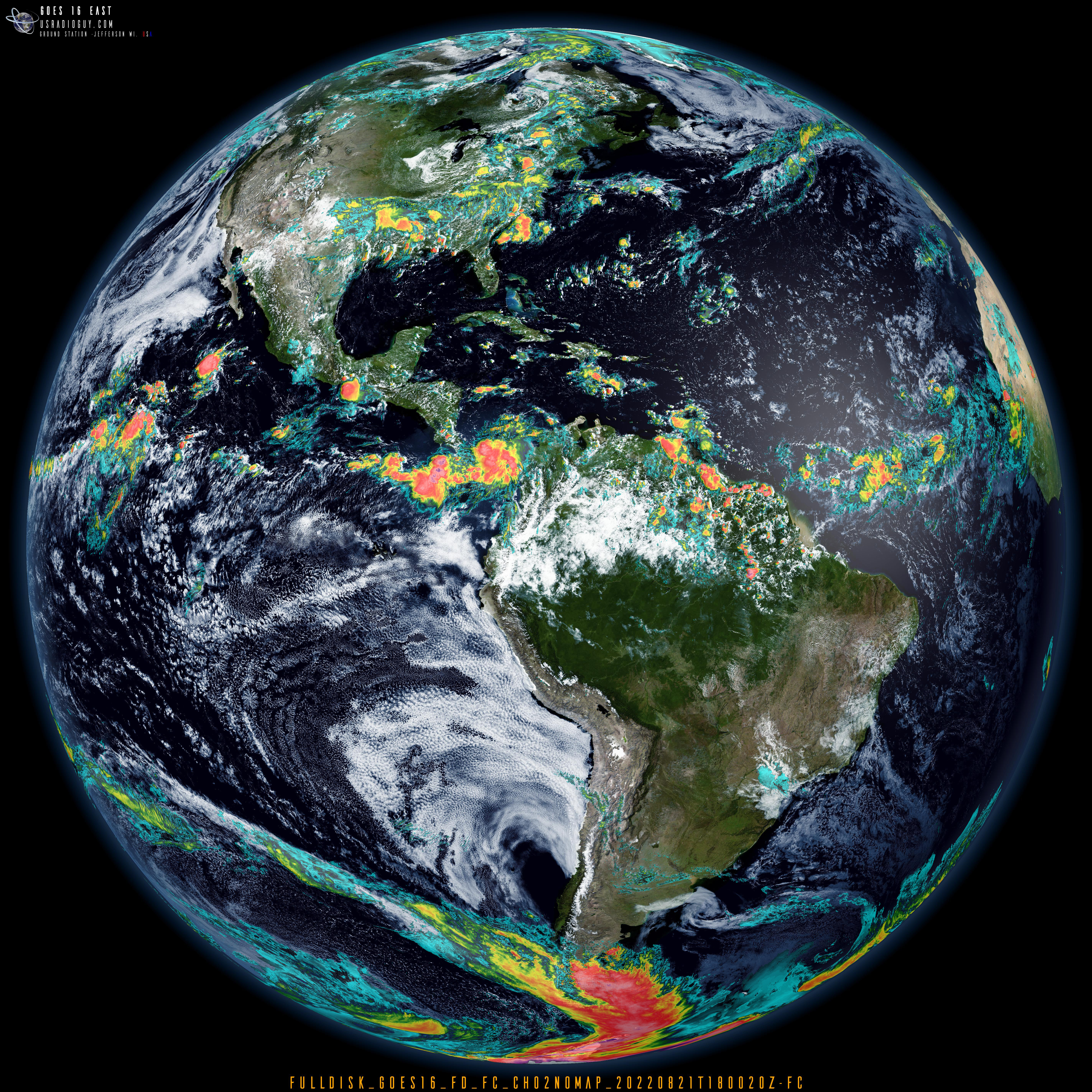
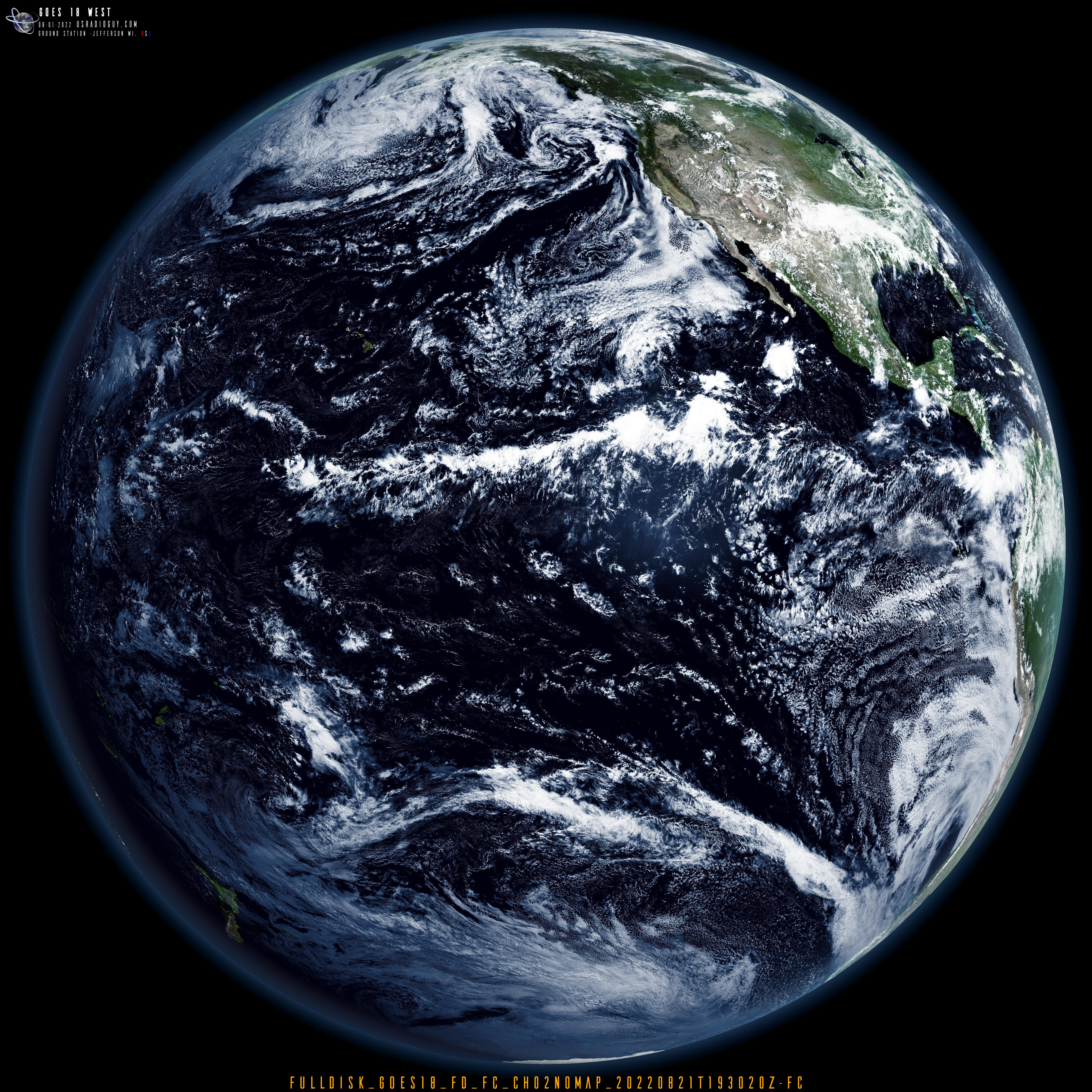
Lastly, the image below, I ran through my system, But, instead of using HRIT, I pulled a GRB image of Channel 02 at 20:30 UTC. 20 MB in size (11390×11390 pixels), I reduced it by 1/2 from about 42 mb (22680×22680 pixels). Definitely zoom in on the cloud structures