Skip to content
USRADIOGUY

USRadioguy.com

Welcome to USRadioguy.com – Unlocking the Potential of Software Defined Radio

  • Home
    • Home of USRadioguy
    • USRadioguy Newsletter
    • Tried and Tested Hardware
    • What is RTL-SDR?
    • Global Weather Data
  • Satellite Reception
    • Geo Stationary Satellites
      • Geo-stationary Satellite Imagery Reception
      • GOESTOOLS on the PI
      • Update Goestools for GOES 18,19
      • Receiving GOES with SatDump CLI Mode
      • GOES receiving in Windows for SatDump GUI
      • Decoding EWS-G1/EWS-G2
      • GOES GRB Reception WIP
      • Optimizing a WIFI Grid Antenna for Maximum Efficiency
    • APT Satellites
      • APT RECEPTION
      • Satdump for Meteor and NOAA decoding
      • METEOR M2- Series
      • WxtoImg Fix
      • Converting to new TLE format
      • Layering Fire and Hotspot Data on Meteor Sat Imagery
      • HRPT Satellite Tracking and Capture
    • Receiving Other Satellites
      • Inmarsat Decoding
      • Receiving the Funcube Amateur Satellite
    • User Maps and Dish Pointers
      • Satellite Dish Pointer
      • User Global Ground Station Maps
      • Usermap rendered with Cesium
      • Global Map of Govt Dish Stations
    • Satellite Details & Information
      • ORBITAL DYNAMICS 101
      • HRIT/EMWIN & GRB Defined
      • Mesoscale Imagery Defined
      • Viterbi, R/S Errors, Packets
      • GOES BAND IMAGERY
      • Stray Light Zone (SLZ)
      • Drifting a geostationary satellite
      • GOES-R Series Multimedia Tour
      • Online Satellite Imagery and Information
      • Satellite Frequencies
      • Solar and Space Weather
  • Satellite Imagery
    • IMAGERY- Current GOES East & West HRIT Satellite Imagery
    • IMAGERY- GOES 16&18 – Past 96 Hours of Imagery
    • High Resolution Imagery
    • Daily 3D view of Earth
    • NOAA APT Satellite imagery
    • PlanetMaker
    • GOES16 A full year of received imagery
  • Imagery Processing
    • Custom Color Lookup Table & Gradients
    • GOES-R Custom Imagery Scripts
    • Global geo-ring composites
    • MODIS VIIRS Global Coverage
    • 3D Satellite Tracking
    • The quest for True Color Imagery
    • 3D animation of realtime data
    • Layering Geo-Spatial Fire Data into Satellite Imagery
    • Orbital dynamics and the Moon
    • National Hurricane Data
  • News, VLOGS & BLOGS
    • News & USRadioguy Blogs
    • USRadioguy VLOGS
  • Project Lab
    • Orbital Information and Visualizations
      • Enhanced Planet Earth
      • Satellites in Orbit
      • Solar System
      • Objects in Orbit
    • Current Station Weather
      • Current Groundstation Weather
      • Global Weather Data
      • Space Weather
    • WWII RADIO
      • WWII K-24 Aerial Camera
      • WWII RADIO
      • RADIO SET SCR-284
      • VS-3 VIBRATOR CONVERSION
      • VIBRATOR CONVERSION MODULE
      • BD-71 Field Switch Board and EE-8B Field Telephones
      • R-100/URR 1944 MORALE RADIO
      • A PORTABLE WWII ERA “MORALE RADIO”
      • AN/GRR-5 THE ANGRY 5
      • WWII Audio Page
    • Raspberry Pi Projects
      • ADS-B Reception
      • Allsky Camera
      • Pi Based Picture Frame
      • PI Based Broadcastify Server
      • Solar Power for PI
    • Hubble Space Telescope Data Processing
    • Zombie Satellites
    • DRONES
  • About Me
    • About Usradioguy
      • SETEC Astronomy
    • Tried and Tested Hardware
    • Rare Captures
    • My Other Interests
    • Presentations
    • Merchandise
    • Privacy Policy
  • Home
  • Satellites
  • NOAA 15,18,19 to transition to private On-orbit operations
NOAA 15

NOAA 15,18,19 to transition to private On-orbit operations

Posted on October 20, 2022October 20, 2022 By Carl
Satellites

Loading

NOAA Awards Parsons Team $16 Million Contract For Polar Operational Environmental Satellites Operations

October 19, 2022


NOAA-19

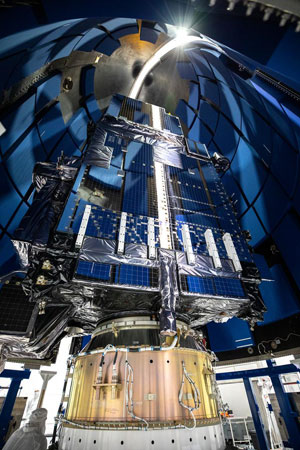
CENTREVILLE, Va., Oct. 19, 2022 — The National Oceanic and Atmospheric Administration (NOAA) has selected a team led by Parsons Corporation to provide engineering services, information technology functionality, and flight operations support to assume on-orbit operations for the Polar Operational Environmental Satellites (POES) NOAA-15, NOAA-18, and NOAA-19. The $16 million definitive contract has a one-year performance period and two one-year option periods and is new work for Parsons.

The Parsons-led team comprises Arctic Slope Technical Services, Inc. (ASTS), a subsidiary of Arctic Slope Regional Corporation (ASRC) Federal, and Kongsberg Satellite Services (KSAT). ASTS currently operates the POES spacecraft and will continue to support operations and implementation of cyber security architecture, while (KSAT) will provide ground antenna support with their KSATlite service.

“In partnership with NOAA, this team will leverage our extensive portfolios of satellite operations and information technology capabilities to demonstrate successful commercialization of the polar operations mission,” said Jason Long, Parsons vice president for civil solutions. “We look forward to further evolving the partnership between government and commercial industry in the space domain to affordably extend the life of these valuable environmental monitoring systems.”

NOAA’s three POES will be one of the first U.S. government satellites transitioned from a legacy government-owned ground control system to a hybrid cloud based commercial operation, setting a precedent that may lead to further commercialization of government-owned satellites in the future.

Over the next six months, the team will move the control of the POES to commercial ground control systems deployed on a hybrid cloud architecture using Parsons’ commercial space software applications while demonstrating successful control of POES, followed by six months of full commercial operations.

Instrument Science data from the satellites will be delivered to NOAA for processing within their existing architecture, retaining these spacecraft as valuable data sources supporting NOAA’s critical mission to keep the public informed of the changing environment.

Parsons has developed multiple operational commercial-space solutions that are based on government programs, to include OrbitXchange™, which enables increased capacity for satellite operations via a cybersecure cloud environment. The company is focused on delivering rapid, affordable off-the-shelf technology that can advance both military and commercial missions.

Coincidentally Parsons Corporation also manufactures high-end SDR systems:

Parson Corporation Software Defined Radio Products For Assured PNT, Modeling & Simulation, Test & Evaluation, And Electronic Warfare
Parsons develops and sells leading-edge SDR systems that are portable, remotely controllable, and able to host and execute challenging RF Applications. Products support Assured Positioning/Navigation/Timing  (APNT), Electronic Warfare (EW), and high-fidelity laboratory modeling, simulation, and testing of complex radio frequency (RF) devices. Modeling & Simulation (M&S) and Testing & Evaluation (T&E) products accelerate research, development, deployment, and market acceptance of advanced RF devices and systems. Expertise also includes the development of proprietary signal processing algorithms for APNT, EW, RF systems, and RF propagation modeling.

Post navigation

❮ Previous Post: Groups that focus on Weather Sat Reception
Next Post: NOAA-15 AVHRR Issues ❯

You may also like

Satellites
AI- Artificial Intelligence
January 15, 2023
News
End Of Life for NOAA 15,18,19?….not so fast…
April 25, 2025
Life
Mapping Ground Stations
February 6, 2022
Interesting stuff you should know!
The altered life of GOES-3
March 6, 2023

Please, Help Support USRadioguy.com

If you like what I do please support me on Ko-fi, It really means a lot, every bit helps!

Hardware Humor Imagery Processing Interesting stuff you should know! Launch News Life News Product Review Satellites Science Software Space Weather Uncategorized VLOG

Alphabetical Listing of all Pages on site:

  • 36-Hour Imagery Processing script
  • 3D animation of realtime data
  • A PORTABLE WWII ERA “MORALE RADIO”
  • About Me
  • ADS-B Reception
  • Allsky Camera
  • AN/GRR-5 THE ANGRY 5
  • BD-71 Field Switch Board and EE-8B Field Telephones
  • Current GOES 16 & 18 False Color Satellite Imagery
  • Custom Color Lookup Table
  • Custom Imagery Scripts for GOES
  • Daily 3D view of Earth
  • Daily Global Composites
  • Decoding EWS-G1 or GOES-13
  • Drifting a geostationary satellite
  • DRONE FUN
  • Even the kitchen sink
  • GEO-RING COMPOSITES
  • GEO-SAT PI FRAME
  • Geo-stationary Satellite Imagery Reception
  • Global Weather Data
  • GOES 19&18 – Last 96 Hours of Imagery
  • GOES BAND IMAGERY
  • GOES GRB Reception
  • GOES receiving in Windows for SatDump
  • GOES-18 Preparing for a new satellite
  • GOES-R Series Multimedia Tour
  • GOES-U (19) Countdown to Launch
  • GOES16 A full year of received imagery
  • Ground Station Map
  • High Resolution Imagery
  • Home
  • House History
  • HRIT/EMWIN & GRB
  • HRPT Satellite Tracking and Capture
  • Hubble Space Telescope Data Processing
  • Inmarsat Decoding
  • Layering Fire and Hotspot Data on Meteor Sat Imagery
  • Layering Geo-Spatial Fire Data into Satellite Imagery
  • Mesoscale Imagery Defined
  • METEOR M2- Series
  • MODIS VIIRS Global Coverage
  • My Other Interests
  • NASA, NOAA, Military, GOVT dish, and tower stations.
  • National Hurricane Data
  • Newsletter terms & conditions
  • NOAA & Meteor APT and LRPT RECEPTION
  • Online Satellite Imagery and Information
  • Optimizing a WIFI Grid Antenna for Maximum Efficiency
  • ORBITAL DYNAMICS 101
  • Orbitron, Gpredict, and PSTRotator with new TLE format
  • PI Based Broadcastify Server
  • Pi Based Picture Frame
  • Presentations
  • Privacy Policy
  • Programming the PI for goestools operation
  • R-100/URR 1944 MORALE RADIO
  • RADIO SET SCR-284
  • Rare Captures
  • Receiving GOES 18,19 with goestools
  • Receiving GOES HRIT with SATDUMP
  • Receiving the Funcube Amateur Satellite
  • Satdump for Meteor and NOAA decoding
  • Satellite Finder
  • Satellite Frequencies
  • Satellite Ground Stations
  • Satellite Tracking
  • Security
  • SETEC Astronomy
  • Solar Power for PI
  • South America GOES 16
  • Space Weather
  • Stray Light Zone (SLZ)
  • Thanks!
  • The quest for True Color Imagery
  • Tried and Tested Hardware
  • Usradioguy Blogs
  • Usradioguy Merchandise
  • USRadioguy Newsletter
  • USRadioguy VLOGS
  • USRADIOGUY Youtube Page
  • VIBRATOR CONVERSION MODULE
  • Viterbi, R/S Errors, Packets
  • VS-3 VIBRATOR CONVERSION
  • What is RTL-SDR?
  • WWII Audio Page
  • WWII K-24 Aerial Camera
  • WWII RADIO
  • WxtoImg Fix
  • Zombie Satellites

Hardware Humor Imagery Processing Interesting stuff you should know! Launch News Life News Product Review Satellites Science Software Space Weather Uncategorized VLOG

Satellite And Weather Related Feeds

  • CIMSS Satellite Blog
  • USRadioguy.com
  • wildfires
  • NASA Earth Observatory
  • SPC Particularly Dangerous Situation (PDS) Tornado/Severe Thunderstorm Watch
  • satellites
  • Satellites News -- ScienceDaily
  • Satellite Liaison Blog
Using Polar2grid and Direct Broadcast files to create imagery
Cirrus over the western Great Lakes
Wildfire in Saskatchewan produces a pyrocumulonimbus cloud
End Of Life for NOAA 15,18,19?….not so fast…
GOES-19 now GOES-EAST
GOES 19 Operational Schedule
The fire cycle
March was nation's 6th warmest on record
Podcast: Could the LA Wildfires harm California's marine life?
Mapping the Tiny Plankton That Feed Giant Right Whales
Lights of Southeast Asia
The Arches That Salt Built
SPC PDS Tornado Watch 98
Five historically huge solar events
65 years since the world’s first weather satellite
Investing in America: NOAA's Science, Service and Stewardship in Action
Satellite measures CO2 and NO2 simultaneously from power plant emissions for the first time
Existing international law can help secure peace and security in outer space
Small, faint and 'unexpected in a lot of different ways': Astronomers make galactic discovery
Another Week, Another Deep South Soaker
4 May 2025 Dust and Accumulating Hail
Southern Plains Deluge
  • Facebook Geo Stationary Satellites
  • Usradioguy Facebook
  • Instagram
  • Reddit
  • Github
  • Linkedin

Copyright © 2025 USRadioguy.com - All Rights Reserved. All material protected by Fair Use Section 107 of the Copyright Act. This site is Verified and Secured with 256 bit SSL encryption