![]()

COSPAS/SARSAT: The Technology Behind Saving Lives
COSPAS/SARSAT is a technology that has been instrumental in saving countless lives over the years. It is a system that utilizes satellites and ground-based receivers to detect and locate emergency distress beacons, providing critical assistance to search and rescue operations around the world.
COSPAS-SARSAT is an international satellite-based search and rescue system that has been in operation since the early 1980s. The system is a joint effort between four organizations: COSPAS (which stands for “Cosmicheskaya Sistyema Poiska Avariynich Sudov,” or “Space System for the Search of Vessels in Distress“), SARSAT (which stands for “Search and Rescue Satellite-Aided Tracking“), the International Cospas-Sarsat Programme and the NOAA (National Oceanic and Atmospheric Administration) of the United States.
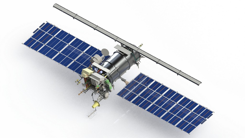
Russia and the United States provide the LEO and GEO satellite platforms. Canada, France, Russia, and the United States contribute components. The Russian NADEZHDA navigation satellites carry the Cospas repeater packages, and NOAA weather satellites carry Sarsat packages. **List of other Countries with SARSAT**
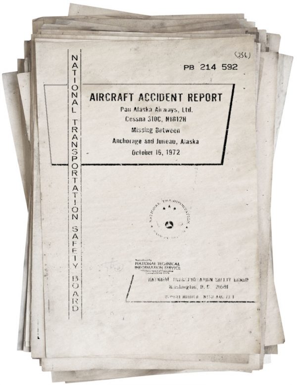
The beginnings of SARSAT date back to October 1972 when a plane carrying two U.S. congressmen, Rep. Hale Boggs (D-La.), the House majority leader and Rep. Nick Begich (D-Alaska), went missing in a remote region of Alaska. A 39 day massive search and rescue effort was mounted. Neither the wreckage of the plane nor the pilot’s and passengers’ remains were ever found.
In reaction to this tragedy, Congress mandated that all aircraft in the United States carry an Emergency Locator Transmitter (ELT). This device was designed to automatically activate after a crash and transmit a homing signal. ELT analog technology had been developed and available since the 1950s. It was designed to automatically transmit a homing signal when a military aircraft crashed.
As the sixties transitioned to the seventies, space shifted from being a new frontier to a platform for looking back at ourselves. Space technology applications opened up using satellites to address weather communications and navigation. Within NASA it was recognized that another benefit of satellite technology could be search and rescue. It was thought that if overflying aircraft within a limited range of a downed aircraft could pick up an activated beacon signal, imagine the coverage area if this same beacon could be picked up by an overflying satellite. And it would solve another problem…. it could also listen for and locate ships in distress at sea. According to the National Oceanic and Atmospheric Administration (NOAA), SARSAT has saved over 46,000 lives since its inception.
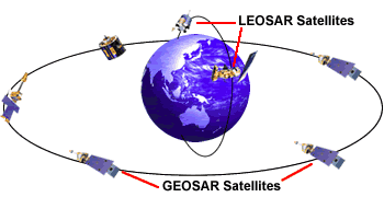
The U.S. SARSAT system uses GPS satellites in medium earth orbit as well as NOAA satellites in low-earth orbits and GOES satellites in geostationary orbits to detect and locate distress signals from 406 emergency distress beacons. When an emergency beacon is activated, the signal is received by satellite and relayed to the nearest available ground station.
One of the key benefits of SARSAT is its ability to rapidly detect distress signals, which allows search and rescue teams to respond quickly and efficiently. Mariners, aviators, and recreational enthusiasts can all access the satellite system in an emergency using a portable radio transmitter called a 406 distress beacon. These beacons can send an SOS signal from anywhere on earth, at any time, including in most extreme weather conditions. As Dr. Chris Moore, the former Director of NOAA’s Office of Search and Rescue, explains, “When a beacon goes off, it’s essentially like a 911 call from the wilderness. SARSAT allows us to hear that call and respond immediately, which can be the difference between life and death.”
Another important aspect of SARSAT is its global coverage. The system is capable of detecting distress signals anywhere on the planet, including over oceans and remote areas. This capability has been critical in many search and rescue operations, such as when a plane crashes in the middle of the ocean or a hiker becomes lost in a remote wilderness area.
According to the USCG, “The SARSAT system is an essential tool for the Coast Guard in conducting search and rescue operations. The system provides a global network of satellites that can quickly detect distress signals from emergency beacons and relay that information to rescue authorities, allowing us to rapidly locate and assist people in distress. The ability to quickly locate and rescue people in distress is critical to our mission of saving lives at sea, and the SARSAT system plays a vital role in that effort.”
Despite its many benefits, SARSAT is not without its limitations. One of the main challenges is the need for individuals to carry and activate a distress beacon in the first place. As Dr. Moore notes, “If someone is in distress and they don’t have a beacon, SARSAT can’t help them.”
Another issue is the potential for false alarms, which can result from accidental activations or malfunctioning beacons. However, according to NOAA, the rate of false alarms has been reduced to less than 1% in recent years, thanks to improvements in beacon technology and increased public awareness.
How it all works together
Search and Rescue (SAR) instruments are flown on board Low Earth Polar Orbiting (LEO), Medium Earth Orbiting (MEO) and Geostationary Earth Orbiting (GEO) satellites provided by the United States, Russian Federation, India, and the European Organization for the Exploitation of Meteorological Satellites (EUMETSAT). These satellites can detect signals coming from the Earth’s surface transmitted by 406 emergency distress beacons. These beacons operate on a 406MHz frequency and are battery-powered radio transmitters designed solely to send a distress signal if activated. Once a beacon is activated it begins to transmit a continuous radio signal which is first picked up by the satellite instrumentation, then used by search and rescue to locate the emergency and render assistance.
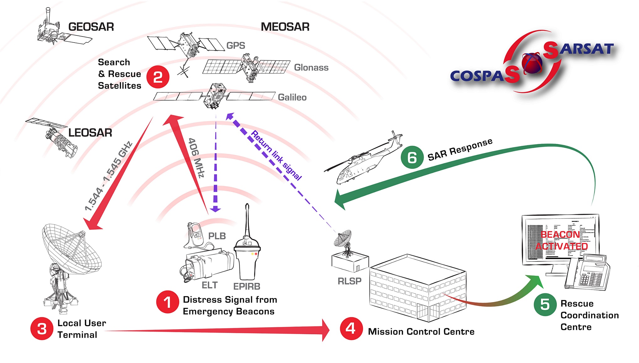
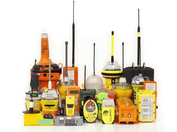
There are three types of 406MHz beacons, each with unique properties depending on the type of environment it is designed for Emergency Locator Transmitters (ELTs) used by the aviation community, Emergency Position Indicating Radio Beacons (EPIRBs) used in the maritime environment, and Personal Locator Beacons (PLBs) used by individuals in multiple wilderness activities.
When activated, ELTs, EPIRBs, and PLBs transmit the distress signal on the 406 MHz frequency. This signal frequency has been designated internationally for use only for distress. Imbedded in this frequency is a unique digital code called a HEX ID. The HEX ID identifies the type of beacon and, if the beacon is registered, important information that helps search and rescue (SAR) specialists determine the best course of action.
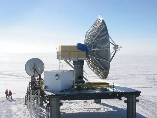
This information can include: who the beacon owner is, the type of aircraft or vessel the beacon is associated with (for ELTs and EPIRBs), emergency points of contact, flight plans, float plans, and wilderness trip plans, and much more. After the satellite receives a beacon signal, it relays the signal to ground stations referred to as local user terminals (LUTs). The LUT processes the data, computes the location of the distress beacon, and transmits a decoded alert message to its associated national Mission Control Center (MCC). This happens almost instantaneously after the initial beacon signal is received.
The MCC then automatically performs matching and merging of alert messages with other received messages, geographically sorts the data, and transmits a distress message to the closest appropriate SAR authority such as a national Rescue Coordination Center (RCC), a foreign SAR Point of Contact (SPOC) and another MCC if the beacon is for example registered to another country. The RCC investigates the beacon alert and launches rescue assets to find the parties in distress if the distress is deemed authentic. This can happen much quicker when the beacon is properly registered.
Return Link Service (RLS) is a new Cospas-Sarsat system enhancement that is coordinated by the French Space agency, CNES (Centre national d’études spatiales). This is an option built into the next-generation 406 beacon itself.
In the case of the United States, the U.S. Mission Control Center (USMCC) receives distress signal data from its LUTs as well as other MCCs that have picked up the signal. It then transmits the distress message information to the closest U.S. national SAR services, such as the U.S. Air Force or U.S. Coast Guard RCCs, depending on the type of distress and its location.
The USMCC also transmits distress messages internationally to SPOCs located in other countries that might have assets in closer proximity to the distress, even though the distress situation is technically taking place within the USMCC service area.
Overall, SARSAT is a critical tool for search and rescue operations around the world, providing rapid and reliable assistance to those in need. As Dr. Moore sums up, “SARSAT is a lifeline for people in distress. It’s a technology that has saved countless lives, and it will continue to do so for many years to come.”
List of Countries that are members of COSPAS/SARSAT
- Algeria
- Argentina
- Australia
- Austria
- Bangladesh
- Belarus
- Belgium
- Brazil
- Bulgaria
- Canada
- Chile
- China
- Colombia
- Croatia
- Cyprus
- Czech Republic
- Denmark
- Ecuador
- Egypt
- Estonia
- Finland
- France
- Germany
- Greece
- Hungary
- Iceland
- India
- Indonesia
- Iran
- Ireland
- Israel
- Italy
- Japan
- Kazakhstan
- Latvia
- Lithuania
- Luxembourg
- Malaysia
- Mexico
- Morocco
- Netherlands
- New Zealand
- Nigeria
- Norway
- Pakistan
- Panama
- Peru
- Philippines
- Poland
- Portugal
- Romania
- Russia
- Saudi Arabia
- Serbia
- Singapore
- Slovakia
- Slovenia
- South Africa
- South Korea
- Spain
- Sri Lanka
- Sweden
- Switzerland
- Thailand
- Tunisia
- Turkey
- Ukraine
- United Arab Emirates
- United Kingdom
- United States
- Uruguay
- Venezuela
Please note that this list may be subject to change as new countries may join the COSPAS-SARSAT system over time.
The following is a list of the satellites that currently carry the COSPAS-SARSAT system:
- NOAA Polar-Orbiting Operational Environmental Satellite (POES) series: NOAA-15, NOAA-18, and NOAA-19
- Geostationary Operational Environmental Satellite (GOES) series: GOES-R, GOES-S, GOES-T, and GOES-U
- MetOp series: MetOp-A, MetOp-B, and MetOp-C (jointly operated by EUMETSAT and NOAA)
- Russian Search and Rescue Satellite System (Sarych): Resurs-P and Kanopus-V
- Indian Space Research Organization’s (ISRO) NavIC Constellation: IRNSS-1A, IRNSS-1B, IRNSS-1C, IRNSS-1D, IRNSS-1E, IRNSS-1F, and IRNSS-1G
It is important to note that not all of these satellites are necessarily operational or currently transmitting SARSAT signals, as satellite systems can experience failures or be decommissioned over time. However, these are the satellites that have carried or currently carry the COSPAS-SARSAT system.
More COSPAS/SARSAT Resources
- https://www.sarsat.noaa.gov/
- https://www.nesdis.noaa.gov/data-research-services/search-rescue
- https://www.nasa.gov/centers/goddard/pdf/105930main_cospas.pdf
- https://www.weather.gov/safety/safeboating-beacons
- https://www.cospas-sarsat.int/en/
The author wishes to credit NOAA, NESDIS, COSPAS, and EUMETSAT for contibuting information for this article