Skip to content
USRADIOGUY

USRadioguy.com

Welcome to USRadioguy.com – Unlocking the Potential of Software Defined Radio

  • Home
    • Home of USRadioguy
    • Tried and Tested Hardware
    • USRadioguy Newsletter
    • What is RTL-SDR?
    • Global Weather Data
  • Satellite Reception
    • Geo Stationary Satellites
      • Geo-stationary Satellite Imagery Reception
      • GOESTOOLS on the PI
      • Update Goestools for GOES 18,19
      • Receiving GOES with SatDump CLI Mode
      • GOES receiving in Windows for SatDump GUI
      • Decoding EWS-G1/EWS-G2
      • GOES GRB Reception WIP
      • Optimizing a WIFI Grid Antenna for Maximum Efficiency
    • APT Satellites
      • APT RECEPTION
      • Satdump for Meteor and NOAA decoding
      • METEOR M2- Series
      • WxtoImg Fix
      • Converting to new TLE format
      • Layering Fire and Hotspot Data on Meteor Sat Imagery
      • HRPT Satellite Tracking and Capture
    • Receiving Other Satellites
      • Inmarsat Decoding
      • Receiving the Funcube Amateur Satellite
    • User Maps and Dish Pointers
      • Satellite Dish Pointer
      • User Global Ground Station Maps
      • Usermap rendered with Cesium
      • Global Map of Govt Dish Stations
    • Satellite Details & Information
      • ORBITAL DYNAMICS 101
      • HRIT/EMWIN & GRB Defined
      • Mesoscale Imagery Defined
      • Viterbi, R/S Errors, Packets
      • GOES BAND IMAGERY
      • Stray Light Zone (SLZ)
      • Drifting a geostationary satellite
      • GOES-R Series Multimedia Tour
      • Online Satellite Imagery and Information
      • Satellite Frequencies
      • Solar and Space Weather
  • Satellite Imagery
    • IMAGERY- Current GOES East & West HRIT Satellite Imagery
    • IMAGERY- GOES 16&18 – Past 96 Hours of Imagery
    • High Resolution Imagery
    • Daily 3D view of Earth
    • PlanetMaker
    • GOES16 A full year of received imagery
  • Imagery Processing
    • Custom Color Lookup Table & Gradients
    • GOES-R Custom Imagery Scripts
    • Global geo-ring composites
    • MODIS VIIRS Global Coverage
    • 3D Satellite Tracking
    • The quest for True Color Imagery
    • 3D animation of realtime data
    • Layering Geo-Spatial Fire Data into Satellite Imagery
    • Orbital dynamics and the Moon
    • National Hurricane Data
  • News, VLOGS & BLOGS
    • News & USRadioguy Blogs
    • USRadioguy VLOGS
  • Project Lab
    • Orbital Information and Visualizations
      • Enhanced Planet Earth
      • Satellites in Orbit
      • Solar System
      • Objects in Orbit
    • Current Station Weather
      • Current Groundstation Weather
      • Global Weather Data
      • Space Weather
    • WWII RADIO
      • WWII K-24 Aerial Camera
      • WWII RADIO
      • RADIO SET SCR-284
      • VS-3 VIBRATOR CONVERSION
      • VIBRATOR CONVERSION MODULE
      • BD-71 Field Switch Board and EE-8B Field Telephones
      • R-100/URR 1944 MORALE RADIO
      • A PORTABLE WWII ERA “MORALE RADIO”
      • AN/GRR-5 THE ANGRY 5
      • WWII Audio Page
    • Raspberry Pi Projects
      • ADS-B Reception
      • Allsky Camera
      • Pi Based Picture Frame
      • PI Based Broadcastify Server
      • Solar Power for PI
    • Your very Own Weather Satellite
    • Hubble Space Telescope Data Processing
    • Zombie Satellites
    • DRONES
  • About Me
    • About Usradioguy
      • SETEC Astronomy
    • Tried and Tested Hardware
    • Rare Captures
    • My Other Interests
    • Presentations
    • Merchandise
    • Privacy Policy
  • Home
  • Science
  • GOES-U Launch Preparations

GOES-U Launch Preparations

Posted on June 24, 2024June 24, 2024 By Carl
Satellites, Science

Loading

GOES-U Prepares for Launch: Nears Completion of Critical Milestones and Arrives at SpaceX Hanger- Ready for Roll Out

Live view of Pad 39A

GOES-U, NOAA’s latest weather satellite, has arrived at the SpaceX hangar at Kennedy Space Center! This critical milestone paves the way for its launch on June 25th aboard a Falcon Heavy rocket. GOES-U will be the final satellite in the GOES-R Series, providing meteorologists with advanced tools to keep us safe from severe weather. Photo credit: NASA/Ben Smegelsky

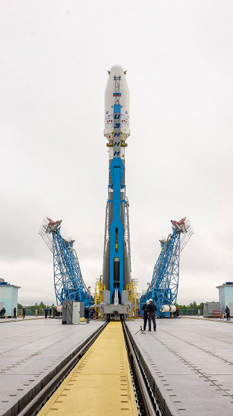
After completing several key steps, the Geostationary Operational Environmental Satellite U (GOES-U) is on track for launch. The satellite, built for the National Oceanic and Atmospheric Administration (NOAA), will liftoff aboard a SpaceX Falcon Heavy rocket from Launch Complex 39A at NASA’s Kennedy Space Center.

Major Milestones Achieved:

  • Secured to Launch Vehicle: On June 10th, technicians at Astrotech Space Operations in Titusville, Florida successfully attached GOES-U to the payload adapter and the payload attach fitting, enabling a secure connection to the top of the Space X Falcon Heavy rocket.
  • Fueled and Ready: The satellite recently underwent fueling operations, where teams loaded over 5,000 pounds of hypergolic propellant and oxidizer. This fuel will provide thrust for GOES-U to maneuver in orbit. Following fueling, the total weight of the spacecraft reached 10,956 pounds.
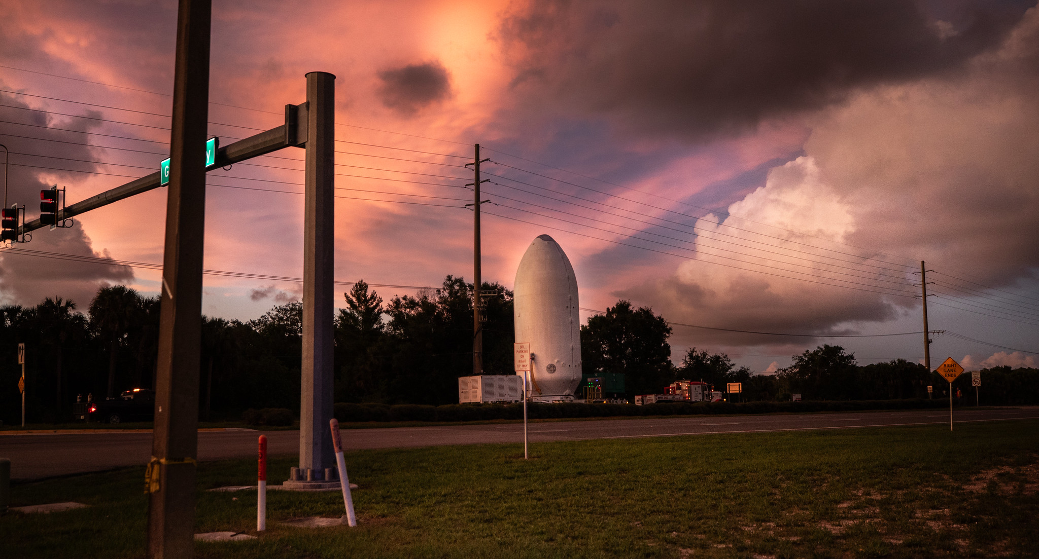
  • Protected for Launch: In preparation for connecting it to the rocket, teams encapsulated the 20-foot-tall satellite inside two payload-fairing halves on June 13th. During the ascent phase of the launch, these fairings will shield GOES-U from the harsh environment of space, protecting it from aerodynamic pressure and heating. Approximately four minutes after liftoff, once no longer needed, the fairing halves will separate and return to Earth for recovery by SpaceX crews for reuse on future missions.
  • Transport Completed: Following encapsulation, workers carefully transported the spacecraft from Astrotech’s facility to NASA Kennedy and SpaceX’s hangar at Launch Complex 39A. The transport operation began on June 14th and finished early on June 15th.

GOES-U Encasulation and Shipment to SpaceXLaunch Facility:

Photo credit: NASA/Ben Smegelsky

Next Steps:

  • Final Preparations: The next mission milestone involves connecting the encapsulated GOES-U to the SpaceX Falcon Heavy rocket before rolling the entire stack out to the launch pad.
  • Launch Day: Liftoff is targeted for a two-hour window opening at 5:16 PM EDT on June 25th. Launch Information here

Want to know how GOES-U ‘goes’ from launchpad to weather hero? This post details its Transition to Operations (T2O) – the crucial steps before it starts keeping you safe! Check it out: Transition to Operations.

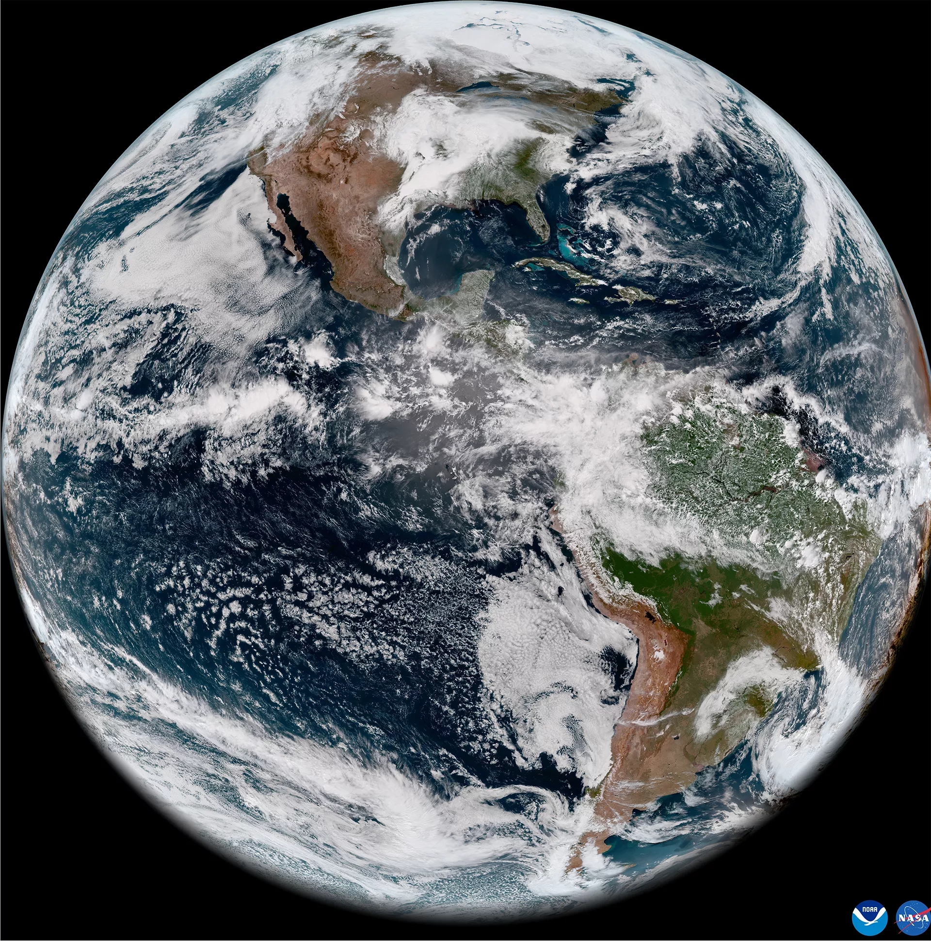
Enhanced Weather Monitoring:

GOES-U is the final satellite in NOAA’s GOES-R Series. It will equip meteorologists with advanced tools for weather forecasting and warnings. The satellite also carries a new instrument to improve detection of space weather hazards, specifically a compact coronagraph instrument.

Launch Partners:

  • NASA’s Launch Services Program, based at Kennedy, is managing the launch service for the GOES-U mission.
  • NASA’s Goddard Space Flight Center in Greenbelt, Maryland oversaw the acquisition of the spacecraft and its instruments.
  • Lockheed Martin designed, built, and tested the GOES-R series satellites, including GOES-U.
  • L3Harris Technologies provided the primary instrument, the Advanced Baseline Imager, along with the ground system, which includes the antenna system for data reception.

With these successful milestones, GOES-U is poised to take its place in space and significantly improve our ability to monitor weather and space weather events.

And now for something completely different…

I also have a dish-monitoring INMARSAT geostationary satellite at 98°West (see my link here). And as I was writing this article, I noticed a warning to Mariners show up on the Decoded texts and plotted maps for the SpaceX Launch of GOES-U

152154Z JUN 24
NAVAREA IV 694/24(11,25,26).
WESTERN NORTH ATLANTIC.
FLORIDA.
1. HAZARDOUS OPERATIONS, ROCKET LAUCHING
   252101Z TO 260002Z JUN, ALTERNATE
   2101Z TO 0002Z DAILY 26 THRU 30 JUN
   2102Z TO 0003Z DAILY 30 JUN THRU 02 JUL
   IN AREAS BOUND BY:
   A. 28-40.00N 080-38.39W, 28-40.00N 080-06.00W,
      28-36.00N 079-15.00W, 28-32.00N 079-15.00W,
      28-26.00N 080-11.00W, 28-26.00N 080-23.00W,
      28-26.00N 080-34.07W.
   B. 28-26.00N 077-28.00W, 28-31.00N 077-28.00W,
      28-34.00N 077-13.00W, 28-31.00N 076-49.00W,
      28-25.00N 076-49.00W, 28-23.00N 077-08.00W.
   C. 27-41.00N 068-08.00W, 27-46.00N 068-07.00W,
      27-42.00N 065-25.00W, 27-35.00N 064-57.00W,
      27-15.00N 064-58.00W, 27-08.00N 065-26.00W.
2. CANCEL THIS MSG 030103Z JUL 24.
Tags: GOES-U Satellite Imagery

Post navigation

❮ Previous Post: What will the neighbors think?
Next Post: GOES-U Launch Day ❯

You may also like

Satellites
Rocket Stacking underway for GOES-T
January 24, 2022
Hardware
Going Green, and to Extremes!
August 15, 2022
Satellites
Meteor M No. 2-3
June 24, 2023
Hardware
NOAA Requests proposals to limit 5G (6G) interference.
April 15, 2023

Please, Help Support USRadioguy.com

If you like what I do please support me on Ko-fi, It really means a lot, every bit helps!

Hardware Humor Imagery Processing Interesting stuff you should know! Launch News Life News Product Review Satellites Science Software Space Weather Uncategorized VLOG

Alphabetical Listing of all Pages on site:

  • 36-Hour Imagery Processing script
  • 3D animation of realtime data
  • A PORTABLE WWII ERA “MORALE RADIO”
  • About Me
  • ADS-B Reception
  • Allsky Camera
  • AN/GRR-5 THE ANGRY 5
  • BD-71 Field Switch Board and EE-8B Field Telephones
  • Current GOES 16 & 18 False Color Satellite Imagery
  • Custom Color Lookup Table
  • Custom Imagery Scripts for GOES
  • Daily 3D view of Earth
  • Daily Global Composites
  • Decoding EWS-G1 or GOES-13
  • Drifting a geostationary satellite
  • DRONE FUN
  • Even the kitchen sink
  • GEO-RING COMPOSITES
  • GEO-SAT PI FRAME
  • Geo-stationary Satellite Imagery Reception
  • Global Weather Data
  • GOES 19&18 – Last 96 Hours of Imagery
  • GOES BAND IMAGERY
  • GOES GRB Reception
  • GOES receiving in Windows for SatDump
  • GOES-18 Preparing for a new satellite
  • GOES-R Series Multimedia Tour
  • GOES-U (19) Countdown to Launch
  • GOES16 A full year of received imagery
  • Ground Station Map
  • High Resolution Imagery
  • Home
  • House History
  • HRIT/EMWIN & GRB
  • HRPT Satellite Tracking and Capture
  • Hubble Space Telescope Data Processing
  • Inmarsat Decoding
  • Layering Fire and Hotspot Data on Meteor Sat Imagery
  • Layering Geo-Spatial Fire Data into Satellite Imagery
  • Mesoscale Imagery Defined
  • METEOR M2- Series
  • MODIS VIIRS Global Coverage
  • My Other Interests
  • NASA, NOAA, Military, GOVT dish, and tower stations.
  • National Hurricane Data
  • Newsletter terms & conditions
  • NOAA & Meteor APT and LRPT RECEPTION
  • Online Satellite Imagery and Information
  • Optimizing a WIFI Grid Antenna for Maximum Efficiency
  • ORBITAL DYNAMICS 101
  • Orbitron, Gpredict, and PSTRotator with new TLE format
  • PI Based Broadcastify Server
  • Pi Based Picture Frame
  • Presentations
  • Privacy Policy
  • Programming the PI for goestools operation
  • R-100/URR 1944 MORALE RADIO
  • RADIO SET SCR-284
  • Rare Captures
  • Receiving GOES 18,19 with goestools
  • Receiving GOES HRIT with SATDUMP
  • Receiving the Funcube Amateur Satellite
  • Satdump for Meteor and NOAA decoding
  • Satellite Finder
  • Satellite Frequencies
  • Satellite Ground Stations
  • Satellite Tracking
  • Security
  • SETEC Astronomy
  • Solar Power for PI
  • South America GOES 16
  • Space Weather
  • Stray Light Zone (SLZ)
  • Thanks!
  • The quest for True Color Imagery
  • Tried and Tested Hardware
  • Usradioguy Blogs
  • Usradioguy Merchandise
  • USRadioguy Newsletter
  • USRadioguy VLOGS
  • USRADIOGUY Youtube Page
  • VIBRATOR CONVERSION MODULE
  • Viterbi, R/S Errors, Packets
  • VS-3 VIBRATOR CONVERSION
  • What is RTL-SDR?
  • WWII Audio Page
  • WWII K-24 Aerial Camera
  • WWII RADIO
  • WxtoImg Fix
  • Your very Own Weather Satellite
  • Zombie Satellites

Hardware Humor Imagery Processing Interesting stuff you should know! Launch News Life News Product Review Satellites Science Software Space Weather Uncategorized VLOG

Satellite And Weather Related Feeds

  • CIMSS Satellite Blog
  • USRadioguy.com
  • wildfires
  • NASA Earth Observatory
  • SPC Particularly Dangerous Situation (PDS) Tornado/Severe Thunderstorm Watch
  • satellites
  • Satellites News -- ScienceDaily
  • Satellite Liaison Blog
Resuspended volcanic ash from the 1980 eruptions of Mount St. Helens
Outbreak of tornadoes across North Dakota
Post-Tropical Cyclone Kiko north of Hawai’i
SatDump 2.0
SatDump 2.0
WXtoIMG: A Legacy in Weather Satellite Decoding
NOAA 15 and 19 Decommisioning
The fire cycle
New NOAA tool can predict potential wildfires on an hourly basis
Unmasking the complicated chemistry of wildfire smoke: What's in it?
By the Warm Light of the Moon
Arctic Sea Ice Ties for 10th-Lowest on Record
Cooper Creek Replenishes Lake Eyre
SPC PDS Severe Thunderstorm Watch 399
Experts to preview launch of historic NOAA space weather satellite observatory
Five historically huge solar events
65 years since the world’s first weather satellite
Hubble just revealed the fiery heart of the Cigar Galaxy
This rare white dwarf looks normal, until Hubble shows its explosive secret
A weirdly shaped telescope could finally find Earth 2. 0
Hurricane Erin: East Coast Impacts and Extratropical Transition
Hurricane Erin (2025) Rapid Intensification
August 2025 Milwaukee Flooding
  • Facebook Geo Stationary Satellites
  • Usradioguy Facebook
  • Instagram
  • Reddit
  • Github
  • Linkedin

Copyright © 2025 USRadioguy.com - All Rights Reserved. All material protected by Fair Use Section 107 of the Copyright Act. This site is Verified and Secured with 256 bit SSL encryption

Help Fund USRadioguy.com

USRadioguy Needs Your Help