Skip to content
USRADIOGUY

USRadioguy.com

Welcome to USRadioguy.com – Unlocking the Potential of Software Defined Radio

  • Home
    • Home of USRadioguy
    • Tried and Tested Hardware
    • USRadioguy Newsletter
    • What is RTL-SDR?
    • Global Weather Data
  • Satellite Reception
    • Geo Stationary Satellites
      • Geo-stationary Satellite Imagery Reception
      • GOESTOOLS on the PI
      • Update Goestools for GOES 18,19
      • Receiving GOES with SatDump CLI Mode
      • GOES receiving in Windows for SatDump GUI
      • Decoding EWS-G1/EWS-G2
      • GOES GRB Reception WIP
      • Optimizing a WIFI Grid Antenna for Maximum Efficiency
    • APT Satellites
      • APT RECEPTION
      • Satdump for Meteor and NOAA decoding
      • METEOR M2- Series
      • WxtoImg Fix
      • Converting to new TLE format
      • Layering Fire and Hotspot Data on Meteor Sat Imagery
      • HRPT Satellite Tracking and Capture
    • Receiving Other Satellites
      • Inmarsat Decoding
      • Receiving the Funcube Amateur Satellite
    • User Maps and Dish Pointers
      • Satellite Dish Pointer
      • User Global Ground Station Maps
      • Usermap rendered with Cesium
      • Global Map of Govt Dish Stations
    • Satellite Details & Information
      • ORBITAL DYNAMICS 101
      • HRIT/EMWIN & GRB Defined
      • Mesoscale Imagery Defined
      • Viterbi, R/S Errors, Packets
      • GOES BAND IMAGERY
      • Stray Light Zone (SLZ)
      • Drifting a geostationary satellite
      • GOES-R Series Multimedia Tour
      • Online Satellite Imagery and Information
      • Satellite Frequencies
      • Solar and Space Weather
  • Satellite Imagery
    • IMAGERY- Current GOES East & West HRIT Satellite Imagery
    • IMAGERY- GOES 16&18 – Past 96 Hours of Imagery
    • High Resolution Imagery
    • Daily 3D view of Earth
    • PlanetMaker
    • GOES16 A full year of received imagery
  • Imagery Processing
    • Custom Color Lookup Table & Gradients
    • GOES-R Custom Imagery Scripts
    • Global geo-ring composites
    • MODIS VIIRS Global Coverage
    • 3D Satellite Tracking
    • The quest for True Color Imagery
    • 3D animation of realtime data
    • Layering Geo-Spatial Fire Data into Satellite Imagery
    • Orbital dynamics and the Moon
    • National Hurricane Data
  • News, VLOGS & BLOGS
    • News & USRadioguy Blogs
    • USRadioguy VLOGS
  • Project Lab
    • Orbital Information and Visualizations
      • Enhanced Planet Earth
      • Satellites in Orbit
      • Solar System
      • Objects in Orbit
    • Current Station Weather
      • Current Groundstation Weather
      • Global Weather Data
      • Space Weather
    • WWII RADIO
      • WWII K-24 Aerial Camera
      • WWII RADIO
      • RADIO SET SCR-284
      • VS-3 VIBRATOR CONVERSION
      • VIBRATOR CONVERSION MODULE
      • BD-71 Field Switch Board and EE-8B Field Telephones
      • R-100/URR 1944 MORALE RADIO
      • A PORTABLE WWII ERA “MORALE RADIO”
      • AN/GRR-5 THE ANGRY 5
      • WWII Audio Page
    • Raspberry Pi Projects
      • ADS-B Reception
      • Allsky Camera
      • Pi Based Picture Frame
      • PI Based Broadcastify Server
      • Solar Power for PI
    • Your very Own Weather Satellite
    • Hubble Space Telescope Data Processing
    • Zombie Satellites
    • DRONES
  • About Me
    • About Usradioguy
      • SETEC Astronomy
    • Tried and Tested Hardware
    • Rare Captures
    • My Other Interests
    • Presentations
    • Merchandise
    • Privacy Policy
  • Home
  • Usradioguy Blogs
  • Satellite Imagery
  • Page 2

Tag: Satellite Imagery

Satellite Processing-Science vs Art:

Posted on April 25, 2024July 10, 2024 By Carl
Satellite Processing-Science vs Art:
Imagery Processing, Satellites, Science, Software

Loading

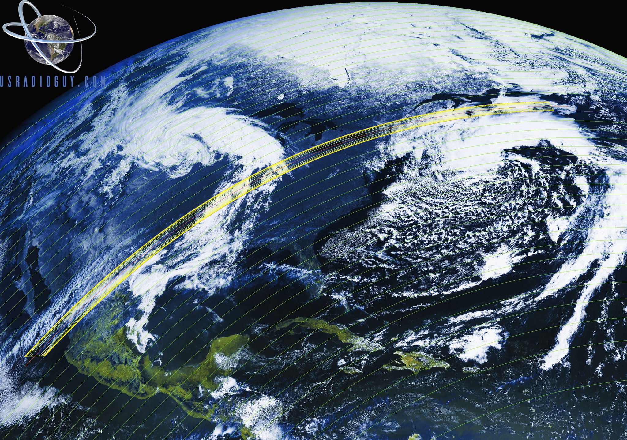
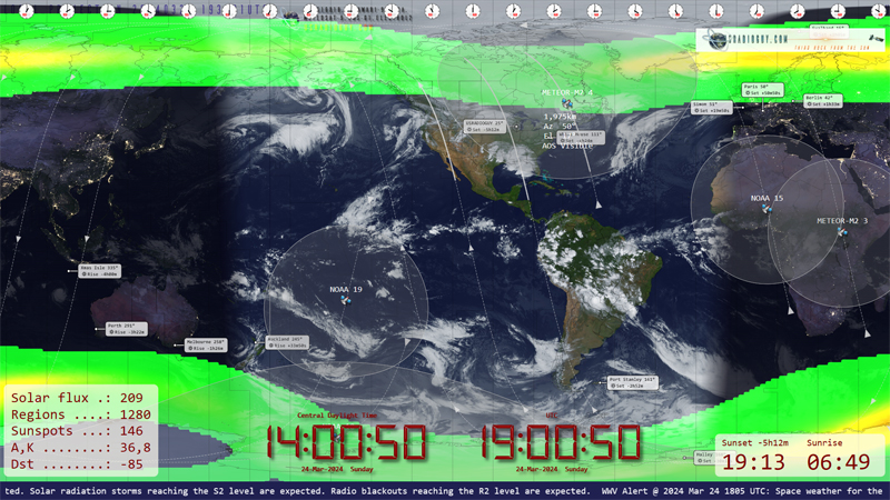
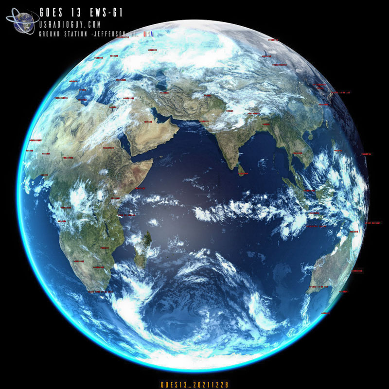
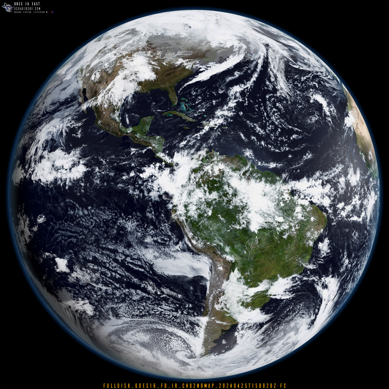
The Science and Art of post-processing satellite imagery. By Carl G. Reinemann, USRadioguy.com At the most recent NOAA user group meeting, after I had finished my presentation, I had a couple of questions regarding my last slide, which was a full disk image of planet Earth, derived from the GOES-16 satellite and then, using bands … Delve Deeper “Satellite Processing-Science vs Art:” »

ECLIPSE 2024

Posted on April 7, 2024July 10, 2024 By Carl
ECLIPSE 2024
News, Satellites, Science

Loading

A GOES-16 MDS request has been coordinated for Tuesday, April 8, 2024, when a Total Solar Eclipse will take place over North America. This eclipse will appear first in the Eastern Pacific and move across Mexico, the United States, and finally over Canada before ending in the North Atlantic Tuesday evening. For this request, the … Delve Deeper “ECLIPSE 2024” »

Simon’s World Map

Posted on March 24, 2024August 7, 2025 By Carl
Simon’s World Map
Satellites, Software

Loading

UPDATE: 06-10-2025 Simon has updated the map (Current: Version 1.5.0) Introducing the ultimate world map for satellite enthusiasts: a powerful and user-friendly tool that goes way beyond just showing you the Earth! Have you ever wished your world map could do more? This software is a game-changer. It’s packed with features specifically designed for satellite … Delve Deeper “Simon’s World Map” »

The Seasons

Posted on March 19, 2024July 10, 2024 By Carl
The Seasons
Imagery Processing, Life, Satellites, Science

Loading

The four seasons, namely spring, summer, fall, and winter, are part of the natural cycle of the Earth’s orbit around the sun. Each season is defined by a unique combination of astronomical and climatic factors, which affect weather patterns, animal behavior, plant growth, and human activities. The GOES-R Series satellites, operated by the National Oceanic … Delve Deeper “The Seasons” »

SARSAT: The Technology Behind Saving Lives

Posted on March 18, 2023July 10, 2024 By Carl
SARSAT: The Technology Behind Saving Lives
Interesting stuff you should know!, Life, Satellites

Loading

COSPAS/SARSAT: The Technology Behind Saving Lives COSPAS/SARSAT is a technology that has been instrumental in saving countless lives over the years. It is a system that utilizes satellites and ground-based receivers to detect and locate emergency distress beacons, providing critical assistance to search and rescue operations around the world. COSPAS-SARSAT is an international satellite-based search … Delve Deeper “SARSAT: The Technology Behind Saving Lives” »

Who are Satellite Data and Imaging Enthusiasts?

Posted on February 22, 2023July 10, 2024 By Carl
Who are Satellite Data and Imaging Enthusiasts?
Interesting stuff you should know!, Life, News, Satellites, Science

Loading

We’re like kids in a candy store, except the candy store is a never-ending galaxy of pixels and the candy is data and images of the Earth from space. They can tell you the exact location of any given spot on the planet just by looking at a grainy satellite image. They see patterns and … Delve Deeper “Who are Satellite Data and Imaging Enthusiasts?” »

USRadioguy VLOG

Posted on February 19, 2023February 19, 2023 By Carl
USRadioguy VLOG
Life, Science, VLOG

Loading

All right, people, buckle up ’cause I am about to enter the world of science and satellite reception vlogging, and let me tell ya, it’s out of this world. It’s like taking science and blasting it into the stratosphere with a giant space cannon. You’ve got these vloggers who are just killing it, explaining complex … Delve Deeper “USRadioguy VLOG” »

Post Processing of received imagery.

Posted on December 28, 2021September 23, 2024 By Carl
Post Processing of received imagery.
Satellites, Science

Loading

So, for a little over two years now, I have been receiving, directly, GOES 16,17, and Himawari 8, along with various APT satellites like Meteor M2 and NOAA 15,18, and 19. I have stored about 3.8 Terrabytes of data from these sats, and, if you’ve been following along on my website, I a constantly trying … Delve Deeper “Post Processing of received imagery.” »

Posts pagination

Previous 1 2

Please, Help Support USRadioguy.com

If you like what I do please support me on Ko-fi, It really means a lot, every bit helps!

Hardware Humor Imagery Processing Interesting stuff you should know! Launch News Life News Product Review Satellites Science Software Space Weather Uncategorized VLOG

Alphabetical Listing of all Pages on site:

  • 36-Hour Imagery Processing script
  • 3D animation of realtime data
  • A PORTABLE WWII ERA “MORALE RADIO”
  • About Me
  • ADS-B Reception
  • Allsky Camera
  • AN/GRR-5 THE ANGRY 5
  • BD-71 Field Switch Board and EE-8B Field Telephones
  • Current GOES 16 & 18 False Color Satellite Imagery
  • Custom Color Lookup Table
  • Custom Imagery Scripts for GOES
  • Daily 3D view of Earth
  • Daily Global Composites
  • Decoding EWS-G1 or GOES-13
  • Drifting a geostationary satellite
  • DRONE FUN
  • Even the kitchen sink
  • GEO-RING COMPOSITES
  • GEO-SAT PI FRAME
  • Geo-stationary Satellite Imagery Reception
  • Global Weather Data
  • GOES 19&18 – Last 96 Hours of Imagery
  • GOES BAND IMAGERY
  • GOES GRB Reception
  • GOES receiving in Windows for SatDump
  • GOES-18 Preparing for a new satellite
  • GOES-R Series Multimedia Tour
  • GOES-U (19) Countdown to Launch
  • GOES16 A full year of received imagery
  • Ground Station Map
  • High Resolution Imagery
  • Home
  • House History
  • HRIT/EMWIN & GRB
  • HRPT Satellite Tracking and Capture
  • Hubble Space Telescope Data Processing
  • Inmarsat Decoding
  • Layering Fire and Hotspot Data on Meteor Sat Imagery
  • Layering Geo-Spatial Fire Data into Satellite Imagery
  • Mesoscale Imagery Defined
  • METEOR M2- Series
  • MODIS VIIRS Global Coverage
  • My Other Interests
  • NASA, NOAA, Military, GOVT dish, and tower stations.
  • National Hurricane Data
  • Newsletter terms & conditions
  • NOAA & Meteor APT and LRPT RECEPTION
  • Online Satellite Imagery and Information
  • Optimizing a WIFI Grid Antenna for Maximum Efficiency
  • ORBITAL DYNAMICS 101
  • Orbitron, Gpredict, and PSTRotator with new TLE format
  • PI Based Broadcastify Server
  • Pi Based Picture Frame
  • Presentations
  • Privacy Policy
  • Programming the PI for goestools operation
  • R-100/URR 1944 MORALE RADIO
  • RADIO SET SCR-284
  • Rare Captures
  • Receiving GOES 18,19 with goestools
  • Receiving GOES HRIT with SATDUMP
  • Receiving the Funcube Amateur Satellite
  • Satdump for Meteor and NOAA decoding
  • Satellite Finder
  • Satellite Frequencies
  • Satellite Ground Stations
  • Satellite Tracking
  • Security
  • SETEC Astronomy
  • Solar Power for PI
  • South America GOES 16
  • Space Weather
  • Stray Light Zone (SLZ)
  • Thanks!
  • The quest for True Color Imagery
  • Tried and Tested Hardware
  • Usradioguy Blogs
  • Usradioguy Merchandise
  • USRadioguy Newsletter
  • USRadioguy VLOGS
  • USRADIOGUY Youtube Page
  • VIBRATOR CONVERSION MODULE
  • Viterbi, R/S Errors, Packets
  • VS-3 VIBRATOR CONVERSION
  • What is RTL-SDR?
  • WWII Audio Page
  • WWII K-24 Aerial Camera
  • WWII RADIO
  • WxtoImg Fix
  • Your very Own Weather Satellite
  • Zombie Satellites

Hardware Humor Imagery Processing Interesting stuff you should know! Launch News Life News Product Review Satellites Science Software Space Weather Uncategorized VLOG

Satellite And Weather Related Feeds

  • CIMSS Satellite Blog
  • USRadioguy.com
  • wildfires
  • NASA Earth Observatory
  • SPC Particularly Dangerous Situation (PDS) Tornado/Severe Thunderstorm Watch
  • satellites
  • Satellites News -- ScienceDaily
  • Satellite Liaison Blog
Resuspended volcanic ash from the 1980 eruptions of Mount St. Helens
Outbreak of tornadoes across North Dakota
Post-Tropical Cyclone Kiko north of Hawai’i
SatDump 2.0
SatDump 2.0
WXtoIMG: A Legacy in Weather Satellite Decoding
NOAA 15 and 19 Decommisioning
The fire cycle
New NOAA tool can predict potential wildfires on an hourly basis
Unmasking the complicated chemistry of wildfire smoke: What's in it?
By the Warm Light of the Moon
Arctic Sea Ice Ties for 10th-Lowest on Record
Cooper Creek Replenishes Lake Eyre
SPC PDS Severe Thunderstorm Watch 399
Experts to preview launch of historic NOAA space weather satellite observatory
Five historically huge solar events
65 years since the world’s first weather satellite
Hubble just revealed the fiery heart of the Cigar Galaxy
This rare white dwarf looks normal, until Hubble shows its explosive secret
A weirdly shaped telescope could finally find Earth 2. 0
Hurricane Erin: East Coast Impacts and Extratropical Transition
Hurricane Erin (2025) Rapid Intensification
August 2025 Milwaukee Flooding
  • Facebook Geo Stationary Satellites
  • Usradioguy Facebook
  • Instagram
  • Reddit
  • Github
  • Linkedin

Copyright © 2025 USRadioguy.com - All Rights Reserved. All material protected by Fair Use Section 107 of the Copyright Act. This site is Verified and Secured with 256 bit SSL encryption

Help Fund USRadioguy.com

USRadioguy Needs Your Help