Skip to content
USRADIOGUY

USRadioguy.com

Welcome to USRadioguy.com – Unlocking the Potential of Software Defined Radio

  • Home
    • Home of USRadioguy
    • Tried and Tested Hardware
    • USRadioguy Newsletter
    • What is RTL-SDR?
    • Global Weather Data
  • Satellite Reception
    • Geo Stationary Satellites
      • Geo-stationary Satellite Imagery Reception
      • GOESTOOLS on the PI
      • Update Goestools for GOES 18,19
      • Receiving GOES with SatDump CLI Mode
      • GOES receiving in Windows for SatDump GUI
      • Decoding EWS-G1/EWS-G2
      • GOES GRB Reception WIP
      • Optimizing a WIFI Grid Antenna for Maximum Efficiency
    • APT Satellites
      • APT RECEPTION
      • Satdump for Meteor and NOAA decoding
      • METEOR M2- Series
      • WxtoImg Fix
      • Converting to new TLE format
      • Layering Fire and Hotspot Data on Meteor Sat Imagery
      • HRPT Satellite Tracking and Capture
    • Receiving Other Satellites
      • Inmarsat Decoding
      • Receiving the Funcube Amateur Satellite
    • User Maps and Dish Pointers
      • Satellite Dish Pointer
      • User Global Ground Station Maps
      • Usermap rendered with Cesium
      • Global Map of Govt Dish Stations
    • Satellite Details & Information
      • ORBITAL DYNAMICS 101
      • HRIT/EMWIN & GRB Defined
      • Mesoscale Imagery Defined
      • Viterbi, R/S Errors, Packets
      • GOES BAND IMAGERY
      • Stray Light Zone (SLZ)
      • Drifting a geostationary satellite
      • GOES-R Series Multimedia Tour
      • Online Satellite Imagery and Information
      • Satellite Frequencies
      • Solar and Space Weather
  • Satellite Imagery
    • IMAGERY- Current GOES East & West HRIT Satellite Imagery
    • IMAGERY- GOES 16&18 – Past 96 Hours of Imagery
    • High Resolution Imagery
    • Daily 3D view of Earth
    • PlanetMaker
    • GOES16 A full year of received imagery
  • Imagery Processing
    • Custom Color Lookup Table & Gradients
    • GOES-R Custom Imagery Scripts
    • Global geo-ring composites
    • MODIS VIIRS Global Coverage
    • 3D Satellite Tracking
    • The quest for True Color Imagery
    • 3D animation of realtime data
    • Layering Geo-Spatial Fire Data into Satellite Imagery
    • Orbital dynamics and the Moon
    • National Hurricane Data
  • News, VLOGS & BLOGS
    • News & USRadioguy Blogs
    • USRadioguy VLOGS
  • Project Lab
    • Orbital Information and Visualizations
      • Enhanced Planet Earth
      • Satellites in Orbit
      • Solar System
      • Objects in Orbit
    • Current Station Weather
      • Current Groundstation Weather
      • Global Weather Data
      • Space Weather
    • WWII RADIO
      • WWII K-24 Aerial Camera
      • WWII RADIO
      • RADIO SET SCR-284
      • VS-3 VIBRATOR CONVERSION
      • VIBRATOR CONVERSION MODULE
      • BD-71 Field Switch Board and EE-8B Field Telephones
      • R-100/URR 1944 MORALE RADIO
      • A PORTABLE WWII ERA “MORALE RADIO”
      • AN/GRR-5 THE ANGRY 5
      • WWII Audio Page
    • Raspberry Pi Projects
      • ADS-B Reception
      • Allsky Camera
      • Pi Based Picture Frame
      • PI Based Broadcastify Server
      • Solar Power for PI
    • Your very Own Weather Satellite
    • Hubble Space Telescope Data Processing
    • Zombie Satellites
    • DRONES
  • About Me
    • About Usradioguy
      • SETEC Astronomy
    • Tried and Tested Hardware
    • Rare Captures
    • My Other Interests
    • Presentations
    • Merchandise
    • Privacy Policy
  • Home
  • Usradioguy Blogs
  • News
  • Page 2

Category: News

The Kessler Syndrome

Posted on July 6, 2024September 23, 2024 By Carl 2 Comments on The Kessler Syndrome
The Kessler Syndrome
Interesting stuff you should know!, News, Satellites, Science, Space Weather

Loading

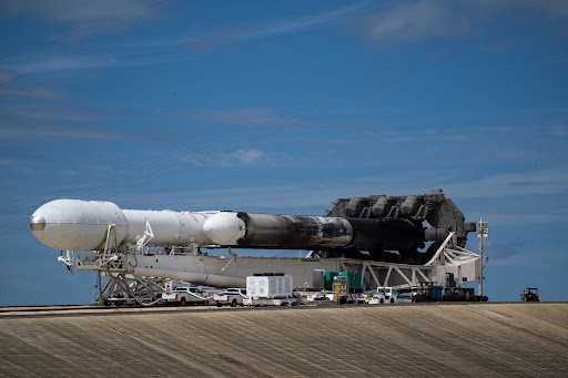
Updated July 6, 2024 On 11 January 2007, China conducted an anti-satellite missile test. A China weather satellite—the FY-1C polar-orbiting satellite of the Fengyun series, at an altitude of 865 kilometers (537 mi), with a mass of 750 kilograms (1,650 lb) —was destroyed by a kinetic kill vehicle traveling at a speed of 8 km/s (18,000 mph) in the opposite direction. A Head-On Engagement attack like this has … Delve Deeper “The Kessler Syndrome” »

GOES-U Launch Day

Posted on June 25, 2024July 10, 2024 By Carl
GOES-U Launch Day
Launch News, News, Satellites, Science

Loading

GOES-U Launch from Liftoff to Booster touchdown GOES U Separation from Booster into Geo Transfer Orbit. NOAA’s latest weather satellite, GOES-U, blasted off on a SpaceX Falcon Heavy rocket Tuesday, June 25th at 17:16 EST from Kennedy Space Center in Florida. The powerful launch marks a new era for weather forecasting and space weather monitoring. … Delve Deeper “GOES-U Launch Day” »

GOES-U to Launch in June

Posted on June 8, 2024July 10, 2024 By Carl
GOES-U to Launch in June
Launch News, News, Satellites, Science

Loading

GOES-U Launch Date and Time – NASA and SpaceX are gearing up for a critical launch on Tuesday, June 25th. Their two-hour target window opens at 5:16 p.m. EDT UPDATE: June 18th 2024 GOES-U Prepares for Launch: Media Gets a Close Look On June 6th, NASA facilitated a media viewing of the National Oceanic and Atmospheric … Delve Deeper “GOES-U to Launch in June” »

NOAA and NASA to Brief Public on GOES-U Launch

Posted on May 23, 2024July 10, 2024 By Carl
NOAA and NASA to Brief Public on GOES-U Launch
Hardware, Launch News, News, Satellites, Science

Heads Up! NOAA and NASA to Brief Public on GOES-U Launch Calling all space enthusiasts and weather satellite watchers! There’s a virtual briefing happening on May 29th, 2024 at 11:00 am ET hosted by NOAA and NASA. The topic? The upcoming launch of GOES-U, the final satellite in the GOES-R series! Experts from NOAA, NASA, … Delve Deeper “NOAA and NASA to Brief Public on GOES-U Launch” »

ECLIPSE 2024

Posted on April 7, 2024July 10, 2024 By Carl
ECLIPSE 2024
News, Satellites, Science

Loading

A GOES-16 MDS request has been coordinated for Tuesday, April 8, 2024, when a Total Solar Eclipse will take place over North America. This eclipse will appear first in the Eastern Pacific and move across Mexico, the United States, and finally over Canada before ending in the North Atlantic Tuesday evening. For this request, the … Delve Deeper “ECLIPSE 2024” »

Mixed results for NOAA Funding

Posted on March 11, 2024July 10, 2024 By Carl
Mixed results for NOAA Funding
News, Satellites, Uncategorized

Loading

Funding Update for Civil Space Programs in Recent Bill March 10, 2024 – US Congress has passed a final fiscal year 2024 spending bill that provides, in some cases, significantly less funding than requested for civil space programs. The recent spending bill offered mixed results for various civil space programs. Here’s a breakdown: Wins for … Delve Deeper “Mixed results for NOAA Funding” »

Life after GOES, The GEO XO mission

Posted on January 25, 2024July 10, 2024 By Carl
Life after GOES, The GEO XO mission
News, Satellites, Science

Loading

Unveiling the Future of Earth Observation: NOAA’s GeoXO Mission Get ready for a game-changer in Earth observation! The National Oceanic and Atmospheric Administration (NOAA) is gearing up for the Geostationary Extended Observations (GeoXO) mission, a next-generation constellation of satellites that will revolutionize our understanding of our planet. NOAA expects that GeoXO will begin operating in … Delve Deeper “Life after GOES, The GEO XO mission” »

Hunga Tonga Eruption

Posted on January 20, 2024November 4, 2024 By Carl
Hunga Tonga Eruption
Imagery Processing, Interesting stuff you should know!, News, Satellites, Science

Loading

Hunga Tonga Hunga Haʻapai Eruption On 20 December 2023 Hunga Tonga Hunga Haʻapai erupted after being relatively inactive since 2014, causing a large plume that was visible from Nukuʻalofa. The Volcanic Ash Advisory Centre Wellington NZ issued an advisory to airlines. Explosions could be heard up to 170 kilometers (110 mi) away. The initial eruption continued until 2 am on … Delve Deeper “Hunga Tonga Eruption” »

Geo Magnetic Storm 04.23.2023

Posted on April 28, 2023July 10, 2024 By Carl
Geo Magnetic Storm 04.23.2023
Life, News, Satellites, Science, Space Weather

Loading

On April 21, 2023, a coronal mass ejection (CME) occurred on the sun, resulting in the emission of a high-speed burst of plasma that traveled towards Earth at a velocity of approximately two million miles per hour. This event triggered a severe geomagnetic storm that attained level 4 out of 5 on NOAA’s space weather … Delve Deeper “Geo Magnetic Storm 04.23.2023” »

NOAA Requests proposals to limit 5G (6G) interference.

Posted on April 15, 2023July 10, 2024 By Carl
NOAA Requests proposals to limit 5G (6G) interference.
Hardware, News, Satellites

Loading

April 14th, 2023 The National Oceanic and Atmospheric Administration (NOAA) has issued a call for proposals for research and development of microwave weather sensors, ground systems, and technology to reduce interference caused by 5G networks. This announcement was made in three Broad Agency Announcements on April 13, 2023, which revealed some of the priorities of … Delve Deeper “NOAA Requests proposals to limit 5G (6G) interference.” »

Posts pagination

Previous 1 2 3 Next

Please, Help Support USRadioguy.com

If you like what I do please support me on Ko-fi, It really means a lot, every bit helps!

Hardware Humor Imagery Processing Interesting stuff you should know! Launch News Life News Product Review Satellites Science Software Space Weather Uncategorized VLOG

Alphabetical Listing of all Pages on site:

  • 36-Hour Imagery Processing script
  • 3D animation of realtime data
  • A PORTABLE WWII ERA “MORALE RADIO”
  • About Me
  • ADS-B Reception
  • Allsky Camera
  • AN/GRR-5 THE ANGRY 5
  • BD-71 Field Switch Board and EE-8B Field Telephones
  • Current GOES 16 & 18 False Color Satellite Imagery
  • Custom Color Lookup Table
  • Custom Imagery Scripts for GOES
  • Daily 3D view of Earth
  • Daily Global Composites
  • Decoding EWS-G1 or GOES-13
  • Drifting a geostationary satellite
  • DRONE FUN
  • Even the kitchen sink
  • GEO-RING COMPOSITES
  • GEO-SAT PI FRAME
  • Geo-stationary Satellite Imagery Reception
  • Global Weather Data
  • GOES 19&18 – Last 96 Hours of Imagery
  • GOES BAND IMAGERY
  • GOES GRB Reception
  • GOES receiving in Windows for SatDump
  • GOES-18 Preparing for a new satellite
  • GOES-R Series Multimedia Tour
  • GOES-U (19) Countdown to Launch
  • GOES16 A full year of received imagery
  • Ground Station Map
  • High Resolution Imagery
  • Home
  • House History
  • HRIT/EMWIN & GRB
  • HRPT Satellite Tracking and Capture
  • Hubble Space Telescope Data Processing
  • Inmarsat Decoding
  • Layering Fire and Hotspot Data on Meteor Sat Imagery
  • Layering Geo-Spatial Fire Data into Satellite Imagery
  • Mesoscale Imagery Defined
  • METEOR M2- Series
  • MODIS VIIRS Global Coverage
  • My Other Interests
  • NASA, NOAA, Military, GOVT dish, and tower stations.
  • National Hurricane Data
  • Newsletter terms & conditions
  • NOAA & Meteor APT and LRPT RECEPTION
  • Online Satellite Imagery and Information
  • Optimizing a WIFI Grid Antenna for Maximum Efficiency
  • ORBITAL DYNAMICS 101
  • Orbitron, Gpredict, and PSTRotator with new TLE format
  • PI Based Broadcastify Server
  • Pi Based Picture Frame
  • Presentations
  • Privacy Policy
  • Programming the PI for goestools operation
  • R-100/URR 1944 MORALE RADIO
  • RADIO SET SCR-284
  • Rare Captures
  • Receiving GOES 18,19 with goestools
  • Receiving GOES HRIT with SATDUMP
  • Receiving the Funcube Amateur Satellite
  • Satdump for Meteor and NOAA decoding
  • Satellite Finder
  • Satellite Frequencies
  • Satellite Ground Stations
  • Satellite Tracking
  • Security
  • SETEC Astronomy
  • Solar Power for PI
  • South America GOES 16
  • Space Weather
  • Stray Light Zone (SLZ)
  • Thanks!
  • The quest for True Color Imagery
  • Tried and Tested Hardware
  • Usradioguy Blogs
  • Usradioguy Merchandise
  • USRadioguy Newsletter
  • USRadioguy VLOGS
  • USRADIOGUY Youtube Page
  • VIBRATOR CONVERSION MODULE
  • Viterbi, R/S Errors, Packets
  • VS-3 VIBRATOR CONVERSION
  • What is RTL-SDR?
  • WWII Audio Page
  • WWII K-24 Aerial Camera
  • WWII RADIO
  • WxtoImg Fix
  • Your very Own Weather Satellite
  • Zombie Satellites

Hardware Humor Imagery Processing Interesting stuff you should know! Launch News Life News Product Review Satellites Science Software Space Weather Uncategorized VLOG

Satellite And Weather Related Feeds

  • CIMSS Satellite Blog
  • USRadioguy.com
  • wildfires
  • NASA Earth Observatory
  • SPC Particularly Dangerous Situation (PDS) Tornado/Severe Thunderstorm Watch
  • satellites
  • Satellites News -- ScienceDaily
  • Satellite Liaison Blog
Resuspended volcanic ash from the 1980 eruptions of Mount St. Helens
Outbreak of tornadoes across North Dakota
Post-Tropical Cyclone Kiko north of Hawai’i
SatDump 2.0
SatDump 2.0
WXtoIMG: A Legacy in Weather Satellite Decoding
NOAA 15 and 19 Decommisioning
The fire cycle
New NOAA tool can predict potential wildfires on an hourly basis
Unmasking the complicated chemistry of wildfire smoke: What's in it?
By the Warm Light of the Moon
Arctic Sea Ice Ties for 10th-Lowest on Record
Cooper Creek Replenishes Lake Eyre
SPC PDS Severe Thunderstorm Watch 399
Experts to preview launch of historic NOAA space weather satellite observatory
Five historically huge solar events
65 years since the world’s first weather satellite
Hubble just revealed the fiery heart of the Cigar Galaxy
This rare white dwarf looks normal, until Hubble shows its explosive secret
A weirdly shaped telescope could finally find Earth 2. 0
Hurricane Erin: East Coast Impacts and Extratropical Transition
Hurricane Erin (2025) Rapid Intensification
August 2025 Milwaukee Flooding
  • Facebook Geo Stationary Satellites
  • Usradioguy Facebook
  • Instagram
  • Reddit
  • Github
  • Linkedin

Copyright © 2025 USRadioguy.com - All Rights Reserved. All material protected by Fair Use Section 107 of the Copyright Act. This site is Verified and Secured with 256 bit SSL encryption

Help Fund USRadioguy.com

USRadioguy Needs Your Help