Skip to content
USRADIOGUY

USRadioguy.com

Welcome to USRadioguy.com – Unlocking the Potential of Software Defined Radio

  • Home
    • Home of USRadioguy
    • Tried and Tested Hardware
    • USRadioguy Newsletter
    • What is RTL-SDR?
    • Global Weather Data
  • Satellite Reception
    • Geo Stationary Satellites
      • Geo-stationary Satellite Imagery Reception
      • GOESTOOLS on the PI
      • Update Goestools for GOES 18,19
      • Receiving GOES with SatDump CLI Mode
      • GOES receiving in Windows for SatDump GUI
      • Decoding EWS-G1/EWS-G2
      • GOES GRB Reception WIP
      • Optimizing a WIFI Grid Antenna for Maximum Efficiency
    • APT Satellites
      • APT RECEPTION
      • Satdump for Meteor and NOAA decoding
      • METEOR M2- Series
      • WxtoImg Fix
      • Converting to new TLE format
      • Layering Fire and Hotspot Data on Meteor Sat Imagery
      • HRPT Satellite Tracking and Capture
    • Receiving Other Satellites
      • Inmarsat Decoding
      • Receiving the Funcube Amateur Satellite
    • User Maps and Dish Pointers
      • Satellite Dish Pointer
      • User Global Ground Station Maps
      • Usermap rendered with Cesium
      • Global Map of Govt Dish Stations
    • Satellite Details & Information
      • ORBITAL DYNAMICS 101
      • HRIT/EMWIN & GRB Defined
      • Mesoscale Imagery Defined
      • Viterbi, R/S Errors, Packets
      • GOES BAND IMAGERY
      • Stray Light Zone (SLZ)
      • Drifting a geostationary satellite
      • GOES-R Series Multimedia Tour
      • Online Satellite Imagery and Information
      • Satellite Frequencies
      • Solar and Space Weather
  • Satellite Imagery
    • IMAGERY- Current GOES East & West HRIT Satellite Imagery
    • IMAGERY- GOES 16&18 – Past 96 Hours of Imagery
    • High Resolution Imagery
    • Daily 3D view of Earth
    • PlanetMaker
    • GOES16 A full year of received imagery
  • Imagery Processing
    • Custom Color Lookup Table & Gradients
    • GOES-R Custom Imagery Scripts
    • Global geo-ring composites
    • MODIS VIIRS Global Coverage
    • 3D Satellite Tracking
    • The quest for True Color Imagery
    • 3D animation of realtime data
    • Layering Geo-Spatial Fire Data into Satellite Imagery
    • Orbital dynamics and the Moon
    • National Hurricane Data
  • News, VLOGS & BLOGS
    • News & USRadioguy Blogs
    • USRadioguy VLOGS
  • Project Lab
    • Orbital Information and Visualizations
      • Enhanced Planet Earth
      • Satellites in Orbit
      • Solar System
      • Objects in Orbit
    • Current Station Weather
      • Current Groundstation Weather
      • Global Weather Data
      • Space Weather
    • WWII RADIO
      • WWII K-24 Aerial Camera
      • WWII RADIO
      • RADIO SET SCR-284
      • VS-3 VIBRATOR CONVERSION
      • VIBRATOR CONVERSION MODULE
      • BD-71 Field Switch Board and EE-8B Field Telephones
      • R-100/URR 1944 MORALE RADIO
      • A PORTABLE WWII ERA “MORALE RADIO”
      • AN/GRR-5 THE ANGRY 5
      • WWII Audio Page
    • Raspberry Pi Projects
      • ADS-B Reception
      • Allsky Camera
      • Pi Based Picture Frame
      • PI Based Broadcastify Server
      • Solar Power for PI
    • Your very Own Weather Satellite
    • Hubble Space Telescope Data Processing
    • Zombie Satellites
    • DRONES
  • About Me
    • About Usradioguy
      • SETEC Astronomy
    • Tried and Tested Hardware
    • Rare Captures
    • My Other Interests
    • Presentations
    • Merchandise
    • Privacy Policy
  • Home
  • Usradioguy Blogs
  • Life

Category: Life

What will the neighbors think?

Posted on June 18, 2024October 6, 2024 By Carl 14 Comments on What will the neighbors think?
What will the neighbors think?
Life, Satellites, Software

Loading

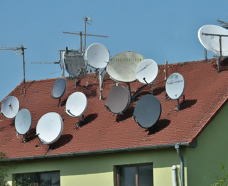
Authors note: This is a rewrite of the original blog post I wrote in 2020, and there have been a lot of changes since then. And I have had A LOT of conversations on forums, emails, and groups about satellite reception. I have given talks and presentations to Universities, NOAA, HAM Radio Clubs, Meteorological groups, … Delve Deeper “What will the neighbors think?” »

The Seasons

Posted on March 19, 2024July 10, 2024 By Carl
The Seasons
Imagery Processing, Life, Satellites, Science

Loading

The four seasons, namely spring, summer, fall, and winter, are part of the natural cycle of the Earth’s orbit around the sun. Each season is defined by a unique combination of astronomical and climatic factors, which affect weather patterns, animal behavior, plant growth, and human activities. The GOES-R Series satellites, operated by the National Oceanic … Delve Deeper “The Seasons” »

Geo Magnetic Storm 04.23.2023

Posted on April 28, 2023July 10, 2024 By Carl
Geo Magnetic Storm 04.23.2023
Life, News, Satellites, Science, Space Weather

Loading

On April 21, 2023, a coronal mass ejection (CME) occurred on the sun, resulting in the emission of a high-speed burst of plasma that traveled towards Earth at a velocity of approximately two million miles per hour. This event triggered a severe geomagnetic storm that attained level 4 out of 5 on NOAA’s space weather … Delve Deeper “Geo Magnetic Storm 04.23.2023” »

SARSAT: The Technology Behind Saving Lives

Posted on March 18, 2023July 10, 2024 By Carl
SARSAT: The Technology Behind Saving Lives
Interesting stuff you should know!, Life, Satellites

Loading

COSPAS/SARSAT: The Technology Behind Saving Lives COSPAS/SARSAT is a technology that has been instrumental in saving countless lives over the years. It is a system that utilizes satellites and ground-based receivers to detect and locate emergency distress beacons, providing critical assistance to search and rescue operations around the world. COSPAS-SARSAT is an international satellite-based search … Delve Deeper “SARSAT: The Technology Behind Saving Lives” »

Who are Satellite Data and Imaging Enthusiasts?

Posted on February 22, 2023July 10, 2024 By Carl
Who are Satellite Data and Imaging Enthusiasts?
Interesting stuff you should know!, Life, News, Satellites, Science

Loading

We’re like kids in a candy store, except the candy store is a never-ending galaxy of pixels and the candy is data and images of the Earth from space. They can tell you the exact location of any given spot on the planet just by looking at a grainy satellite image. They see patterns and … Delve Deeper “Who are Satellite Data and Imaging Enthusiasts?” »

USRadioguy VLOG

Posted on February 19, 2023February 19, 2023 By Carl
USRadioguy VLOG
Life, Science, VLOG

Loading

All right, people, buckle up ’cause I am about to enter the world of science and satellite reception vlogging, and let me tell ya, it’s out of this world. It’s like taking science and blasting it into the stratosphere with a giant space cannon. You’ve got these vloggers who are just killing it, explaining complex … Delve Deeper “USRadioguy VLOG” »

Nuclear Winter Primer

Posted on February 15, 2023September 30, 2024 By Carl
Nuclear Winter Primer
Interesting stuff you should know!, Life

Loading

As a young man I read all of Carl Sagan’s books, and even some of his papers, and once, was lucky enough to attend one of his lectures he gave at a local University. One of the papers he co-authored that I read was “Global Atmospheric Consequences of Nuclear War” which is the foundation on … Delve Deeper “Nuclear Winter Primer” »

Groups that focus on Weather Sat Reception

Posted on September 26, 2022September 26, 2022 By Carl
Groups that focus on Weather Sat Reception
Life, Satellites

Loading

There are quite a bit of us hobbyists out there on the planet (See the map of hobbyists here!), that focus on and share techniques, images, software, guides etc. If you’re interested in learning about or sharing what you know, here’s a list to get you started with groups! Geo-Stationary Weather Satellite Group on Facebook … Delve Deeper “Groups that focus on Weather Sat Reception” »

Going Green, and to Extremes!

Posted on August 15, 2022April 6, 2025 By Carl
Going Green, and to Extremes!
Hardware, Interesting stuff you should know!, Life, Science

Loading

Going Green, and to Extremes! Sometimes, you just have to share, and this really deserves to be seen! A Self-Sufficient Sentinel: Manuel Lausmann’s Remote Satellite Ground Station in Arctic Norway In the remote and challenging environment of Sør-Helgeland, North Norway (JP65EQ), Manuel Lausmann (DO3MLA) has constructed a remarkable, self-powered satellite ground receiving station. This installation … Delve Deeper “Going Green, and to Extremes!” »

Mapping Ground Stations

Posted on February 6, 2022November 4, 2024 By Carl
Mapping Ground Stations
Life, Satellites, Science

Loading

It’s a small world after all…. Thinking of all the people from all around the world I have met through this nerdy hobby, and all the various countries they come from, I decided to try and map them out, on a global basis. There are lots and lots of sites that allow you to create … Delve Deeper “Mapping Ground Stations” »

Posts pagination

1 2 Next

Please, Help Support USRadioguy.com

If you like what I do please support me on Ko-fi, It really means a lot, every bit helps!

Hardware Humor Imagery Processing Interesting stuff you should know! Launch News Life News Product Review Satellites Science Software Space Weather Uncategorized VLOG

Alphabetical Listing of all Pages on site:

  • 36-Hour Imagery Processing script
  • 3D animation of realtime data
  • A PORTABLE WWII ERA “MORALE RADIO”
  • About Me
  • ADS-B Reception
  • Allsky Camera
  • AN/GRR-5 THE ANGRY 5
  • BD-71 Field Switch Board and EE-8B Field Telephones
  • Current GOES 16 & 18 False Color Satellite Imagery
  • Custom Color Lookup Table
  • Custom Imagery Scripts for GOES
  • Daily 3D view of Earth
  • Daily Global Composites
  • Decoding EWS-G1 or GOES-13
  • Drifting a geostationary satellite
  • DRONE FUN
  • Even the kitchen sink
  • GEO-RING COMPOSITES
  • GEO-SAT PI FRAME
  • Geo-stationary Satellite Imagery Reception
  • Global Weather Data
  • GOES 19&18 – Last 96 Hours of Imagery
  • GOES BAND IMAGERY
  • GOES GRB Reception
  • GOES receiving in Windows for SatDump
  • GOES-18 Preparing for a new satellite
  • GOES-R Series Multimedia Tour
  • GOES-U (19) Countdown to Launch
  • GOES16 A full year of received imagery
  • Ground Station Map
  • High Resolution Imagery
  • Home
  • House History
  • HRIT/EMWIN & GRB
  • HRPT Satellite Tracking and Capture
  • Hubble Space Telescope Data Processing
  • Inmarsat Decoding
  • Layering Fire and Hotspot Data on Meteor Sat Imagery
  • Layering Geo-Spatial Fire Data into Satellite Imagery
  • Mesoscale Imagery Defined
  • METEOR M2- Series
  • MODIS VIIRS Global Coverage
  • My Other Interests
  • NASA, NOAA, Military, GOVT dish, and tower stations.
  • National Hurricane Data
  • Newsletter terms & conditions
  • NOAA & Meteor APT and LRPT RECEPTION
  • Online Satellite Imagery and Information
  • Optimizing a WIFI Grid Antenna for Maximum Efficiency
  • ORBITAL DYNAMICS 101
  • Orbitron, Gpredict, and PSTRotator with new TLE format
  • PI Based Broadcastify Server
  • Pi Based Picture Frame
  • Presentations
  • Privacy Policy
  • Programming the PI for goestools operation
  • R-100/URR 1944 MORALE RADIO
  • RADIO SET SCR-284
  • Rare Captures
  • Receiving GOES 18,19 with goestools
  • Receiving GOES HRIT with SATDUMP
  • Receiving the Funcube Amateur Satellite
  • Satdump for Meteor and NOAA decoding
  • Satellite Finder
  • Satellite Frequencies
  • Satellite Ground Stations
  • Satellite Tracking
  • Security
  • SETEC Astronomy
  • Solar Power for PI
  • South America GOES 16
  • Space Weather
  • Stray Light Zone (SLZ)
  • Thanks!
  • The quest for True Color Imagery
  • Tried and Tested Hardware
  • Usradioguy Blogs
  • Usradioguy Merchandise
  • USRadioguy Newsletter
  • USRadioguy VLOGS
  • USRADIOGUY Youtube Page
  • VIBRATOR CONVERSION MODULE
  • Viterbi, R/S Errors, Packets
  • VS-3 VIBRATOR CONVERSION
  • What is RTL-SDR?
  • WWII Audio Page
  • WWII K-24 Aerial Camera
  • WWII RADIO
  • WxtoImg Fix
  • Your very Own Weather Satellite
  • Zombie Satellites

Hardware Humor Imagery Processing Interesting stuff you should know! Launch News Life News Product Review Satellites Science Software Space Weather Uncategorized VLOG

Satellite And Weather Related Feeds

  • CIMSS Satellite Blog
  • USRadioguy.com
  • wildfires
  • NASA Earth Observatory
  • SPC Particularly Dangerous Situation (PDS) Tornado/Severe Thunderstorm Watch
  • satellites
  • Satellites News -- ScienceDaily
  • Satellite Liaison Blog
Post-Tropical Cyclone Kiko north of Hawai’i
A Foggy Morning for Lake Superior
Severe thunderstorms produce giant hail and isolated tornadoes in the Southern Plains
SatDump 2.0
SatDump 2.0
WXtoIMG: A Legacy in Weather Satellite Decoding
NOAA 15 and 19 Decommisioning
The fire cycle
New NOAA tool can predict potential wildfires on an hourly basis
Unmasking the complicated chemistry of wildfire smoke: What's in it?
Greenland Ice Sheet Gets a Refresh
Color Along the Anadyr
Monsoon Rains Flood Pakistan
SPC PDS Severe Thunderstorm Watch 399
Experts to preview launch of historic NOAA space weather satellite observatory
Five historically huge solar events
65 years since the world’s first weather satellite
This rare white dwarf looks normal, until Hubble shows its explosive secret
A weirdly shaped telescope could finally find Earth 2. 0
Butterfly nebula reveals sparkling gems, fiery dust, and the ingredients of life
Hurricane Erin: East Coast Impacts and Extratropical Transition
Hurricane Erin (2025) Rapid Intensification
August 2025 Milwaukee Flooding
  • Facebook Geo Stationary Satellites
  • Usradioguy Facebook
  • Instagram
  • Reddit
  • Github
  • Linkedin

Copyright © 2025 USRadioguy.com - All Rights Reserved. All material protected by Fair Use Section 107 of the Copyright Act. This site is Verified and Secured with 256 bit SSL encryption

Help Fund USRadioguy.com

USRadioguy Needs Your Help