Skip to content
USRADIOGUY

USRadioguy.com

Welcome to USRadioguy.com – Unlocking the Potential of Software Defined Radio

  • Home
    • Home of USRadioguy
    • Tried and Tested Hardware
    • USRadioguy Newsletter
    • What is RTL-SDR?
    • Global Weather Data
  • Satellite Reception
    • Geo Stationary Satellites
      • Geo-stationary Satellite Imagery Reception
      • GOESTOOLS on the PI
      • Update Goestools for GOES 18,19
      • Receiving GOES with SatDump CLI Mode
      • GOES receiving in Windows for SatDump GUI
      • Decoding EWS-G1/EWS-G2
      • GOES GRB Reception WIP
      • Optimizing a WIFI Grid Antenna for Maximum Efficiency
    • APT Satellites
      • APT RECEPTION
      • Satdump for Meteor and NOAA decoding
      • METEOR M2- Series
      • WxtoImg Fix
      • Converting to new TLE format
      • Layering Fire and Hotspot Data on Meteor Sat Imagery
      • HRPT Satellite Tracking and Capture
    • Receiving Other Satellites
      • Inmarsat Decoding
      • Receiving the Funcube Amateur Satellite
    • User Maps and Dish Pointers
      • Satellite Dish Pointer
      • User Global Ground Station Maps
      • Usermap rendered with Cesium
      • Global Map of Govt Dish Stations
    • Satellite Details & Information
      • ORBITAL DYNAMICS 101
      • HRIT/EMWIN & GRB Defined
      • Mesoscale Imagery Defined
      • Viterbi, R/S Errors, Packets
      • GOES BAND IMAGERY
      • Stray Light Zone (SLZ)
      • Drifting a geostationary satellite
      • GOES-R Series Multimedia Tour
      • Online Satellite Imagery and Information
      • Satellite Frequencies
      • Solar and Space Weather
  • Satellite Imagery
    • IMAGERY- Current GOES East & West HRIT Satellite Imagery
    • IMAGERY- GOES 16&18 – Past 96 Hours of Imagery
    • High Resolution Imagery
    • Daily 3D view of Earth
    • PlanetMaker
    • GOES16 A full year of received imagery
  • Imagery Processing
    • Custom Color Lookup Table & Gradients
    • GOES-R Custom Imagery Scripts
    • Global geo-ring composites
    • MODIS VIIRS Global Coverage
    • 3D Satellite Tracking
    • The quest for True Color Imagery
    • 3D animation of realtime data
    • Layering Geo-Spatial Fire Data into Satellite Imagery
    • Orbital dynamics and the Moon
    • National Hurricane Data
  • News, VLOGS & BLOGS
    • News & USRadioguy Blogs
    • USRadioguy VLOGS
  • Project Lab
    • Orbital Information and Visualizations
      • Enhanced Planet Earth
      • Satellites in Orbit
      • Solar System
      • Objects in Orbit
    • Current Station Weather
      • Current Groundstation Weather
      • Global Weather Data
      • Space Weather
    • WWII RADIO
      • WWII K-24 Aerial Camera
      • WWII RADIO
      • RADIO SET SCR-284
      • VS-3 VIBRATOR CONVERSION
      • VIBRATOR CONVERSION MODULE
      • BD-71 Field Switch Board and EE-8B Field Telephones
      • R-100/URR 1944 MORALE RADIO
      • A PORTABLE WWII ERA “MORALE RADIO”
      • AN/GRR-5 THE ANGRY 5
      • WWII Audio Page
    • Raspberry Pi Projects
      • ADS-B Reception
      • Allsky Camera
      • Pi Based Picture Frame
      • PI Based Broadcastify Server
      • Solar Power for PI
    • Your very Own Weather Satellite
    • Hubble Space Telescope Data Processing
    • Zombie Satellites
    • DRONES
  • About Me
    • About Usradioguy
      • SETEC Astronomy
    • Tried and Tested Hardware
    • Rare Captures
    • My Other Interests
    • Presentations
    • Merchandise
    • Privacy Policy
  • Home
  • Usradioguy Blogs
  • Software
  • Page 2

Category: Software

Ham It Up Nano by Nooelec

Posted on May 18, 2024July 25, 2024 By Carl
Ham It Up Nano by Nooelec
Hardware, Product Review, Software

Loading

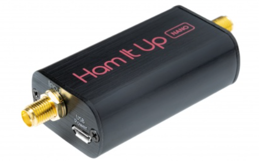
Unfold the Hidden Radio Spectrum with the Ham It Up Nano If you have ever craved the ability to explore a wider range of the radio spectrum with your SDR (Software Defined Radio)? This tiny powerhouse significantly expands your SDR’s reach, allowing you to delve into the fascinating world of Low Frequency (LF), Medium Frequency … Delve Deeper “Ham It Up Nano by Nooelec” »

Satellite Processing-Science vs Art:

Posted on April 25, 2024July 10, 2024 By Carl
Satellite Processing-Science vs Art:
Imagery Processing, Satellites, Science, Software

Loading

The Science and Art of post-processing satellite imagery. By Carl G. Reinemann, USRadioguy.com At the most recent NOAA user group meeting, after I had finished my presentation, I had a couple of questions regarding my last slide, which was a full disk image of planet Earth, derived from the GOES-16 satellite and then, using bands … Delve Deeper “Satellite Processing-Science vs Art:” »

Simon’s World Map

Posted on March 24, 2024August 7, 2025 By Carl
Simon’s World Map
Satellites, Software

Loading

UPDATE: 06-10-2025 Simon has updated the map (Current: Version 1.5.0) Introducing the ultimate world map for satellite enthusiasts: a powerful and user-friendly tool that goes way beyond just showing you the Earth! Have you ever wished your world map could do more? This software is a game-changer. It’s packed with features specifically designed for satellite … Delve Deeper “Simon’s World Map” »

Goestools for Windows

Posted on July 14, 2023July 14, 2023 By Carl
Goestools for Windows
Satellites, Software

Loading

Goestools for Windows What’s in a name? -Wingoes perhaps? Great news for those who may be hesitant to take the plunge into LINUX or using a Raspberry PI or equivalent SBC, Jamie Vital, who has written some very cool software for satellite imagery display, has ported the goestools software written by Pieter Nordhuis to run … Delve Deeper “Goestools for Windows” »

Satellite imagery reprojection method

Posted on April 13, 2023April 29, 2023 By Carl
Satellite imagery reprojection method
Satellites, Science, Software

Loading

One of the fun parts of receiving satellite imagery is what you can do with the post-processing of the images. Map projections are mathematical models that allow us to represent a three-dimensional surface of the Earth on a two-dimensional map. There are many types of map projections, and each has its own set of advantages … Delve Deeper “Satellite imagery reprojection method” »

Online Dish Pointer

Posted on January 22, 2023January 22, 2023 By Carl
Online Dish Pointer
Satellites, Software

Loading

NEW Dish Pointer for Geostationary Satellites. I created a Satellite Dish Pointer page over the weekend, added in all 539 current geostationary satellites, and added a map to find your location and then automatically calculate the Longitude, Azimuth,(true north), Azimuth (magnetic north), Elevation, and Skew angles for both 0° and 90° degree style dishes. Magnetic Declination tables … Delve Deeper “Online Dish Pointer” »

AI- Artificial Intelligence

Posted on January 15, 2023April 20, 2023 By Carl
AI- Artificial Intelligence
Satellites, Science, Software

Loading

A new artificial intelligence chatbot called ChatGPT is answering questions and taking instructions from users in a conversational, human-like way.

Himawari-8 to Himawari-9 Transition

Posted on December 11, 2022December 13, 2022 By Carl
Himawari-8 to Himawari-9 Transition
Satellites, Science, Software

Loading

The Japan Meteorological Agency (JMA) will switch operations from Himawari-8 to Himawari-9 on 13 December at 05:00 UTC Himawari 9 has been in space in on-orbit storage since 2016, Happily waiting for its chance to become the primary Satellite, taking over from Himawari-8. Same tech, identical satellites, same AHI sensors, etc. Now is the time … Delve Deeper “Himawari-8 to Himawari-9 Transition” »

Posts pagination

Previous 1 2

Please, Help Support USRadioguy.com

If you like what I do please support me on Ko-fi, It really means a lot, every bit helps!

Hardware Humor Imagery Processing Interesting stuff you should know! Launch News Life News Product Review Satellites Science Software Space Weather Uncategorized VLOG

Alphabetical Listing of all Pages on site:

  • 36-Hour Imagery Processing script
  • 3D animation of realtime data
  • A PORTABLE WWII ERA “MORALE RADIO”
  • About Me
  • ADS-B Reception
  • Allsky Camera
  • AN/GRR-5 THE ANGRY 5
  • BD-71 Field Switch Board and EE-8B Field Telephones
  • Current GOES 16 & 18 False Color Satellite Imagery
  • Custom Color Lookup Table
  • Custom Imagery Scripts for GOES
  • Daily 3D view of Earth
  • Daily Global Composites
  • Decoding EWS-G1 or GOES-13
  • Drifting a geostationary satellite
  • DRONE FUN
  • Even the kitchen sink
  • GEO-RING COMPOSITES
  • GEO-SAT PI FRAME
  • Geo-stationary Satellite Imagery Reception
  • Global Weather Data
  • GOES 19&18 – Last 96 Hours of Imagery
  • GOES BAND IMAGERY
  • GOES GRB Reception
  • GOES receiving in Windows for SatDump
  • GOES-18 Preparing for a new satellite
  • GOES-R Series Multimedia Tour
  • GOES-U (19) Countdown to Launch
  • GOES16 A full year of received imagery
  • Ground Station Map
  • High Resolution Imagery
  • Home
  • House History
  • HRIT/EMWIN & GRB
  • HRPT Satellite Tracking and Capture
  • Hubble Space Telescope Data Processing
  • Inmarsat Decoding
  • Layering Fire and Hotspot Data on Meteor Sat Imagery
  • Layering Geo-Spatial Fire Data into Satellite Imagery
  • Mesoscale Imagery Defined
  • METEOR M2- Series
  • MODIS VIIRS Global Coverage
  • My Other Interests
  • NASA, NOAA, Military, GOVT dish, and tower stations.
  • National Hurricane Data
  • Newsletter terms & conditions
  • NOAA & Meteor APT and LRPT RECEPTION
  • Online Satellite Imagery and Information
  • Optimizing a WIFI Grid Antenna for Maximum Efficiency
  • ORBITAL DYNAMICS 101
  • Orbitron, Gpredict, and PSTRotator with new TLE format
  • PI Based Broadcastify Server
  • Pi Based Picture Frame
  • Presentations
  • Privacy Policy
  • Programming the PI for goestools operation
  • R-100/URR 1944 MORALE RADIO
  • RADIO SET SCR-284
  • Rare Captures
  • Receiving GOES 18,19 with goestools
  • Receiving GOES HRIT with SATDUMP
  • Receiving the Funcube Amateur Satellite
  • Satdump for Meteor and NOAA decoding
  • Satellite Finder
  • Satellite Frequencies
  • Satellite Ground Stations
  • Satellite Tracking
  • Security
  • SETEC Astronomy
  • Solar Power for PI
  • South America GOES 16
  • Space Weather
  • Stray Light Zone (SLZ)
  • Thanks!
  • The quest for True Color Imagery
  • Tried and Tested Hardware
  • Usradioguy Blogs
  • Usradioguy Merchandise
  • USRadioguy Newsletter
  • USRadioguy VLOGS
  • USRADIOGUY Youtube Page
  • VIBRATOR CONVERSION MODULE
  • Viterbi, R/S Errors, Packets
  • VS-3 VIBRATOR CONVERSION
  • What is RTL-SDR?
  • WWII Audio Page
  • WWII K-24 Aerial Camera
  • WWII RADIO
  • WxtoImg Fix
  • Your very Own Weather Satellite
  • Zombie Satellites

Hardware Humor Imagery Processing Interesting stuff you should know! Launch News Life News Product Review Satellites Science Software Space Weather Uncategorized VLOG

Satellite And Weather Related Feeds

  • CIMSS Satellite Blog
  • USRadioguy.com
  • wildfires
  • NASA Earth Observatory
  • SPC Particularly Dangerous Situation (PDS) Tornado/Severe Thunderstorm Watch
  • satellites
  • Satellites News -- ScienceDaily
  • Satellite Liaison Blog
Thermal signatures of the Chevron El Segundo refinery fire near Los Angeles
Category 2 Hurricane Imelda passes over Bermuda
Hurricane Humberto reaches Category 5 intensity in the western Atlantic
SatDump 2.0
SatDump 2.0
WXtoIMG: A Legacy in Weather Satellite Decoding
NOAA 15 and 19 Decommisioning
The fire cycle
New NOAA tool can predict potential wildfires on an hourly basis
Unmasking the complicated chemistry of wildfire smoke: What's in it?
A Desert Intersection
Imelda and Humberto Crowd the Atlantic
The Erie Canal Turns 200
SPC PDS Severe Thunderstorm Watch 399
Experts to preview launch of historic NOAA space weather satellite observatory
Five historically huge solar events
65 years since the world’s first weather satellite
Webb spots first hints of atmosphere on a potentially habitable world
Hidden galaxy bursting with baby stars, X-ray fireworks, and cosmic energy
Hubble just revealed the fiery heart of the Cigar Galaxy
Gulf of Alaska Hurricane-Force Low
Pesky September Low Impacts Mid-Atlantic
Hurricane Erin: East Coast Impacts and Extratropical Transition
  • Facebook Geo Stationary Satellites
  • Usradioguy Facebook
  • Instagram
  • Reddit
  • Github
  • Linkedin

Copyright © 2025 USRadioguy.com - All Rights Reserved. All material protected by Fair Use Section 107 of the Copyright Act. This site is Verified and Secured with 256 bit SSL encryption

Help Fund USRadioguy.com

USRadioguy Needs Your Help