Skip to content
USRADIOGUY

USRadioguy.com

Welcome to USRadioguy.com – Unlocking the Potential of Software Defined Radio

  • Home
    • Home of USRadioguy
    • Tried and Tested Hardware
    • USRadioguy Newsletter
    • What is RTL-SDR?
    • Global Weather Data
  • Satellite Reception
    • Geo Stationary Satellites
      • Geo-stationary Satellite Imagery Reception
      • GOESTOOLS on the PI
      • Update Goestools for GOES 18,19
      • Receiving GOES with SatDump CLI Mode
      • GOES receiving in Windows for SatDump GUI
      • Decoding EWS-G1/EWS-G2
      • GOES GRB Reception WIP
      • Optimizing a WIFI Grid Antenna for Maximum Efficiency
    • APT Satellites
      • APT RECEPTION
      • Satdump for Meteor and NOAA decoding
      • METEOR M2- Series
      • WxtoImg Fix
      • Converting to new TLE format
      • Layering Fire and Hotspot Data on Meteor Sat Imagery
      • HRPT Satellite Tracking and Capture
    • Receiving Other Satellites
      • Inmarsat Decoding
      • Receiving the Funcube Amateur Satellite
    • User Maps and Dish Pointers
      • Satellite Dish Pointer
      • User Global Ground Station Maps
      • Usermap rendered with Cesium
      • Global Map of Govt Dish Stations
    • Satellite Details & Information
      • ORBITAL DYNAMICS 101
      • HRIT/EMWIN & GRB Defined
      • Mesoscale Imagery Defined
      • Viterbi, R/S Errors, Packets
      • GOES BAND IMAGERY
      • Stray Light Zone (SLZ)
      • Drifting a geostationary satellite
      • GOES-R Series Multimedia Tour
      • Online Satellite Imagery and Information
      • Satellite Frequencies
      • Solar and Space Weather
  • Satellite Imagery
    • IMAGERY- Current GOES East & West HRIT Satellite Imagery
    • IMAGERY- GOES 16&18 – Past 96 Hours of Imagery
    • High Resolution Imagery
    • Daily 3D view of Earth
    • PlanetMaker
    • GOES16 A full year of received imagery
  • Imagery Processing
    • Custom Color Lookup Table & Gradients
    • GOES-R Custom Imagery Scripts
    • Global geo-ring composites
    • MODIS VIIRS Global Coverage
    • 3D Satellite Tracking
    • The quest for True Color Imagery
    • 3D animation of realtime data
    • Layering Geo-Spatial Fire Data into Satellite Imagery
    • Orbital dynamics and the Moon
    • National Hurricane Data
  • News, VLOGS & BLOGS
    • News & USRadioguy Blogs
    • USRadioguy VLOGS
  • Project Lab
    • Orbital Information and Visualizations
      • Enhanced Planet Earth
      • Satellites in Orbit
      • Solar System
      • Objects in Orbit
    • Current Station Weather
      • Current Groundstation Weather
      • Global Weather Data
      • Space Weather
    • WWII RADIO
      • WWII K-24 Aerial Camera
      • WWII RADIO
      • RADIO SET SCR-284
      • VS-3 VIBRATOR CONVERSION
      • VIBRATOR CONVERSION MODULE
      • BD-71 Field Switch Board and EE-8B Field Telephones
      • R-100/URR 1944 MORALE RADIO
      • A PORTABLE WWII ERA “MORALE RADIO”
      • AN/GRR-5 THE ANGRY 5
      • WWII Audio Page
    • Raspberry Pi Projects
      • ADS-B Reception
      • Allsky Camera
      • Pi Based Picture Frame
      • PI Based Broadcastify Server
      • Solar Power for PI
    • Your very Own Weather Satellite
    • Hubble Space Telescope Data Processing
    • Zombie Satellites
    • DRONES
  • About Me
    • About Usradioguy
      • SETEC Astronomy
    • Tried and Tested Hardware
    • Rare Captures
    • My Other Interests
    • Presentations
    • Merchandise
    • Privacy Policy
  • Home
  • Usradioguy Blogs
  • Science
  • Page 3

Category: Science

GOES-U, the 4th and Last of the GOES-R Series

Posted on March 26, 2024June 18, 2024 By Carl
GOES-U, the 4th and Last of the GOES-R Series
Satellites, Science

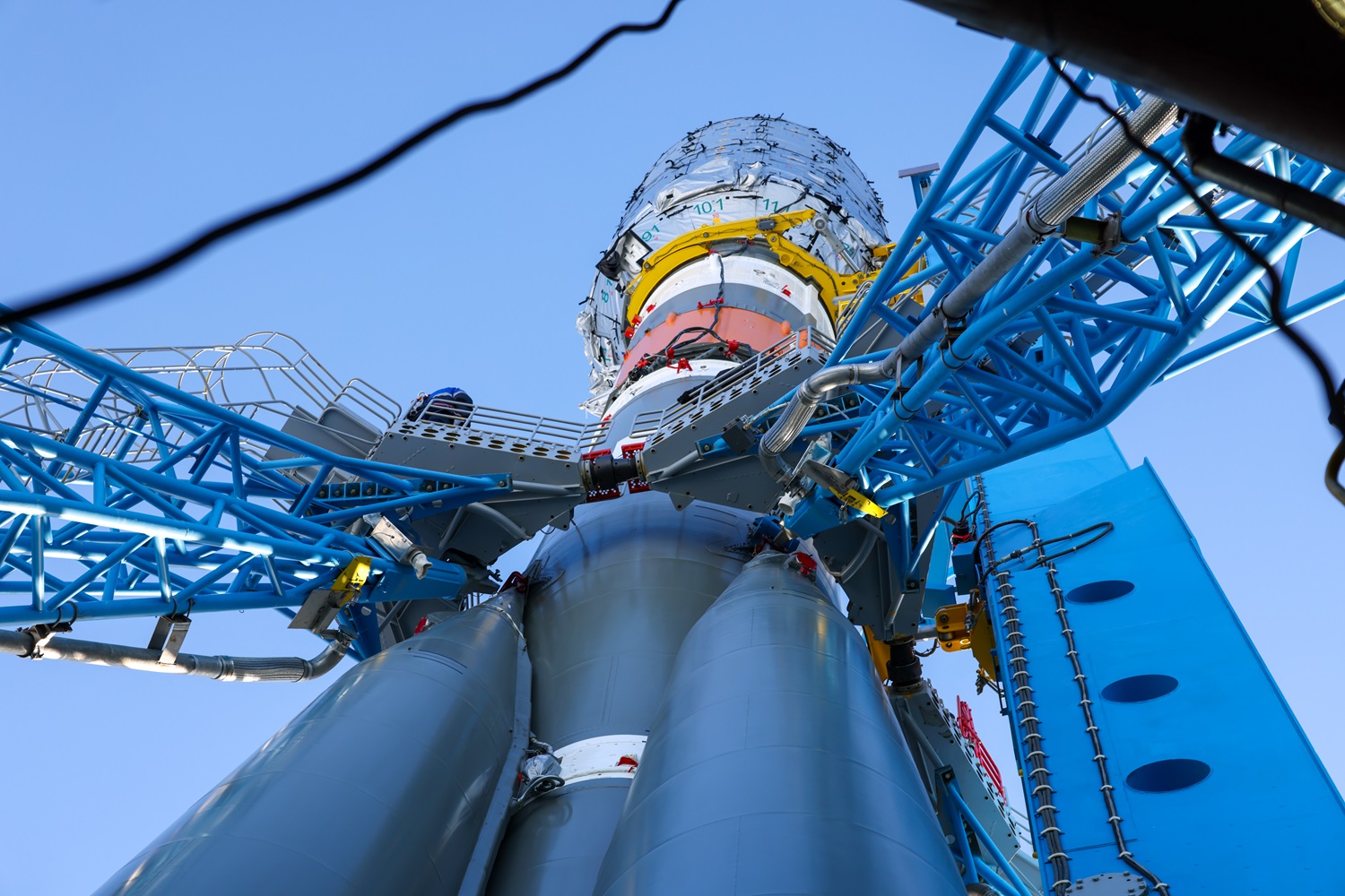
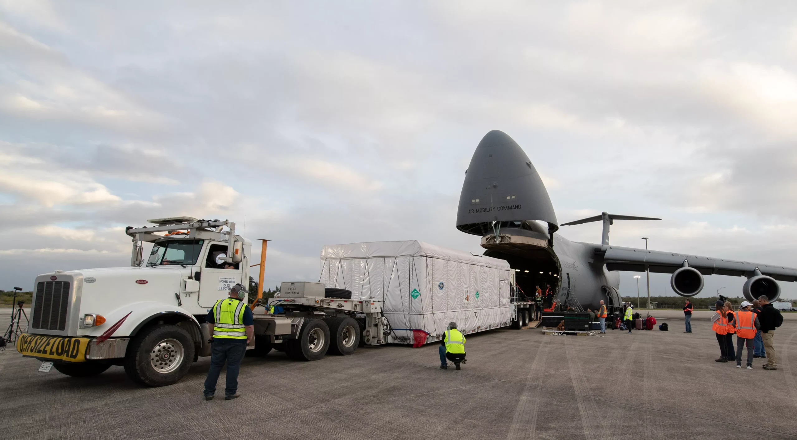
GOES-U Launch Rescheduled to Lift Off After Minor Delay Updated June 10th. 2024 The launch of GOES-U, the final satellite in NOAA’s GOES-R Series, has been rescheduled for Tuesday, June 25th. This shift allows extra time for engineers to complete repairs and tests on the Falcon Heavy core booster after a minor liquid oxygen leak … Delve Deeper “GOES-U, the 4th and Last of the GOES-R Series” »

The Seasons

Posted on March 19, 2024July 10, 2024 By Carl
The Seasons
Imagery Processing, Life, Satellites, Science

Loading

The four seasons, namely spring, summer, fall, and winter, are part of the natural cycle of the Earth’s orbit around the sun. Each season is defined by a unique combination of astronomical and climatic factors, which affect weather patterns, animal behavior, plant growth, and human activities. The GOES-R Series satellites, operated by the National Oceanic … Delve Deeper “The Seasons” »

Meteor M 2-4 Launch

Posted on February 29, 2024July 10, 2024 By Carl
Meteor M 2-4 Launch
Launch News, Satellites, Science

Loading

Meteor-M No. 2-4, will rocket off on February 29th. Liftoff from the Vostochny Cosmodrome aboard a Soyuz-2.1b rocket is scheduled for 8:43 Moscow time (5:43 UTC).

Life after GOES, The GEO XO mission

Posted on January 25, 2024July 10, 2024 By Carl
Life after GOES, The GEO XO mission
News, Satellites, Science

Loading

Unveiling the Future of Earth Observation: NOAA’s GeoXO Mission Get ready for a game-changer in Earth observation! The National Oceanic and Atmospheric Administration (NOAA) is gearing up for the Geostationary Extended Observations (GeoXO) mission, a next-generation constellation of satellites that will revolutionize our understanding of our planet. NOAA expects that GeoXO will begin operating in … Delve Deeper “Life after GOES, The GEO XO mission” »

Hunga Tonga Eruption

Posted on January 20, 2024November 4, 2024 By Carl
Hunga Tonga Eruption
Imagery Processing, Interesting stuff you should know!, News, Satellites, Science

Loading

Hunga Tonga Hunga Haʻapai Eruption On 20 December 2023 Hunga Tonga Hunga Haʻapai erupted after being relatively inactive since 2014, causing a large plume that was visible from Nukuʻalofa. The Volcanic Ash Advisory Centre Wellington NZ issued an advisory to airlines. Explosions could be heard up to 170 kilometers (110 mi) away. The initial eruption continued until 2 am on … Delve Deeper “Hunga Tonga Eruption” »

Geo Magnetic Storm 04.23.2023

Posted on April 28, 2023July 10, 2024 By Carl
Geo Magnetic Storm 04.23.2023
Life, News, Satellites, Science, Space Weather

Loading

On April 21, 2023, a coronal mass ejection (CME) occurred on the sun, resulting in the emission of a high-speed burst of plasma that traveled towards Earth at a velocity of approximately two million miles per hour. This event triggered a severe geomagnetic storm that attained level 4 out of 5 on NOAA’s space weather … Delve Deeper “Geo Magnetic Storm 04.23.2023” »

Satellite imagery reprojection method

Posted on April 13, 2023April 29, 2023 By Carl
Satellite imagery reprojection method
Satellites, Science, Software

Loading

One of the fun parts of receiving satellite imagery is what you can do with the post-processing of the images. Map projections are mathematical models that allow us to represent a three-dimensional surface of the Earth on a two-dimensional map. There are many types of map projections, and each has its own set of advantages … Delve Deeper “Satellite imagery reprojection method” »

The altered life of GOES-3

Posted on March 6, 2023July 10, 2024 By Carl
The altered life of GOES-3
Interesting stuff you should know!, Satellites, Science

Loading

GOES-3 weather satellite did not go gently into that goodnight…. For over 20 years, the South Pole relied on the GOES-3 weather satellite for communication links with the outside world. However, this satellite was decommissioned in 2016 after 38 years in operation. GOES-3 was launched in 1978 aboard a Delta 2914 carrier rocket, the satellite … Delve Deeper “The altered life of GOES-3” »

Who are Satellite Data and Imaging Enthusiasts?

Posted on February 22, 2023July 10, 2024 By Carl
Who are Satellite Data and Imaging Enthusiasts?
Interesting stuff you should know!, Life, News, Satellites, Science

Loading

We’re like kids in a candy store, except the candy store is a never-ending galaxy of pixels and the candy is data and images of the Earth from space. They can tell you the exact location of any given spot on the planet just by looking at a grainy satellite image. They see patterns and … Delve Deeper “Who are Satellite Data and Imaging Enthusiasts?” »

USRadioguy VLOG

Posted on February 19, 2023February 19, 2023 By Carl
USRadioguy VLOG
Life, Science, VLOG

Loading

All right, people, buckle up ’cause I am about to enter the world of science and satellite reception vlogging, and let me tell ya, it’s out of this world. It’s like taking science and blasting it into the stratosphere with a giant space cannon. You’ve got these vloggers who are just killing it, explaining complex … Delve Deeper “USRadioguy VLOG” »

Posts pagination

Previous 1 2 3 4 … 7 Next

Please, Help Support USRadioguy.com

If you like what I do please support me on Ko-fi, It really means a lot, every bit helps!

Hardware Humor Imagery Processing Interesting stuff you should know! Launch News Life News Product Review Satellites Science Software Space Weather Uncategorized VLOG

Alphabetical Listing of all Pages on site:

  • 36-Hour Imagery Processing script
  • 3D animation of realtime data
  • A PORTABLE WWII ERA “MORALE RADIO”
  • About Me
  • ADS-B Reception
  • Allsky Camera
  • AN/GRR-5 THE ANGRY 5
  • BD-71 Field Switch Board and EE-8B Field Telephones
  • Current GOES 16 & 18 False Color Satellite Imagery
  • Custom Color Lookup Table
  • Custom Imagery Scripts for GOES
  • Daily 3D view of Earth
  • Daily Global Composites
  • Decoding EWS-G1 or GOES-13
  • Drifting a geostationary satellite
  • DRONE FUN
  • Even the kitchen sink
  • GEO-RING COMPOSITES
  • GEO-SAT PI FRAME
  • Geo-stationary Satellite Imagery Reception
  • Global Weather Data
  • GOES 19&18 – Last 96 Hours of Imagery
  • GOES BAND IMAGERY
  • GOES GRB Reception
  • GOES receiving in Windows for SatDump
  • GOES-18 Preparing for a new satellite
  • GOES-R Series Multimedia Tour
  • GOES-U (19) Countdown to Launch
  • GOES16 A full year of received imagery
  • Ground Station Map
  • High Resolution Imagery
  • Home
  • House History
  • HRIT/EMWIN & GRB
  • HRPT Satellite Tracking and Capture
  • Hubble Space Telescope Data Processing
  • Inmarsat Decoding
  • Layering Fire and Hotspot Data on Meteor Sat Imagery
  • Layering Geo-Spatial Fire Data into Satellite Imagery
  • Mesoscale Imagery Defined
  • METEOR M2- Series
  • MODIS VIIRS Global Coverage
  • My Other Interests
  • NASA, NOAA, Military, GOVT dish, and tower stations.
  • National Hurricane Data
  • Newsletter terms & conditions
  • NOAA & Meteor APT and LRPT RECEPTION
  • Online Satellite Imagery and Information
  • Optimizing a WIFI Grid Antenna for Maximum Efficiency
  • ORBITAL DYNAMICS 101
  • Orbitron, Gpredict, and PSTRotator with new TLE format
  • PI Based Broadcastify Server
  • Pi Based Picture Frame
  • Presentations
  • Privacy Policy
  • Programming the PI for goestools operation
  • R-100/URR 1944 MORALE RADIO
  • RADIO SET SCR-284
  • Rare Captures
  • Receiving GOES 18,19 with goestools
  • Receiving GOES HRIT with SATDUMP
  • Receiving the Funcube Amateur Satellite
  • Satdump for Meteor and NOAA decoding
  • Satellite Finder
  • Satellite Frequencies
  • Satellite Ground Stations
  • Satellite Tracking
  • Security
  • SETEC Astronomy
  • Solar Power for PI
  • South America GOES 16
  • Space Weather
  • Stray Light Zone (SLZ)
  • Thanks!
  • The quest for True Color Imagery
  • Tried and Tested Hardware
  • Usradioguy Blogs
  • Usradioguy Merchandise
  • USRadioguy Newsletter
  • USRadioguy VLOGS
  • USRADIOGUY Youtube Page
  • VIBRATOR CONVERSION MODULE
  • Viterbi, R/S Errors, Packets
  • VS-3 VIBRATOR CONVERSION
  • What is RTL-SDR?
  • WWII Audio Page
  • WWII K-24 Aerial Camera
  • WWII RADIO
  • WxtoImg Fix
  • Your very Own Weather Satellite
  • Zombie Satellites

Hardware Humor Imagery Processing Interesting stuff you should know! Launch News Life News Product Review Satellites Science Software Space Weather Uncategorized VLOG

Satellite And Weather Related Feeds

  • CIMSS Satellite Blog
  • USRadioguy.com
  • wildfires
  • NASA Earth Observatory
  • SPC Particularly Dangerous Situation (PDS) Tornado/Severe Thunderstorm Watch
  • satellites
  • Satellites News -- ScienceDaily
  • Satellite Liaison Blog
Thermal signatures of the Chevron El Segundo refinery fire near Los Angeles
Category 2 Hurricane Imelda passes over Bermuda
Hurricane Humberto reaches Category 5 intensity in the western Atlantic
SatDump 2.0
SatDump 2.0
WXtoIMG: A Legacy in Weather Satellite Decoding
NOAA 15 and 19 Decommisioning
The fire cycle
New NOAA tool can predict potential wildfires on an hourly basis
Unmasking the complicated chemistry of wildfire smoke: What's in it?
A Desert Intersection
Imelda and Humberto Crowd the Atlantic
The Erie Canal Turns 200
SPC PDS Severe Thunderstorm Watch 399
Experts to preview launch of historic NOAA space weather satellite observatory
Five historically huge solar events
65 years since the world’s first weather satellite
Webb spots first hints of atmosphere on a potentially habitable world
Hidden galaxy bursting with baby stars, X-ray fireworks, and cosmic energy
Hubble just revealed the fiery heart of the Cigar Galaxy
Gulf of Alaska Hurricane-Force Low
Pesky September Low Impacts Mid-Atlantic
Hurricane Erin: East Coast Impacts and Extratropical Transition
  • Facebook Geo Stationary Satellites
  • Usradioguy Facebook
  • Instagram
  • Reddit
  • Github
  • Linkedin

Copyright © 2025 USRadioguy.com - All Rights Reserved. All material protected by Fair Use Section 107 of the Copyright Act. This site is Verified and Secured with 256 bit SSL encryption

Help Fund USRadioguy.com

USRadioguy Needs Your Help