


Satellites, Science, Software
![]()
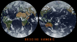
One of the fun parts of receiving satellite imagery is what you can do with the post-processing of the images. Map projections are mathematical models that allow us to represent a three-dimensional surface of the Earth on a two-dimensional map. There are many types of map projections, and each has its own set of advantages … Delve Deeper “Satellite imagery reprojection method” »